Old Maps of Alfred, New York for Hiking & Exploration
Hike through history with 37 historic maps of Alfred. Explore old trails, ghost towns, and forgotten backroads — perfect for outdoor adventurers and local explorers.
- Rediscover forgotten places: Map out old mining camps, roads, and footpaths that no longer exist on modern maps.
- Layer with modern tools: Combine with LiDAR or satellite views to plan hikes through historical terrain.
- Made for exploration: Popular among hikers, overlanders, and local history lovers.
Use these maps to find adventure and explore the hidden past of Alfred.
Alfred, NY maps
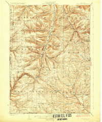
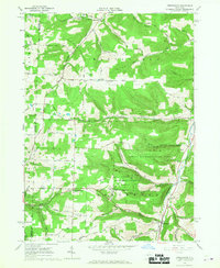
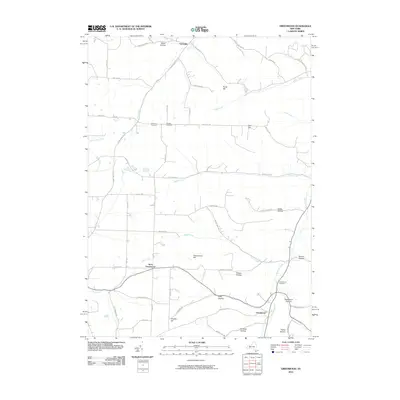
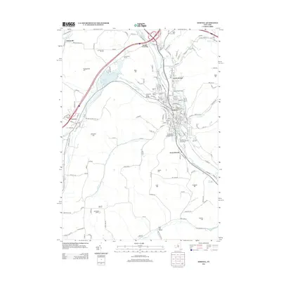
(37)- 1915 Map of Hornell, 1962 Print
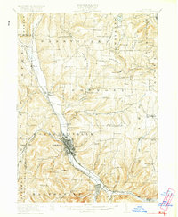
 1915 Hornell1962 Print · USGSSteuben County was a bustling rail hub when this survey was conducted, featuring a dense network of steam and electric lines. Genealogists can locate dozens of country schoolhouses like Babcock School and Eells School, alongside rural settlements such as Arkport and Haskinville.
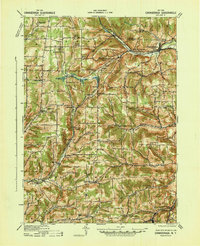
 - 1916 Map of Canaseraga
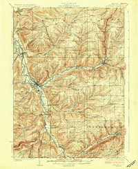
 1916 Canaseraga1916 Print · USGSAllegany and Livingston counties appear in the decade before the Great War, during the peak of the local rail era. Genealogists can locate dozens of numbered schoolhouses and family-named landmarks like Whitney Crossings, Karrdale, and the Jersey Hill School.4 unique versions available
 - 1918 Map of Hornell
 1918 Hornell1918 Print · USGSThe rail-and-river corridor of Steuben County comes alive in the years following the Great War. Genealogists can trace family footprints across dozens of country school sites like Dutch Street School and rail hubs from Arkport to Canisteo.6 unique versions available
 - 1926 Map of Wellsville
 1926 Wellsville1926 Print · USGSAllegany County's southern reaches appear here in the mid-1920s as a hub of river-valley commerce and upland farming. Genealogists can trace early homesteads near Irish Settlement, Stannards Corners, and numerous rural schools like Ford Brook School.5 unique versions available
 - 1926 Map of Greenwood
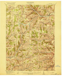
 1926 Greenwood1926 Print · USGSSteuben County during the mid-1920s reveals a landscape defined by the deep valleys of Bennetts Creek and the hills of West Union. Genealogists and historians can trace numerous rural schoolhouses and vanished hamlets like Rough and Ready and Barney Mills.4 unique versions available
 - 1940 Map of Canaseraga
 1940 Canaseraga1940 Print · USGSAllegany County's rural township structure is captured here just before the mid-century, showing a landscape tied together by local district schools and the Erie railroad. Researchers can locate early homesteads near Brewer Corners, trace the rail sidings at Garwoods Sta, or find ancestral landmarks like the County House and Jersey Hill School.2 unique versions available
 - 1950 Map of Elmira
 1950 Elmira1950 Print · USGSThe Finger Lakes region thrived in the late 1940s as a hub of industry and transport. Trace family roots and vanished landmarks near Seneca Lake or explore the rail lines of the Erie RR and the sprawling Seneca Ordnance Depot.2 unique versions available
 - 1958 Map of Elmira
 1958 Elmira1958 Print · USGSThe New York Finger Lakes during the late fifties reveal a complex landscape of glacial geology and industrial growth. Researchers can trace historic transport corridors like the Erie Canal and Erie RR, or locate institutional landmarks like Cornell University.2 unique versions available
 - 1962 Map of Elmira, 1969 Print
 1962 Elmira1969 Print · USGSThe Finger Lakes region and Southern Tier are captured here during a period of industrial maturity and highway expansion. Researchers can trace the path of the Erie Canal, the footprint of the Seneca Army Depot, and legacy rail lines through Elmira and Ithaca.4 unique versions available
 - 1964 Map of Alfred, 1965 Print
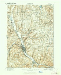
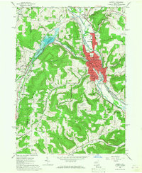
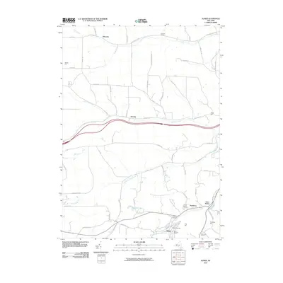
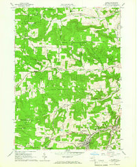 1964 Alfred1965 Print · USGSAllegany County’s collegiate and rural landscape comes into focus in the 1960s as reforestation efforts transform the hills. Genealogists and local historians can trace family-named routes and landmarks like Lippincott Cem, Alfred Station, and the campus of Alfred University.3 unique versions available
 - 1965 Map of Elmira
 1965 Elmira1965 Print · USGSThe Finger Lakes and Southern Tier regions are captured in the mid-sixties, showcasing a landscape of deep glacial valleys and heavy rail infrastructure. Trace old railroad corridors like the Pennsylvania RR or visit landmarks like Letchworth State Park and the Seneca Army Depot.
 - 1965 Map of Andover, 1967 Print
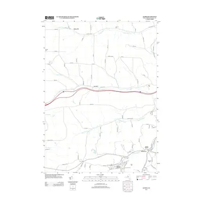
 1965 Andover1967 Print · USGSAllegany County in the mid-sixties reveals a landscape of railroad heritage and timber conservation near the village of Andover. Genealogists can trace family names at St Johns Cem and East Valley Cem or locate industrial sites like the many southern Oil Wells.2 unique versions available
 - 1965 Map of Greenwood, 1967 Print
 1965 Greenwood1967 Print · USGSThe Steuben County highlands during the mid-1960s reveal a landscape of active oil wells and deep rural valleys. You can trace family roots at Gull Hill Cem or locate old homesteads along SNYDER GULLY ROAD and BREWSTER ROAD.2 unique versions available
 - 1965 Map of Hornell, 1967 Print
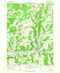
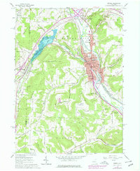
 1965 Hornell1967 Print · USGSThe Canisteo River valley is shown at a mid-century peak of industrial activity as the Erie Lackawanna railroad winds through the city. Researchers can trace neighborhood development near St Marys Cem or locate the rural crossroads of Bishopville and Hartsville Center.2 unique versions available
 - 1978 Map of Greenwood
 1978 Greenwood1978 Print · USGSSteuben County's ridges and hollows are detailed in this late 1970s survey as the local landscape balanced agriculture with a growing energy infrastructure. Researchers can locate remote burial grounds like Slaight Cem and trace the distribution of Oil Wells near West Greenwood.
 - 1978 Map of Hornell
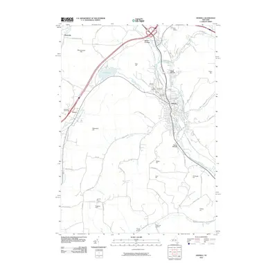
 1978 Hornell1978 Print · USGSSteuben County was a bustling valley hub in the late seventies, defined by its rail corridor and the newly developed Almond Lake. Genealogists and local historians can trace family plots and parish life through St Marys Cemetery, Hartsville Church, and the Columbian School.
 - 1986 Map of Hornell
 1986 Hornell1986 Print · USGSThe Southern Tier and Finger Lakes region thrive in the 1980s as rail and river corridors link Hornell to Corning. Trace local heritage through landmarks like Alfred University, the Veterans Adm Center, and the shores of Keuka Lake.2 unique versions available
 - 2010 Map of Andover, 2010 Print
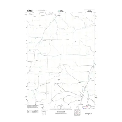
 2010 Andover2010 Print · USGSCovers Alfred, including Wellsville, Andover, and other nearby areas
 - 2010 Map of Greenwood, 2010 Print
 2010 Greenwood2010 Print · USGSCovers Alfred, including Canisteo, Andover, and other nearby areas
 - 2010 Map of Alfred, 2010 Print
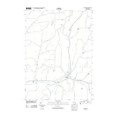
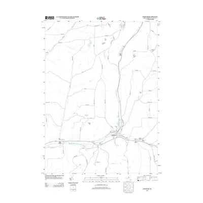
 2010 Alfred2010 Print · USGSCovers Alfred, including Almond, Ward, and other nearby areas
 - 2010 Map of Hornell, 2010 Print
 2010 Hornell2010 Print · USGSCovers Alfred, including Hornell, Hornellsville, and other nearby areas
 - 2013 Map of Alfred, 2013 Print
 2013 Alfred2013 Print · USGSCovers Alfred, including Almond, Ward, and other nearby areas
 - 2013 Map of Hornell, 2013 Print
 2013 Hornell2013 Print · USGSCovers Alfred, including Hornell, Hornellsville, and other nearby areas
 - 2013 Map of Greenwood, 2013 Print
 2013 Greenwood2013 Print · USGSCovers Alfred, including Canisteo, Andover, and other nearby areas
 - 2013 Map of Andover, 2013 Print
 2013 Andover2013 Print · USGSCovers Alfred, including Wellsville, Andover, and other nearby areas
Showing maps 1-25 of 37
Top cities near Alfred
- Hornell historical maps
- Wellsville historical maps
- Wellsville historical maps
- Hornellsville historical maps
- Alfred historical maps
- Wayland historical maps
See more
Top neighborhoods of Alfred
- Alfred Station historical maps
- Tinkertown historical maps
- Tip Top historical maps
- Alfred historical maps
Frequently asked questions
- What are the different types of historical maps available for Alfred?
- What is the oldest map of Alfred?
- Where can I purchase historical maps of Alfred for my home or office?
- Where can I download high-res historical maps of Alfred?
- Are there historical topographic maps available for Alfred?
- Is there historical aerial imagery available for Alfred?
- Where are historical maps of Alfred sourced from?