Old Maps of Bolivar, New York for Genealogy
Trace your family roots with 38 historic maps of Bolivar. These high-res maps reveal old neighborhoods, homesites, landmarks, and streets — helping you uncover where your ancestors lived and how the area evolved over time.
- Explore historic neighborhoods: Identify where your relatives may have lived in the 1800s or 1900s.
- Compare maps over time: Trace the changes in streets, buildings, and landmarks for multi-generational research.
- Perfect for genealogy & ancestry research: Used by family historians and researchers to map out lineage and migration.
These maps are an incredible resource for exploring your personal connection to Bolivar's past.
Bolivar, NY maps
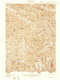
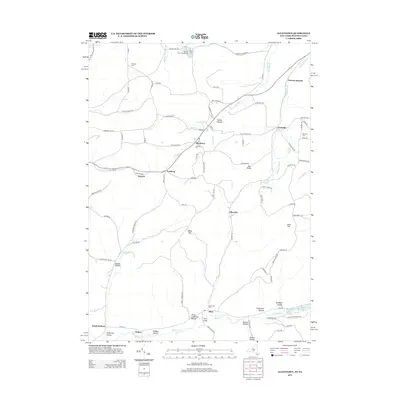
(38)- 1925 Map of Belmont
 1925 Belmont1925 Print · USGSAllegany County hills and river valleys are shown in the mid-twenties, centered on the railroad hubs and rural townships. Trace the tracks of the Erie RR and Shawmut RR past local landmarks like School No 5 and Richburg.4 unique versions available
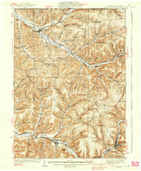
 - 1934 Map of Coudersport
 1934 Coudersport1934 Print · USGSPotter and McKean Counties appear here in the mid-1930s, showing a landscape of deep hollows and river-valley rail towns. Genealogists can trace family names through dozens of rural landmarks like Sartwell Cr Ch, Knowlton Station, and Shinglehouse.3 unique versions available
 - 1938 Map of Coudersport
 1938 Coudersport1938 Print · USGSNorthern Pennsylvania during the mid-1930s was a landscape of deep hollows and river-bottom settlements tied to the Allegheny and Oswayo. Researchers can trace the placement of rural landmarks like Crandall Hill Fire Tower, Sartwell Creek Ch, and the Plank Road Sch.3 unique versions available
 - 1939 Map of Belmont, 1961 Print
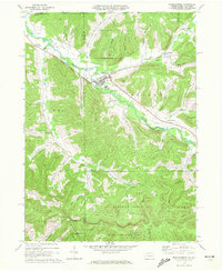
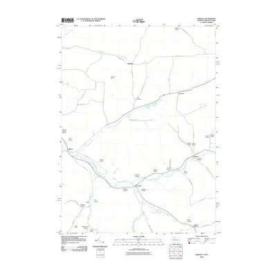
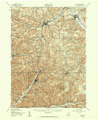 1939 Belmont1961 Print · USGSAllegany County highlands at the end of the 1930s show a landscape shaped by the Genesee River and the legacy of the Pittsburg Shawmut and Northern RR. Genealogists can trace family school districts like Carnahan Sch or explore the early footprints of Richburg and Little Genesee.2 unique versions available
 - 1957 Map of Warren, 1964 Print
 1957 Warren1964 Print · USGSThe northern Pennsylvania oil and timber country comes into focus in the mid-fifties, showing the region before modern highway expansions. Trace the industrial rail networks of the Pennsylvania RR and the early Allegheny River Reservoir near Warren and Oil City.4 unique versions available
 - 1958 Map of Warren
 1958 Warren1958 Print · USGSNorthern Pennsylvania’s timber and oil country is captured here during the late fifties, showing the interplay of industrial valleys and vast state forests. Genealogists can trace family connections across the Cornplanter Indian Reservation or through rail hubs like Oil City and Saint Marys.
 - 1959 Map of Warren
 1959 Warren1959 Print · USGSNorthern Pennsylvania's oil and timber country comes alive in this late-fifties study of the forest-clad plateaus. Trace the historic Cornplanter (Indian Reservation), the sprawling Oil Field, and the rail lines of the Pennsylvania RR.2 unique versions available
 - 1960 Map of Buffalo
 1960 Buffalo1960 Print · USGSWestern New York and the Niagara Peninsula thrive during the mid-twentieth century industrial peak. Genealogists and historians can trace family-named points and early settlements from Dunkirk Light to the Allegany Indian Reservation.
 - 1962 Map of Buffalo, 1980 Print
 1962 Buffalo1980 Print · USGSThe Niagara Frontier and Western New York are captured here in the early sixties, showing the vital industrial and maritime nexus between the U.S. and Canada. Researchers can trace the path of the Welland Canal, locate the Allegany Indian Reservation, or find family sites near Chautauqua Lake.2 unique versions available
 - 1965 Map of Allentown, 1966 Print
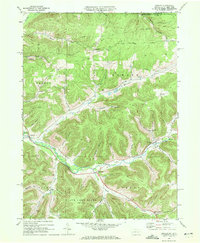
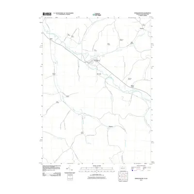
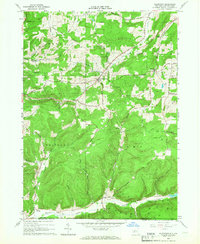 1965 Allentown1966 Print · USGSAllegany County during the mid-1960s reveals a landscape defined by its petroleum heritage and deep valley settlements. Researchers can trace the extensive network of Oil Wells across Bow Ridge, find family plots at Dimmick Cem, and locate the small communities of Allentown and Petrolia.
 - 1965 Map of Bolivar, 1967 Print
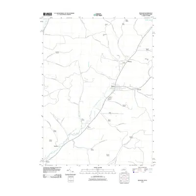
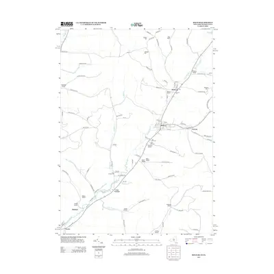
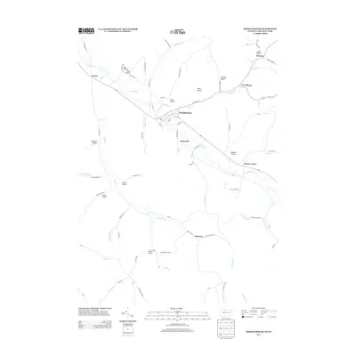
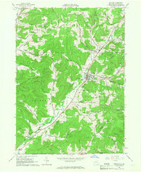 1965 Bolivar1967 Print · USGSAllegany County oil and gas fields are in full operation during the mid-sixties, showing a landscape shaped by energy and rail. Genealogists can trace family plots at Little Genesee Cem or follow the old Pittsburgh Shawmut and Northern Railroad line.2 unique versions available
 - 1967 Map of Buffalo
 1967 Buffalo1967 Print · USGSWestern New York and the Lake Erie shoreline are shown here during the mid-1960s industrial peak. Researchers can trace the massive rail networks of the Erie Railroad, locate the Cattaraugus Indian Reservation, or find historic sites like Fort Erie.
 - 1969 Map of Shinglehouse, 1972 Print
 1969 Shinglehouse1972 Print · USGSThe Oswayo Creek valley in the late sixties reveals a landscape shaped by the Shinglehouse Oil Field and the borough of Shinglehouse. Researchers can trace old family landmarks and rural communities from Myrtle and East Sharon to the Maple Grove Cem and Bell Run Union Ch.2 unique versions available
 - 1969 Map of Oswayo, 1972 Print
 1969 Oswayo1972 Print · USGSPotter County's northern hollows are captured here in the late sixties, showing a landscape shaped by petroleum extraction and old rail routes. Researchers can trace the Oswayo Creek Grade through Millport or locate family sites near the Rathbone Cem and Kibbeville.4 unique versions available
 - 1971 Map of Warren
 1971 Warren1971 Print · USGSNorth Central Pennsylvania is captured here in the early seventies, showing a landscape defined by industrial centers and massive state forests. Genealogists and historians can trace the rail lines of the Penn Central and Erie Lackawanna connecting towns like Warren, Kane, and Du Bois.
 - 1973 Map of Buffalo
 1973 Buffalo1973 Print · USGSWestern New York and Ontario's Golden Horseshoe meet in the early seventies, spanning from the industrial waterfronts of Buffalo to the hills of Allegany State Park. Trace the paths of the Welland Canal and Erie Lackawanna railroad through the lakefront towns of Dunkirk and Port Colborne.
 - 1980 Map of Bradford, 1982 Print
 1980 Bradford1982 Print · USGSNorthern Pennsylvania's oil country and deep forests are captured here during the 1980s. Genealogists and researchers can trace rail-side settlements like Kushequa, Gifford, and Lewis Run or locate specific Oil and Gas Field sites across the plateau.
 - 1986 Map of Olean
 1986 Olean1986 Print · USGSThe Southern Tier and northern Pennsylvania border are captured here in the mid-1980s as the regional rail and river economy evolved. Genealogists and local historians can trace family-named sites across the Allegany Indian Reservation, identify old Oil Field tracts, or locate landmarks like St Bonaventure University and the Tannery.2 unique versions available
 - 2010 Map of Allentown, 2010 Print
 2010 Allentown2010 Print · USGSCovers Bolivar, including Wellsville, Scio, and other nearby areas
 - 2010 Map of Bolivar, 2010 Print
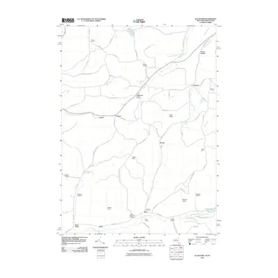
 2010 Bolivar2010 Print · USGSCovers Bolivar, including Genesee, Wirt, and other nearby areas
 - 2010 Map of Shinglehouse, 2010 Print
 2010 Shinglehouse2010 Print · USGSCovers Bolivar, including Liberty Township, Genesee, and other nearby areas
 - 2010 Map of Oswayo, 2010 Print
 2010 Oswayo2010 Print · USGSCovers Bolivar, including Alma, Hebron Township, and other nearby areas
 - 2013 Map of Allentown, 2013 Print
 2013 Allentown2013 Print · USGSCovers Bolivar, including Wellsville, Scio, and other nearby areas
 - 2013 Map of Bolivar, 2013 Print
 2013 Bolivar2013 Print · USGSCovers Bolivar, including Genesee, Wirt, and other nearby areas
 - 2013 Map of Shinglehouse, 2013 Print
 2013 Shinglehouse2013 Print · USGSCovers Bolivar, including Liberty Township, Genesee, and other nearby areas
Showing maps 1-25 of 38
Top cities near Bolivar
- Wellsville historical maps
- Wellsville historical maps
- Portville historical maps
- Cuba historical maps
- Amity historical maps
- Hinsdale historical maps
See more
Top neighborhoods of Bolivar
- South Bolivar historical maps
- Vosburg historical maps
- Hoben historical maps
- Kossuth historical maps
- Sawyer historical maps
- Bolivar historical maps
Frequently asked questions
- What are the different types of historical maps available for Bolivar?
- What is the oldest map of Bolivar?
- Where can I purchase historical maps of Bolivar for my home or office?
- Where can I download high-res historical maps of Bolivar?
- Are there historical topographic maps available for Bolivar?
- Is there historical aerial imagery available for Bolivar?
- Where are historical maps of Bolivar sourced from?