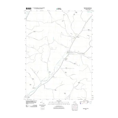
2010 Map of Bolivar
USGS Topo · Published 2010About this map
Bolivar and Richburg sit at the heart of this Allegany County landscape, connected by the winding course of Little Genesee Creek. The map reflects a deeply settled rural corridor where local life historically centered on the creek valley and the surrounding hills. Genealogy researchers will find several burial grounds documented, including Richburg Cemetery, Saint Marys Cemetery, and Maple Lawn Cemetery near the town centers, as well as the more isolated Well Cemetery further south. The terrain is defined by a series of named hollows and heights, such as Richburg Hill and Jordan Hill, which historically dictated the paths of local roads like Salt Rising Rd and Kansas Hollow Rd. Smaller settlements like Sanford and Kossuth are also recorded, marking the intersections and valley floors that have supported these communities into the twenty-first century.
Find a feature on this map
70 named features on this map. Tap any name to fly to it.
Don’t see what you’re looking for? This feature index may not catch every label — zoom into the map to look around manually.
Map Details
Editions of this 2010 Bolivar Map
This is the sole edition of this map. No revisions or reprints were ever made.
Other maps of this area

1898 · Olean
USGS Topo · 1:62,500

1925 · Belmont
USGS Topo · 1:62,500

1933 · Smethport
USGS Topo · 1:62,500

1934 · Coudersport
USGS Topo · 1:48,000

1937 · Smethport
USGS Topo · 1:62,500

1938 · Coudersport
USGS Topo · 1:62,500

1938 · Olean
USGS Topo · 1:62,500

1939 · Belmont
USGS Topo · 1:62,500

1943 · Olean
USGS Topo · 1:62,500

1957 · Warren
USGS Topo · 1:250,000