Old Maps of Granger, New York for Hiking & Exploration
Hike through history with 46 historic maps of Granger. Explore old trails, ghost towns, and forgotten backroads — perfect for outdoor adventurers and local explorers.
- Rediscover forgotten places: Map out old mining camps, roads, and footpaths that no longer exist on modern maps.
- Layer with modern tools: Combine with LiDAR or satellite views to plan hikes through historical terrain.
- Made for exploration: Popular among hikers, overlanders, and local history lovers.
Use these maps to find adventure and explore the hidden past of Granger.
Granger, NY maps
(46)- 1905 Map of Portage
 1905 Portage1905 Print · USGSWyoming County at the turn of the century shows a landscape defined by the deep gorge of the Genesee River and a busy rail network. Genealogists can trace family names at Halls Corners, explore the Silver Lake Assembly, or locate the mills and stations at Rock Glen and Portageville.6 unique versions available
 - 1905 Map of Nunda
 1905 Nunda1905 Print · USGSLivingston County rail and river life are captured here at the turn of the century, centered on the Genesee River valley. Trace the vanished streets of St Helena, locate the Sonyea P O Craig Colony, and follow the complex rail junctions at Mount Morris.6 unique versions available
 - 1906 Map of Angelica
 1906 Angelica1906 Print · USGSAllegany County thrived as a railroad and river corridor during the early twentieth century. Researchers can trace the path of the Pennsylvania R R and find long-established villages like Angelica, Fillmore, and the river crossing at Belfast.6 unique versions available
 - 1916 Map of Canaseraga
 1916 Canaseraga1916 Print · USGSAllegany and Livingston counties appear in the decade before the Great War, during the peak of the local rail era. Genealogists can locate dozens of numbered schoolhouses and family-named landmarks like Whitney Crossings, Karrdale, and the Jersey Hill School.4 unique versions available
 - 1940 Map of Canaseraga
 1940 Canaseraga1940 Print · USGSAllegany County's rural township structure is captured here just before the mid-century, showing a landscape tied together by local district schools and the Erie railroad. Researchers can locate early homesteads near Brewer Corners, trace the rail sidings at Garwoods Sta, or find ancestral landmarks like the County House and Jersey Hill School.2 unique versions available
 - 1941 Map of Angelica
 1941 Angelica1941 Print · USGSAllegany County during the early years of the Second World War was defined by its river-valley rail lines and high-country hamlets. Researchers can trace the legacy of Houghton College, the impact of the Caneadea Dam, and find vanished crossroads like Aristotle and McGrawville.
 - 1943 Map of Nunda, 1960 Print
 1943 Nunda1960 Print · USGSLivingston County's agricultural valleys and steep gorges are captured here during the early 1940s. Genealogists and rail historians can trace the routes of the Pennsylvania and Erie lines through Dalton, Nunda, and the rural crossing at Nunda Junction.
 - 1943 Map of Portageville, 1960 Print
 1943 Portageville1960 Print · USGSThe Genesee River valley in the early 1940s shows a landscape defined by dramatic waterfalls and the vital corridors of the Erie and Pennsylvania railroads. Trace the industrial footprints of Mills Mills and Bluestone or locate family roots near Portageville.
 - 1944 Map of Nunda
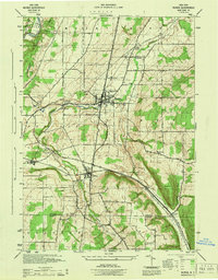 1944 Nunda1944 Print · USGSLivingston and Allegany counties are shown here during the mid-forties, capturing the rural rail-and-river network of the Genesee Valley. Researchers can trace historic family-named routes and vanished sidings at Nunda Junction, Hunts Hollow, and Dalton.
 - 1944 Map of Portageville
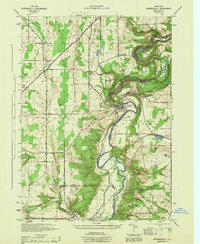 1944 Portageville1944 Print · USGSThe Genesee River valley in the mid-1940s is defined by its dramatic falls and the intersection of rail lines like the Erie and Pennsylvania. Genealogists and historians can trace the rural communities of Portageville, Wiscoy, and Mills during this wartime era.
 - 1950 Map of Elmira
 1950 Elmira1950 Print · USGSThe Finger Lakes region thrived in the late 1940s as a hub of industry and transport. Trace family roots and vanished landmarks near Seneca Lake or explore the rail lines of the Erie RR and the sprawling Seneca Ordnance Depot.2 unique versions available
 - 1958 Map of Elmira
 1958 Elmira1958 Print · USGSThe New York Finger Lakes during the late fifties reveal a complex landscape of glacial geology and industrial growth. Researchers can trace historic transport corridors like the Erie Canal and Erie RR, or locate institutional landmarks like Cornell University.2 unique versions available
 - 1960 Map of Buffalo
 1960 Buffalo1960 Print · USGSWestern New York and the Niagara Peninsula thrive during the mid-twentieth century industrial peak. Genealogists and historians can trace family-named points and early settlements from Dunkirk Light to the Allegany Indian Reservation.
 - 1962 Map of Elmira, 1969 Print
 1962 Elmira1969 Print · USGSThe Finger Lakes region and Southern Tier are captured here during a period of industrial maturity and highway expansion. Researchers can trace the path of the Erie Canal, the footprint of the Seneca Army Depot, and legacy rail lines through Elmira and Ithaca.4 unique versions available
 - 1962 Map of Buffalo, 1980 Print
 1962 Buffalo1980 Print · USGSThe Niagara Frontier and Western New York are captured here in the early sixties, showing the vital industrial and maritime nexus between the U.S. and Canada. Researchers can trace the path of the Welland Canal, locate the Allegany Indian Reservation, or find family sites near Chautauqua Lake.2 unique versions available
 - 1964 Map of Fillmore, 1965 Print
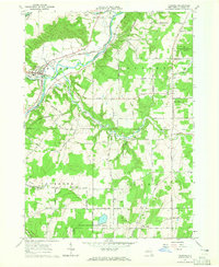 1964 Fillmore1965 Print · USGSThe Genesee River valley in Allegany County is captured here in the mid-1960s as a landscape of rural hamlets and riverside rail. Researchers can trace local heritage through sites like St Patricks Ch, the village of Fillmore, and the uniquely named Cheese Factory Road.2 unique versions available
 - 1964 Map of Birdsall, 1965 Print
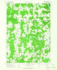 1964 Birdsall1965 Print · USGSAllegany County was characterized by its upland farms and state forests in the mid-1960s. Genealogists can trace family connections through the German Settlement Cem, Weaver Settlement Cem, and the Erie Railroad corridor.2 unique versions available
 - 1965 Map of Elmira
 1965 Elmira1965 Print · USGSThe Finger Lakes and Southern Tier regions are captured in the mid-sixties, showcasing a landscape of deep glacial valleys and heavy rail infrastructure. Trace old railroad corridors like the Pennsylvania RR or visit landmarks like Letchworth State Park and the Seneca Army Depot.
 - 1967 Map of Buffalo
 1967 Buffalo1967 Print · USGSWestern New York and the Lake Erie shoreline are shown here during the mid-1960s industrial peak. Researchers can trace the massive rail networks of the Erie Railroad, locate the Cattaraugus Indian Reservation, or find historic sites like Fort Erie.
 - 1972 Map of Nunda, 1974 Print
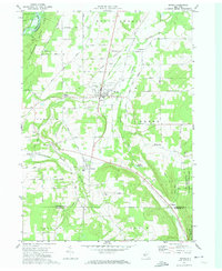 1972 Nunda1974 Print · USGSLivingston County in the early 1970s shows a landscape of river valleys and rail towns shaped by the Erie-Lackawanna. Genealogists and historians can trace family locations near St Helena Cem, the village of Nunda, and the rural settlement of Barkertown.2 unique versions available
 - 1972 Map of Portageville, 1974 Print
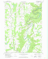 1972 Portageville1974 Print · USGSThe Genesee River valley in the early 1970s reveals a landscape defined by the falls of Letchworth State Park and rural Wyoming County hamlets. Researchers can trace historic cemeteries and small settlements like Portageville, Mills Mills, and Griffith Corners.3 unique versions available
 - 1973 Map of Buffalo
 1973 Buffalo1973 Print · USGSWestern New York and Ontario's Golden Horseshoe meet in the early seventies, spanning from the industrial waterfronts of Buffalo to the hills of Allegany State Park. Trace the paths of the Welland Canal and Erie Lackawanna railroad through the lakefront towns of Dunkirk and Port Colborne.
 - 1983 Map of Canandaigua, 1985 Print
 1983 Canandaigua1985 Print · USGSThe Finger Lakes and Genesee Valley appear in high detail in the early 1980s as the region's transport and academic centers reached a peak. Researchers can trace rail lines like the Lehigh Valley RR and find landmarks such as the Mount Morris Dam and Gannagaro State Historical Site.2 unique versions available
 - 1984 Map of Buffalo, 1985 Print
 1984 Buffalo1985 Print · USGSWestern New York's industrial and transport hubs are in full view during the mid-eighties, from the Lake Erie waterfront to the Genesee Valley. Researchers can trace the legacy of the Erie Canal, find ancestral sites like Mount Calvary Cem, or locate the Attica Correctional Facility.2 unique versions available
 - 1986 Map of Olean
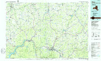 1986 Olean1986 Print · USGSThe Southern Tier and northern Pennsylvania border are captured here in the mid-1980s as the regional rail and river economy evolved. Genealogists and local historians can trace family-named sites across the Allegany Indian Reservation, identify old Oil Field tracts, or locate landmarks like St Bonaventure University and the Tannery.2 unique versions available
Showing maps 1-25 of 46
Top cities near Granger
- Warsaw historical maps
- Alfred historical maps
- Mount Morris historical maps
- Alfred historical maps
- Cuba historical maps
- Castile historical maps
See more
Top neighborhoods of Granger
Frequently asked questions
- What are the different types of historical maps available for Granger?
- What is the oldest map of Granger?
- Where can I purchase historical maps of Granger for my home or office?
- Where can I download high-res historical maps of Granger?
- Are there historical topographic maps available for Granger?
- Is there historical aerial imagery available for Granger?
- Where are historical maps of Granger sourced from?