2020s Maps of Wellsville, New York
Explore 6 historic maps of Wellsville from the 2020s. These maps offer a rare glimpse into what life looked like during the 2020s — showing old roads, neighborhoods, homes, and landmarks that have changed or disappeared over time.
Whether you're researching your family's past, planning a metal detecting trip, or studying how Wellsville's landscape evolved across the 2020s, these high-resolution maps are a powerful tool for exploring the history of this region.
- Focus on a specific era: All maps on this page are from the 2020s, giving you a focused view of this time period.
- See what’s changed: Compare century-old streets, trails, and buildings to today's modern landscape using overlays and satellite layers.
- Research with precision: Use these maps for genealogy, historical research, land use analysis, or educational projects.
- View, download, or print: Maps are fully viewable online in high resolution, and can be downloaded or printed for your own records.
Start exploring Wellsville's history through authentic maps from the 2020s. This is your window into the past.
Wellsville, NY maps
(6)- 2023 Map of Belmont, 2023 Print
 2023 Belmont2023 Print · USGSWestern New York's river valleys and wooded ridges come alive in this contemporary record of Allegany County. Genealogists and historians can trace the rural landscape across Belmont and Friendship, locating family-named landmarks and sites like Norton Cem or Inavale.
 - 2023 Map of Wellsville North, 2023 Print
 2023 Wellsville North2023 Print · USGSAllegany County’s river valleys and high ridges are shown here in the early twenty-first century, centered on the Genesee River and Scio. Genealogists can locate several family and local burial grounds including Rogers Cem and Black Tucker Cem among the hills.
 - 2023 Map of Wellsville South, 2023 Print
 2023 Wellsville South2023 Print · USGSThe Genesee River valley in Allegany County remains a landscape of highland farms and river-bottom settlements in the early twenty-first century. Genealogists and local historians can trace family burial sites at Woodlawn Cem, Johnson Cem, and Sacred Heart Cem.
 - 2023 Map of Whitesville, 2023 Print
 2023 Whitesville2023 Print · USGSAllegany County’s southern valleys are captured here in the early twenty-first century, showing a landscape defined by creeks and hill-country hamlets. Genealogists can locate numerous rural burial grounds including Whitesville Rural Cem, Hallsport Union Cem, and Beech Hill Cem.
 - 2023 Map of Andover, 2023 Print
 2023 Andover2023 Print · USGSAndover and its surrounding valleys are captured here in the early twenty-first century, showing the enduring settlement patterns of Allegany County. Genealogists can locate several historic burial sites like Hillside Cem, Valley Brook Cem, and East Valley Cem.
 - 2023 Map of Allentown, 2023 Print
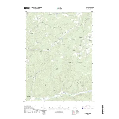 2023 Allentown2023 Print · USGSAllegany County’s dissected plateau is shown in great detail during the early 2020s, revealing a landscape shaped by narrow valleys and upland ridges. Researchers can trace rural cemeteries and small hamlets like Petrolia and Allentown, or locate family landmarks near Sunnyside Cem.
End of results
Showing maps 1-6 of 6
Top cities near Wellsville
- Alfred historical maps
- Wellsville historical maps
- Hornellsville historical maps
- Alfred historical maps
- Caneadea historical maps
- Amity historical maps
See more
Top neighborhoods of Wellsville
Frequently asked questions
- What are the different types of historical maps available for Wellsville?
- What is the oldest map of Wellsville?
- Where can I purchase historical maps of Wellsville for my home or office?
- Where can I download high-res historical maps of Wellsville?
- Are there historical topographic maps available for Wellsville?
- Is there historical aerial imagery available for Wellsville?
- Where are historical maps of Wellsville sourced from?