1960s Maps of Willing, New York
Explore 10 historic maps of Willing from the 1960s. These maps offer a rare glimpse into what life looked like during the 1960s — showing old roads, neighborhoods, homes, and landmarks that have changed or disappeared over time.
Whether you're researching your family's past, planning a metal detecting trip, or studying how Willing's landscape evolved across the 1960s, these high-resolution maps are a powerful tool for exploring the history of this region.
- Focus on a specific era: All maps on this page are from the 1960s, giving you a focused view of this time period.
- See what’s changed: Compare century-old streets, trails, and buildings to today's modern landscape using overlays and satellite layers.
- Research with precision: Use these maps for genealogy, historical research, land use analysis, or educational projects.
- View, download, or print: Maps are fully viewable online in high resolution, and can be downloaded or printed for your own records.
Start exploring Willing's history through authentic maps from the 1960s. This is your window into the past.
Willing, NY maps
(10)- 1960 Map of Williamsport
 1960 Williamsport1960 Print · USGSNorth-central Pennsylvania in the mid-twentieth century was a vital corridor of rail and river industry stretching from the New York line to the coal regions. Genealogists can trace the rail networks of the Pennsylvania RR and Lehigh Valley RR connecting towns like Williamsport, Towanda, and Lock Haven.
 - 1962 Map of Williamsport, 1966 Print
 1962 Williamsport1966 Print · USGSNorth-central Pennsylvania was a landscape of industrial river hubs and vast state woodlands in the early sixties. Researchers can trace the path of the Pennsylvania Railroad through Williamsport and explore the remote reaches of Bucktail State Park.5 unique versions available
 - 1962 Map of Elmira, 1969 Print
 1962 Elmira1969 Print · USGSThe Finger Lakes region and Southern Tier are captured here during a period of industrial maturity and highway expansion. Researchers can trace the path of the Erie Canal, the footprint of the Seneca Army Depot, and legacy rail lines through Elmira and Ithaca.4 unique versions available
 - 1965 Map of Elmira
 1965 Elmira1965 Print · USGSThe Finger Lakes and Southern Tier regions are captured in the mid-sixties, showcasing a landscape of deep glacial valleys and heavy rail infrastructure. Trace old railroad corridors like the Pennsylvania RR or visit landmarks like Letchworth State Park and the Seneca Army Depot.
 - 1965 Map of Williamsport
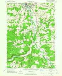
 1965 Williamsport1965 Print · USGSNorth-central Pennsylvania in the mid-1960s is defined by the industrial river towns and vast timberlands of the Allegheny Plateau. Researchers can trace historic rail lines like the Erie Lackawanna and Reading as they thread through Williamsport, Lock Haven, and Jersey Shore.
 - 1965 Map of Whitesville, 1966 Print
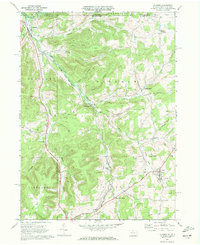
 1965 Whitesville1966 Print · USGSAllegany County near the Pennsylvania border is shown here as a center of energy production in the mid-sixties. Genealogists and researchers can locate family-named features like Beech Hill Cem and trace old crossroads at Whitesville, Hallsport, and Spring Mills.2 unique versions available
 - 1965 Map of Wellsville South, 1967 Print
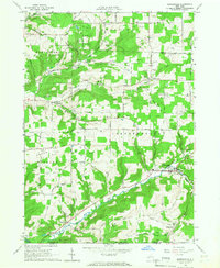
 1965 Wellsville South1967 Print · USGSThe Genesee River valley in the mid-sixties reveals a landscape of oil production and rural New York life. Genealogists can trace family landmarks like Johnson Cem or follow the Erie-Lackawanna rail line through Wellsville and Stannards.2 unique versions available
 - 1966 Map of Williamsport
 1966 Williamsport1966 Print · USGSThe Susquehanna Valley was a hub of transit and industry in the mid-seventies, where the river's West Branch connected major college towns and timberlands. Researchers can trace historical rail lines like the Reading or locate regional landmarks from Jersey Shore to Ricketts Glen State Park.
 - 1969 Map of Ellisburg, 1972 Print
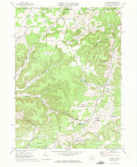 1969 Ellisburg1972 Print · USGSPotter County, Pennsylvania, is shown during the late sixties as an active hub for the regional energy industry. Genealogists and historians can trace family locations near Andrews Settlement, the path of the Old Oswayo Railroad Grade, and Rose Lake.3 unique versions available
 - 1969 Map of Ulysses, 1972 Print
 1969 Ulysses1972 Print · USGSPotter County at the end of the sixties shows a landscape of river-fed valleys and energy infrastructure. Trace local history through North Bingham Cem, the Hickox Landing Field, and old transport routes like Pusher Siding.2 unique versions available
End of results
Showing maps 1-10 of 10
Top cities near Willing
- Wellsville historical maps
- Alfred historical maps
- Wellsville historical maps
- Alfred historical maps
- Amity historical maps
- Bolivar historical maps
See more
Top neighborhoods of Willing
- Mapes historical maps
- Paynesville historical maps
- Hallsport historical maps
- Shongo historical maps
- Stannards historical maps
Frequently asked questions
- What are the different types of historical maps available for Willing?
- What is the oldest map of Willing?
- Where can I purchase historical maps of Willing for my home or office?
- Where can I download high-res historical maps of Willing?
- Are there historical topographic maps available for Willing?
- Is there historical aerial imagery available for Willing?
- Where are historical maps of Willing sourced from?