2020s Maps of Kirkwood, New York
Explore 7 historic maps of Kirkwood from the 2020s. These maps offer a rare glimpse into what life looked like during the 2020s — showing old roads, neighborhoods, homes, and landmarks that have changed or disappeared over time.
Whether you're researching your family's past, planning a metal detecting trip, or studying how Kirkwood's landscape evolved across the 2020s, these high-resolution maps are a powerful tool for exploring the history of this region.
- Focus on a specific era: All maps on this page are from the 2020s, giving you a focused view of this time period.
- See what’s changed: Compare century-old streets, trails, and buildings to today's modern landscape using overlays and satellite layers.
- Research with precision: Use these maps for genealogy, historical research, land use analysis, or educational projects.
- View, download, or print: Maps are fully viewable online in high resolution, and can be downloaded or printed for your own records.
Start exploring Kirkwood's history through authentic maps from the 2020s. This is your window into the past.
Kirkwood, NY maps
(7)- 2023 Map of Franklin Forks, 2023 Print
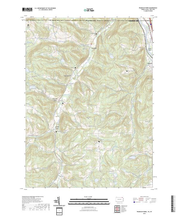 2023 Franklin Forks2023 Print · USGSSusquehanna County’s highland terrain and creek valleys are captured in modern detail just south of the New York border. Genealogists can trace family heritage through numerous remote burial sites like Butts - Martin Farm Cem, Lawsville Cem, and Mountain Valley Cem.
 - 2023 Map of Great Bend, 2023 Print
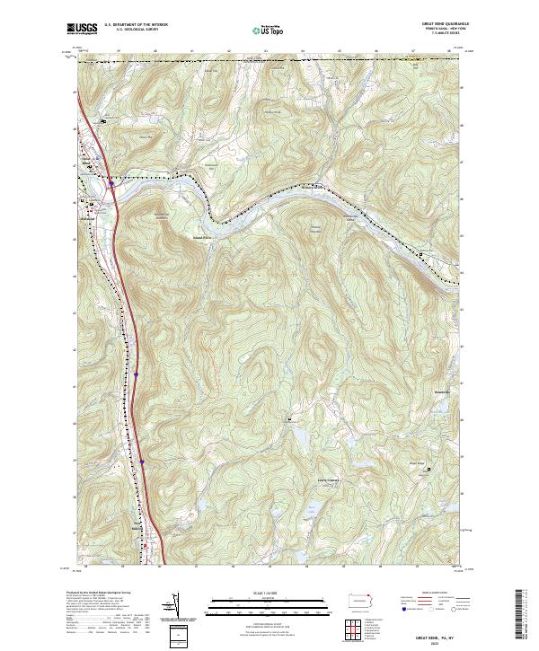 2023 Great Bend2023 Print · USGSThe Susquehanna River valley near the New York border is shown here in its modern landscape, where historical settlements and transportation corridors converge. Family historians can locate numerous burial sites, from Rose Hill Cem to the First Presbyterian Church Cem, alongside landmarks like Woodbridge Island.
 - 2023 Map of Binghamton West, 2023 Print
 2023 Binghamton West2023 Print · USGSThe Tri-Cities area of New York is shown in detail during its modern era, where the urban riverfront meets southern tier ridges. Researchers can trace institutional footprints at Binghamton University and locate historic burial grounds like Spring Forest Cem and Floral Park Cem.
 - 2023 Map of Castle Creek, 2023 Print
 2023 Castle Creek2023 Print · USGSThe Chenango River valley north of Johnson City shows a landscape of institutional growth and upland hamlets. Genealogists can trace family names across Nimmonsburg Cem, the settlement at Castle Creek, and the grounds of SUNY Broome Community College.
 - 2023 Map of Windsor, 2023 Print
 2023 Windsor2023 Print · USGSBroome County's river valleys and high ridges are captured in this recent survey, showcasing the village of Windsor along the Susquehanna River. Genealogists can trace family names at the Windsor Village Cem, Mountain View Cem, or Knox Cem.
 - 2023 Map of Chenango Forks, 2023 Print
 2023 Chenango Forks2023 Print · USGSThe northern Broome County landscape is captured here where the Tioughnioga River and Chenango River meet. Genealogists and local researchers can trace historic burial sites like Toombs Cem and Collins-Hall Cem alongside the small hamlets of Sanitaria Springs and Port Crane.
 - 2023 Map of Binghamton East, 2023 Print
 2023 Binghamton East2023 Print · USGSThe Susquehanna River valley south of Binghamton remains a landscape of family-named hollows and historic river towns in the early twenty-first century. Genealogists can trace small burial sites like Finch Family Cem and Methodist Church Cem near Conklin Forks.
End of results
Showing maps 1-7 of 7
Top cities near Kirkwood
- Union historical maps
- Binghamton historical maps
- Vestal historical maps
- Johnson City historical maps
- Endwell historical maps
- Chenango historical maps
See more
Top neighborhoods of Kirkwood
- Kirkwood Center historical maps
- Langdon historical maps
- Riverside historical maps
- Brookvale historical maps
- Fivemile Point historical maps
- Popes Ravine historical maps
Frequently asked questions
- What are the different types of historical maps available for Kirkwood?
- What is the oldest map of Kirkwood?
- Where can I purchase historical maps of Kirkwood for my home or office?
- Where can I download high-res historical maps of Kirkwood?
- Are there historical topographic maps available for Kirkwood?
- Is there historical aerial imagery available for Kirkwood?
- Where are historical maps of Kirkwood sourced from?