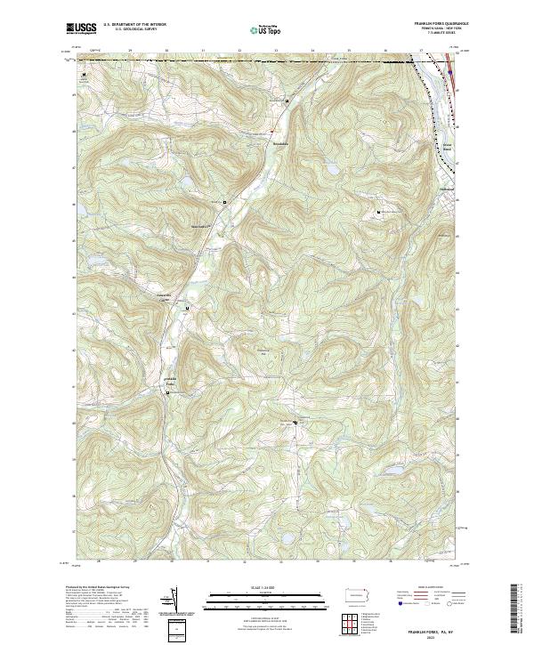
2023 Map of Franklin Forks
USGS Topo · Published 2023About this map
Snake Creek winds through this portion of Susquehanna County, carving a valley that anchors the settlements of Brookdale, Stanfordville, and Franklin Forks. The landscape is defined by its numerous family and community burial grounds, such as the Butts - Martin Farm Cem and Bailey Cem, which offer significant genealogical value for researchers of the region's early farming families. Further south, Lawsville Center and the dual sites of Franklin Hill Cem - West and Franklin Hill Cem - East sit atop the high ground between Snake Creek and DuBois Creek. To the northeast, the terrain shifts toward the Susquehanna River valley, where Great Bend and Hallstead serve as gateway communities near the New York border. Water features are abundant across the highlands, including Mingo Lake, Bel-Air Lake, and the DuBois Reservoir, reflecting a landscape well-integrated with its natural drainage systems.
Find a feature on this map
104 named features on this map. Tap any name to fly to it.
Don’t see what you’re looking for? This feature index may not catch every label — zoom into the map to look around manually.
Map Details
Editions of this 2023 Franklin Forks Map
This is the sole edition of this map. No revisions or reprints were ever made.
Other maps of this area

1904 · Binghamton
USGS Topo · 1:62,500

1905 · Nineveh
USGS Topo · 1:62,500

1932 · Susquehanna
USGS Topo · 1:62,500

1935 · Binghamton West
USGS Topo · 1:24,000

1935 · Susquehanna
USGS Topo · 1:62,500

1937 · Binghamton East
USGS Topo · 1:24,000

1942 · Binghamton West
USGS Topo · 1:31,680

1942 · Binghamton East
USGS Topo · 1:31,680

1943 · Montrose
USGS Topo · 1:62,500

1945 · Montrose
USGS Topo · 1:62,500