Old Maps of Kirkwood, New York
Explore 74 old maps of Kirkwood, spanning from 1904 to today. These high-resolution historic maps reveal how streets, neighborhoods, landmarks, and natural features evolved over time — perfect for genealogy, metal detecting, research, and local history exploration.
What you can do with these maps:
- See how Kirkwood changed over time: Compare historical maps to modern-day views to trace roads, homesites, rail lines & more.
- View detailed metadata: Each map includes creators, publishers, year, scale, and archive source.
- Overlay maps with satellite & LiDAR: Visualize the past alongside modern tools to explore terrain & human change.
- Trusted historical sources: Maps sourced from the USGS, Library of Congress, and other archives.
- Access maps your way: View online, download high-res files, or order prints for personal or research use.
Start exploring old maps of Kirkwood to uncover forgotten places, hidden landmarks, and the deep history beneath your feet.
Kirkwood, NY maps
(74)- 1904 Map of Binghamton
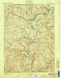
 1904 Binghamton1904 Print · USGSBinghamton at the turn of the century serves as the heart of a massive rail network where the Chenango and Susquehanna rivers meet. Researchers can trace the early layout of industrial Lestershire, the hill-station at Sanitaria Springs, and the diverse hamlets of New Ireland and Port Dickinson.9 unique versions available
 - 1905 Map of Nineveh
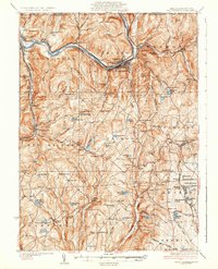
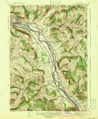
 1905 Nineveh1905 Print · USGSBroome County at the turn of the century shows a landscape dominated by the winding Susquehanna River and vital rail corridors. Genealogists can trace early homesteads and hamlets from Vallonia Springs to Center Village, alongside the path of the Delaware and Hudson railroad.6 unique versions available
 - 1932 Map of Susquehanna, 1959 Print
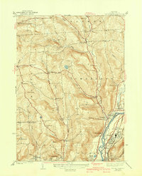
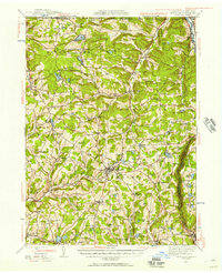
 1932 Susquehanna1959 Print · USGSSusquehanna County at the start of the 1930s is a landscape of thriving rail junctions and upland farming crossroads. Researchers can trace the path of the Erie RR through Lanesboro or locate rural landmarks like Sweet Chapel and the Lamb Cem.
 - 1934 Map of Castle Creek
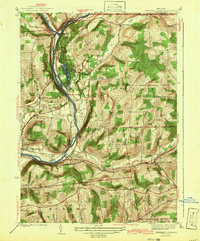
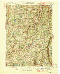
 1934 Castle Creek1934 Print · USGSBroome County was transitioning into a regional transit hub during the mid-1930s as major railroads and highways began to reshape the river valleys. Genealogists can locate numerous rural schoolhouses and ethnic landmarks like the Polish Cem and Harry L Johnson Sch.
 - 1935 Map of Binghamton West
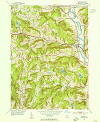
 1935 Binghamton West1935 Print · USGSBinghamton and its surrounding hill country are captured in the mid-1930s, showing the city's riverfront core alongside quiet rural settlements. Researchers can trace historic family names and community landmarks from Bible School Park to remote rural sites like Turkey Lane Sch and Hawleyton.
 - 1935 Map of Chenango Forks
 1935 Chenango Forks1935 Print · USGSThe river valleys and rail corridors of Broome County come alive in this mid-1930s survey of the Chenango Forks area. Genealogists can trace rural life through a network of local institutions like West Colesville Ch, Oak Hill Sch, and the C C C Camp.
 - 1935 Map of Susquehanna
 1935 Susquehanna1935 Print · USGSThe Susquehanna River valley in the 1930s was a bustling corridor of heavy rail and industrial settlements along the New York border. Genealogists and historians can trace family homesteads near rural schools like Oak Hill Sch and early transit routes like the Newburg Turnpike.3 unique versions available
 - 1937 Map of Binghamton East
 1937 Binghamton East1937 Print · USGSBroome County at the edge of the Southern Tier reflects a bustling rail-and-river landscape just before the war. Researchers can trace ancestral farmsteads and rural infrastructure through local landmarks like Acre Sch, Conklin Forks, and the State Hospital.2 unique versions available
 - 1942 Map of Binghamton West
 1942 Binghamton West1942 Print · USGSThe river confluence and bustling rail corridors of the early 1940s define this area as it transitions from city streets to upland farms. Researchers can trace historic family landmarks and rural school sites such as Crocker Cem, Bunn Hill Ch, and the Turkey Lane Sch.2 unique versions available
 - 1942 Map of Castle Creek
 1942 Castle Creek1942 Print · USGSBroome County at the start of the 1940s reveals a region balancing river-valley industry with upland rural life. Genealogists can trace family roots through landmarks like the Camp Meeting Grounds, the Polish Cem, and schools like Finch Hollow Sch.3 unique versions available
 - 1942 Map of Chenango Forks
 1942 Chenango Forks1942 Print · USGSUpper Broome County in the years before the war shows a landscape shaped by river junctions and burgeoning state park development. Local historians can trace early school districts and railroad routes through Chenango Forks, Sanitaria Springs, and the CCC Camp at Chenango Valley State Park.3 unique versions available
 - 1942 Map of Binghamton East
 1942 Binghamton East1942 Print · USGSBroome County at the start of the 1940s was defined by the busy rail corridors and river towns along the Pennsylvania border. Genealogists and local historians can trace family-named landmarks like Stilson Hollow and rural school sites such as Acre Sch and School No 11.3 unique versions available
 - 1943 Map of Montrose, 1957 Print
 1943 Montrose1957 Print · USGSSusquehanna County at the height of the mid-century railroad era shows a landscape of upland farms and valley rail junctions. Researchers can locate long-standing family landmarks and rural hubs like South Montrose, the Lehigh Valley line, and Prospect Hill Cem.3 unique versions available
 - 1945 Map of Montrose
 1945 Montrose1945 Print · USGSSusquehanna County is shown in the mid-1940s as a landscape of rural schoolhouses and established rail corridors. Genealogists and historians can locate family landmarks such as Prospect Hill Cem, tracing the paths between Montrose and the mills at Snows Mill.2 unique versions available
 - 1948 Map of Binghamton, 1980 Print
 1948 Binghamton1980 Print · USGSCentral New York and the Southern Tier thrive in the late 1940s as a hub of rail traffic and mountain industry. Researchers can trace historic transit lines like the Erie Railroad through Binghamton or find old valley settlements near Oneonta and Delhi.
 - 1950 Map of Binghamton
 1950 Binghamton1950 Print · USGSBinghamton and the surrounding Southern Tier are shown in the mid-century era, highlighting the intricate rail and river networks that drove local industry. Researchers can trace the path of the Erie Railroad and locate landmarks from Otsego Lake to Sidney Mountain.2 unique versions available
 - 1950 Map of Chenango Forks, 1951 Print
 1950 Chenango Forks1951 Print · USGSThe river valleys and rail lines north of Binghamton converge here at the start of the 1950s. Genealogists and local historians can trace the rural school system from School No 29 to School No 5, or follow the rail-era growth of Port Crane and Sanitaria Springs.
 - 1950 Map of Scranton, 1952 Print
 1950 Scranton1952 Print · USGSMid-century Northeast Pennsylvania and the Hudson Valley come alive in this survey of the tri-state region. Genealogists and historians can trace the dense rail networks of the Erie RR and DL&W RR between industrial hubs like Scranton and Wilkes-Barre.
 - 1952 Map of Windsor, 1955 Print
 1952 Windsor1955 Print · USGSThe Susquehanna River valley in the early fifties shows a landscape of established hill-country hamlets and riverfront industry. Genealogists and local researchers can trace family landmarks at Riverside Cem, the settlement at Lester, and the rural Central Sch.3 unique versions available
 - 1953 Map of Scranton
 1953 Scranton1953 Print · USGSNortheastern Pennsylvania and the Catskills are shown in great detail during the early fifties, a time when rail lines and river valleys dictated the region's growth. Genealogists and historians can trace the industrial hearts of Scranton and Wilkes-Barre or locate remote landmarks like High Point and Lake Wallenpaupack.
 - 1958 Map of Binghamton
 1958 Binghamton1958 Print · USGSCentral New York in the late fifties was a network of manufacturing cities and river valleys connected by vital rail lines. Genealogists and historians can trace family roots in Oneonta, Norwich, and Cooperstown or locate long-standing farms along Schoharie Creek.
 - 1959 Map of Scranton
 1959 Scranton1959 Print · USGSThe northern coalfields and the Hudson Valley meet in this mid-century survey of the Pennsylvania and New York borderlands. Genealogists and historians can trace the intricate rail networks of the Erie Railroad and the vast waters of Lake Wallenpaupack.2 unique versions available
 - 1960 Map of Chenango Forks, 1963 Print
 1960 Chenango Forks1963 Print · USGSThe river valleys of Broome County come alive in this early 1960s survey of the river confluence and the growing Chenango Valley. Genealogists and local historians can trace the foundations of Chenango Forks, the grounds of Chenango Valley State Park, and rural landmarks like Toombs Cem.
 - 1961 Map of Castle Creek, 1963 Print
 1961 Castle Creek1963 Print · USGSBroome County in the early sixties shows a landscape of growing valley towns and hilltop hamlets. Genealogists and local historians can trace family plots at Chenango Valley Cemetery or explore the development of Hillcrest and the Broome County Airport.
 - 1961 Map of Binghamton West, 1964 Print
 1961 Binghamton West1964 Print · USGSBinghamton and Johnson City are shown in the early sixties as they developed around the Susquehanna and Chenango Rivers. Researchers can trace historic local institutions like Harpur College, Spring Forest Cemetery, and the Erie-Lackawanna rail lines.
Showing maps 1-25 of 74
Top cities near Kirkwood
- Union historical maps
- Binghamton historical maps
- Vestal historical maps
- Johnson City historical maps
- Endwell historical maps
- Chenango historical maps
See more
Top neighborhoods of Kirkwood
- Kirkwood Center historical maps
- Langdon historical maps
- Riverside historical maps
- Brookvale historical maps
- Fivemile Point historical maps
- Popes Ravine historical maps
Frequently asked questions
- What are the different types of historical maps available for Kirkwood?
- What is the oldest map of Kirkwood?
- Where can I purchase historical maps of Kirkwood for my home or office?
- Where can I download high-res historical maps of Kirkwood?
- Are there historical topographic maps available for Kirkwood?
- Is there historical aerial imagery available for Kirkwood?
- Where are historical maps of Kirkwood sourced from?