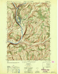
1950 Map of Chenango Forks
USGS Topo · Published 1951About this map
The confluence of the Tioughnioga River and the Chenango River anchors this postwar landscape in Broome County, marking a vital transit corridor where water, rail, and road converge. The Delaware Lackawanna and Western railroad tracks follow the river valley, connecting settlements like Chenango Forks and Chenango Bridge. To the east, the Delaware and Hudson line cuts through the hills toward Sanitaria Springs and Osborne.
Find a feature on this map
39 named features on this map. Tap any name to fly to it.
Don’t see what you’re looking for? This feature index may not catch every label — zoom into the map to look around manually.
Map Details
Editions of this 1950 Chenango Forks Map
This is the sole edition of this map. No revisions or reprints were ever made.
Other maps of this area

1902 · Coventry
USGS Topo · 1:62,500

1904 · Binghamton
USGS Topo · 1:62,500

1904 · Greene
USGS Topo · 1:62,500

1904 · Oxford
USGS Topo · 1:62,500

1905 · Nineveh
USGS Topo · 1:62,500

1934 · Castle Creek
USGS Topo · 1:24,000

1935 · Binghamton West
USGS Topo · 1:24,000

1935 · Chenango Forks
USGS Topo · 1:24,000

1937 · Binghamton East
USGS Topo · 1:24,000

1942 · Binghamton West
USGS Topo · 1:31,680