2020s Maps of Olean, New York
Explore 3 historic maps of Olean from the 2020s. These maps offer a rare glimpse into what life looked like during the 2020s — showing old roads, neighborhoods, homes, and landmarks that have changed or disappeared over time.
Whether you're researching your family's past, planning a metal detecting trip, or studying how Olean's landscape evolved across the 2020s, these high-resolution maps are a powerful tool for exploring the history of this region.
- Focus on a specific era: All maps on this page are from the 2020s, giving you a focused view of this time period.
- See what’s changed: Compare century-old streets, trails, and buildings to today's modern landscape using overlays and satellite layers.
- Research with precision: Use these maps for genealogy, historical research, land use analysis, or educational projects.
- View, download, or print: Maps are fully viewable online in high resolution, and can be downloaded or printed for your own records.
Start exploring Olean's history through authentic maps from the 2020s. This is your window into the past.
Olean, NY maps
(3)- 2023 Map of Hinsdale, 2023 Print
 2023 Hinsdale2023 Print · USGSCattaraugus County in the early twenty-first century remains a landscape of high ridges and deep creek valleys. Researchers can locate family burial sites at Hinsdale Cem or trace the early settlement footprints at Ischua and Smith Hollow.
 - 2023 Map of Eldred, 2023 Print
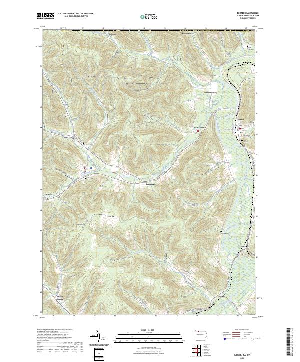 2023 Eldred2023 Print · USGSMcKean County at the turn of the twenty-first century reveals a landscape of deep hollows and river-bottom settlements along the Allegheny River. Genealogists can locate family burial grounds like Saint Raphael Cem and Moody Hollow Cem or trace the early foundations of Duke Center and Eldred.
 - 2023 Map of Olean, 2023 Print
 2023 Olean2023 Print · USGSSouthern New York's industrial and academic heritage is preserved here as the city centers grew around the Allegheny River. Researchers can locate family landmarks from Mount View Cem to the grounds of Saint Bonaventure University and the settlement at Rock City.
End of results
Showing maps 1-3 of 3
Top cities near Olean
- Olean historical maps
- Bradford historical maps
- Allegany historical maps
- Portville historical maps
- Cuba historical maps
- Franklinville historical maps
See more
Top neighborhoods of Olean
Frequently asked questions
- What are the different types of historical maps available for Olean?
- What is the oldest map of Olean?
- Where can I purchase historical maps of Olean for my home or office?
- Where can I download high-res historical maps of Olean?
- Are there historical topographic maps available for Olean?
- Is there historical aerial imagery available for Olean?
- Where are historical maps of Olean sourced from?