Old Maps of French Creek, New York for Metal Detecting
Plan your next treasure hunt with 44 historic maps of French Creek. Find old homesites, ghost towns, trails, and gathering spots that may be lost to time — perfect for identifying promising metal detecting locations.
- Locate forgotten sites: Uncover places like long-lost settlements, abandoned rail lines, or gathering spots.
- Plan better hunts: Use map overlays combined with LiDAR or satellite views to narrow in on historically rich areas.
- Made for detectorists: Thousands of hobbyists use these maps to discover relics, coins, and hidden history.
Use these historic maps to boost your research and find new opportunities beneath the surface of French Creek.
French Creek, NY maps
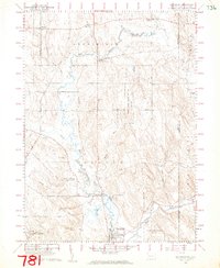
(44)- 1905 Map of Clymer
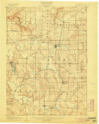 1905 Clymer1905 Print · USGSWestern Chautauqua County at the turn of the century shows a landscape of busy rail corridors and small rural hamlets. Genealogists can trace family roots through crossroads like Sheldon Corners or follow the old tracks through Sherman and Panama Sta.4 unique versions available
 - 1913 Map of North East, 1962 Print
 1913 North East1962 Print · USGSThe Lake Erie shoreline and the Pennsylvania-New York border come alive in this survey of the pre-war lakefront and interior. Genealogists can locate dozens of early district schools and family landmarks like Colts Station, Lowville, and the McCord School.
 - 1915 Map of North East
 1915 North East1915 Print · USGSCoastal Erie County at the height of its early twentieth-century rail and fruit-growing era shows a landscape transitioning from bustling lake ports to quiet hilltop farmsteads. Genealogists can trace family connections through numerous rural schoolhouses and small hubs like Philipsville, Colts Station, and Moorheadville.5 unique versions available
 - 1929 Map of Corry
 1929 Corry1929 Print · USGSThe industrial hub of Corry and the rural expanses of Erie and Crawford counties are captured here just before the Great Depression. Genealogists can trace family roots through numerous remote schools and churches, from Harbor Hall Ch to the tiny settlement of Hatchtown.2 unique versions available
 - 1929 Map of Union City, 1961 Print
 1929 Union City1961 Print · USGSNorthwestern Pennsylvania in the late twenties remains a landscape of busy rail junctions and crossroads hamlets like Wattsburg and Union City. Genealogists can trace family footprints across dozens of local landmarks, including the Cottage Hill Ch, Barton Sch, and Tillotson Corners.
 - 1932 Map of Corry
 1932 Corry1932 Print · USGSThe industrial crossroads at the junction of the Pennsylvania and Erie Railroads come to life in the early 1930s. Trace old family roots and rural schoolhouses like Picidilli Sch and Daytown Sch near Spartansburg and Corry.3 unique versions available
 - 1932 Map of Union City
 1932 Union City1932 Print · USGSNorthwestern Pennsylvania at the dawn of the 1930s reveals a landscape of thriving rail junctions and rural crossroads. Genealogists can trace family landmarks and forgotten hamlets such as Riceville, Mill Village, and the many one-room schools like Bonnell Sch.3 unique versions available
 - 1939 Map of Clymer, 1957 Print
 1939 Clymer1957 Print · USGSChautauqua County’s rural uplands are shown here just before the 1940s, highlighting a network of rail-side hamlets and crossroads. Genealogists can locate family-named sites like Raters Corners and Sheldon Corners or trace the Pennsylvania rail line.4 unique versions available
 - 1941 Map of Clymer, 1945 Print
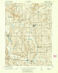
 1941 Clymer1945 Print · USGSChautauqua County at the start of the 1940s reveals a landscape of highland dairy farms and vital rail links. Genealogists can trace family footprints at Sheldon Corners, find the Nettle Hill Sch, or follow the Pennsylvania RR through Sherman.
 - 1943 Map of North East
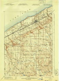
 1943 North East1943 Print · USGSThe Lake Erie shoreline in the early 1940s reveals a landscape of productive orchards and lakeside communities at the Pennsylvania-New York border. Family historians can locate dozens of neighborhood schoolhouses and rural crossroads like Colts Station, Gospel Hill Sch, and Orchard Beach.
 - 1954 Map of Clymer, 1957 Print
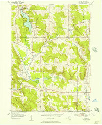 1954 Clymer1957 Print · USGSChautauqua County in the mid-fifties presents a landscape of dairy farms and rural hamlets connected by narrow valley roads. Researchers can trace family history through sites like Marks Corners Cem, Edwards Chapel, and the shoreline settlements of Findley Lake.3 unique versions available
 - 1957 Map of Warren, 1964 Print
 1957 Warren1964 Print · USGSThe northern Pennsylvania oil and timber country comes into focus in the mid-fifties, showing the region before modern highway expansions. Trace the industrial rail networks of the Pennsylvania RR and the early Allegheny River Reservoir near Warren and Oil City.4 unique versions available
 - 1958 Map of Warren
 1958 Warren1958 Print · USGSNorthern Pennsylvania’s timber and oil country is captured here during the late fifties, showing the interplay of industrial valleys and vast state forests. Genealogists can trace family connections across the Cornplanter Indian Reservation or through rail hubs like Oil City and Saint Marys.
 - 1959 Map of Warren
 1959 Warren1959 Print · USGSNorthern Pennsylvania's oil and timber country comes alive in this late-fifties study of the forest-clad plateaus. Trace the historic Cornplanter (Indian Reservation), the sprawling Oil Field, and the rail lines of the Pennsylvania RR.2 unique versions available
 - 1960 Map of Buffalo
 1960 Buffalo1960 Print · USGSWestern New York and the Niagara Peninsula thrive during the mid-twentieth century industrial peak. Genealogists and historians can trace family-named points and early settlements from Dunkirk Light to the Allegany Indian Reservation.
 - 1960 Map of Wattsburg, 1962 Print
 1960 Wattsburg1962 Print · USGSNorthwestern Pennsylvania in the early sixties was a landscape of winding creeks and quiet crossroads. Genealogists and local historians can trace family-named routes and landmarks like West Mina Cem, the Fairgrounds at Wattsburg, and the Township Sch.4 unique versions available
 - 1962 Map of Buffalo, 1980 Print
 1962 Buffalo1980 Print · USGSThe Niagara Frontier and Western New York are captured here in the early sixties, showing the vital industrial and maritime nexus between the U.S. and Canada. Researchers can trace the path of the Welland Canal, locate the Allegany Indian Reservation, or find family sites near Chautauqua Lake.2 unique versions available
 - 1967 Map of Buffalo
 1967 Buffalo1967 Print · USGSWestern New York and the Lake Erie shoreline are shown here during the mid-1960s industrial peak. Researchers can trace the massive rail networks of the Erie Railroad, locate the Cattaraugus Indian Reservation, or find historic sites like Fort Erie.
 - 1968 Map of Corry, 1971 Print
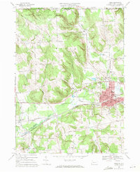 1968 Corry1971 Print · USGSCorry and the surrounding Erie County townships are captured here in the late sixties at the height of their rail-era significance. Researchers can trace the dual lines of the Penn Central through Elgin or locate family sites near Wheelock Cem and Ranges Corners.3 unique versions available
 - 1968 Map of Union City, 1973 Print
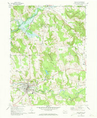 1968 Union City1973 Print · USGSUnion City and its surrounding rural townships thrive during the late sixties as a crossroads of the Penn Central and Erie-Lackawanna railroads. Local historians can trace family-named landmarks like Kimble Corners and Arbuckle or locate the Evergreen Cem and St Teresa Ch.3 unique versions available
 - 1971 Map of Warren
 1971 Warren1971 Print · USGSNorth Central Pennsylvania is captured here in the early seventies, showing a landscape defined by industrial centers and massive state forests. Genealogists and historians can trace the rail lines of the Penn Central and Erie Lackawanna connecting towns like Warren, Kane, and Du Bois.
 - 1973 Map of Buffalo
 1973 Buffalo1973 Print · USGSWestern New York and Ontario's Golden Horseshoe meet in the early seventies, spanning from the industrial waterfronts of Buffalo to the hills of Allegany State Park. Trace the paths of the Welland Canal and Erie Lackawanna railroad through the lakefront towns of Dunkirk and Port Colborne.
 - 1983 Map of Warren, 1984 Print
 1983 Warren1984 Print · USGSNorthwestern Pennsylvania at the dawn of the 1980s reveals a landscape defined by the petroleum industry and expansive public lands. Trace the legacy of early oil at Drake Well Memorial Park and Pithole City Historical Site, or locate family sites near Warren State Hospital and Kellettville.
 - 1986 Map of Jamestown
 1986 Jamestown1986 Print · USGSChautauqua County and the Lake Erie shoreline are captured in the mid-eighties as the region balanced its industrial rail hubs with lakeside culture. Local historians can trace the grounds of the Chautauqua Institution, the expansion of Jamestown, and rural landmarks like Sunset Hill Cemetery.2 unique versions available
 - 2010 Map of Clymer, 2010 Print
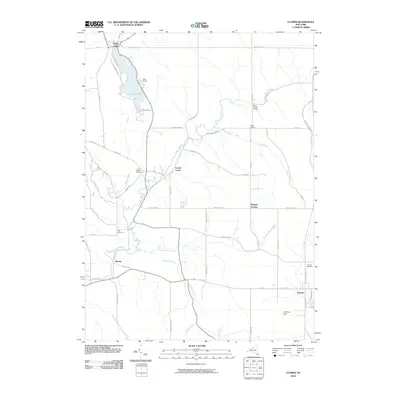 2010 Clymer2010 Print · USGSCovers French Creek, including Clymer, Sherman, and other nearby areas
Showing maps 1-25 of 44
Top cities near French Creek
- Harborcreek Township historical maps
- North East historical maps
- Corry historical maps
- Westfield historical maps
- Chautauqua historical maps
- Union City historical maps
See more
Top neighborhoods of French Creek
Frequently asked questions
- What are the different types of historical maps available for French Creek?
- What is the oldest map of French Creek?
- Where can I purchase historical maps of French Creek for my home or office?
- Where can I download high-res historical maps of French Creek?
- Are there historical topographic maps available for French Creek?
- Is there historical aerial imagery available for French Creek?
- Where are historical maps of French Creek sourced from?