1930s Maps of French Creek, New York
Explore 3 historic maps of French Creek from the 1930s. These maps offer a rare glimpse into what life looked like during the 1930s — showing old roads, neighborhoods, homes, and landmarks that have changed or disappeared over time.
Whether you're researching your family's past, planning a metal detecting trip, or studying how French Creek's landscape evolved across the 1930s, these high-resolution maps are a powerful tool for exploring the history of this region.
- Focus on a specific era: All maps on this page are from the 1930s, giving you a focused view of this time period.
- See what’s changed: Compare century-old streets, trails, and buildings to today's modern landscape using overlays and satellite layers.
- Research with precision: Use these maps for genealogy, historical research, land use analysis, or educational projects.
- View, download, or print: Maps are fully viewable online in high resolution, and can be downloaded or printed for your own records.
Start exploring French Creek's history through authentic maps from the 1930s. This is your window into the past.
French Creek, NY maps
(3)- 1932 Map of Corry
 1932 Corry1932 Print · USGSThe industrial crossroads at the junction of the Pennsylvania and Erie Railroads come to life in the early 1930s. Trace old family roots and rural schoolhouses like Picidilli Sch and Daytown Sch near Spartansburg and Corry.3 unique versions available
 - 1932 Map of Union City
 1932 Union City1932 Print · USGSNorthwestern Pennsylvania at the dawn of the 1930s reveals a landscape of thriving rail junctions and rural crossroads. Genealogists can trace family landmarks and forgotten hamlets such as Riceville, Mill Village, and the many one-room schools like Bonnell Sch.3 unique versions available
 - 1939 Map of Clymer, 1957 Print
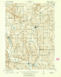 1939 Clymer1957 Print · USGSChautauqua County’s rural uplands are shown here just before the 1940s, highlighting a network of rail-side hamlets and crossroads. Genealogists can locate family-named sites like Raters Corners and Sheldon Corners or trace the Pennsylvania rail line.4 unique versions available
End of results
Showing maps 1-3 of 3
Top cities near French Creek
- Harborcreek Township historical maps
- North East historical maps
- Corry historical maps
- Westfield historical maps
- Chautauqua historical maps
- Union City historical maps
See more
Top neighborhoods of French Creek
Frequently asked questions
- What are the different types of historical maps available for French Creek?
- What is the oldest map of French Creek?
- Where can I purchase historical maps of French Creek for my home or office?
- Where can I download high-res historical maps of French Creek?
- Are there historical topographic maps available for French Creek?
- Is there historical aerial imagery available for French Creek?
- Where are historical maps of French Creek sourced from?