2020s Maps of French Creek, New York
Explore 4 historic maps of French Creek from the 2020s. These maps offer a rare glimpse into what life looked like during the 2020s — showing old roads, neighborhoods, homes, and landmarks that have changed or disappeared over time.
Whether you're researching your family's past, planning a metal detecting trip, or studying how French Creek's landscape evolved across the 2020s, these high-resolution maps are a powerful tool for exploring the history of this region.
- Focus on a specific era: All maps on this page are from the 2020s, giving you a focused view of this time period.
- See what’s changed: Compare century-old streets, trails, and buildings to today's modern landscape using overlays and satellite layers.
- Research with precision: Use these maps for genealogy, historical research, land use analysis, or educational projects.
- View, download, or print: Maps are fully viewable online in high resolution, and can be downloaded or printed for your own records.
Start exploring French Creek's history through authentic maps from the 2020s. This is your window into the past.
French Creek, NY maps
(4)- 2023 Map of Wattsburg, 2023 Print
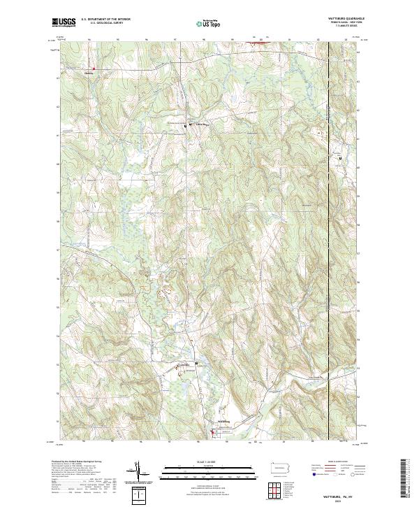 2023 Wattsburg2023 Print · USGSCrossing the Pennsylvania and New York border, this modern topographic study captures the rural hamlets and glacial terrain of Erie and Chautauqua counties. Genealogists can locate family burial sites like the Old Miller Burial Ground and Lowville Cem near the banks of the West Branch French Creek.
 - 2023 Map of Clymer, 2023 Print
 2023 Clymer2023 Print · USGSSouthwestern Chautauqua County is captured here in the 2020s, showing a landscape of quiet hamlets and glacial lakes near the Pennsylvania border. Researchers can trace local lineage through Findley Lake Cem, Holland Cem, and the rural crossroads of Morgan Corners.
 - 2023 Map of Corry, 2023 Print
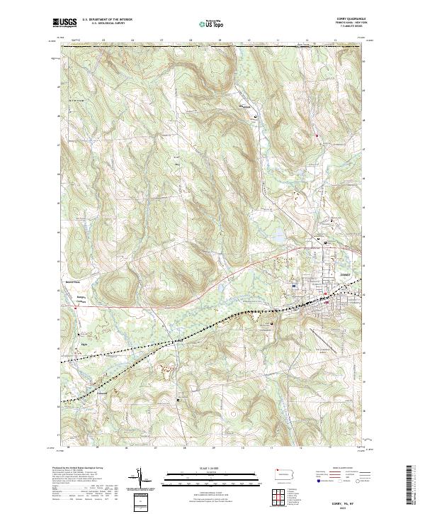 2023 Corry2023 Print · USGSThe Pennsylvania and New York border country comes alive in this contemporary record of the Upper French Creek valley. Genealogists can trace family names through rural landmarks like McCray Cem and Saint Thomas Cem, or explore the crossroads at Ranges Corners and Lovell.
 - 2023 Map of Union City, 2023 Print
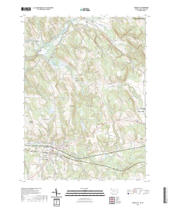 2023 Union City2023 Print · USGSThe Erie County countryside near Union City comes into focus in this contemporary survey of the Pennsylvania-New York borderlands. Researchers can locate several burial sites including Thompson Pioneer Cem and Lawn Cem of Beaverdam, alongside rural settlements like Elgin and Arbuckle.
End of results
Showing maps 1-4 of 4
Top cities near French Creek
- Harborcreek Township historical maps
- North East historical maps
- Corry historical maps
- Westfield historical maps
- Chautauqua historical maps
- Union City historical maps
See more
Top neighborhoods of French Creek
Frequently asked questions
- What are the different types of historical maps available for French Creek?
- What is the oldest map of French Creek?
- Where can I purchase historical maps of French Creek for my home or office?
- Where can I download high-res historical maps of French Creek?
- Are there historical topographic maps available for French Creek?
- Is there historical aerial imagery available for French Creek?
- Where are historical maps of French Creek sourced from?