Old Maps of Smithville, New York for Genealogy
Trace your family roots with 22 historic maps of Smithville. These high-res maps reveal old neighborhoods, homesites, landmarks, and streets — helping you uncover where your ancestors lived and how the area evolved over time.
- Explore historic neighborhoods: Identify where your relatives may have lived in the 1800s or 1900s.
- Compare maps over time: Trace the changes in streets, buildings, and landmarks for multi-generational research.
- Perfect for genealogy & ancestry research: Used by family historians and researchers to map out lineage and migration.
These maps are an incredible resource for exploring your personal connection to Smithville's past.
Smithville, NY maps
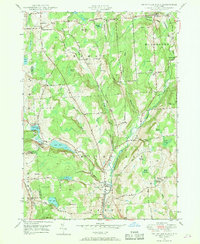
(22)- 1902 Map of Coventry
 1902 Coventry1902 Print · USGSChenango County at the start of the twentieth century was a landscape of hilltop farms and busy valley rail towns. Researchers can trace ancestral roots in Oxford, Coventry, and Brisben or locate family lands along Genegantslet Creek.2 unique versions available
 - 1904 Map of Greene
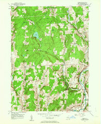
 1904 Greene1904 Print · USGSThe river valleys of Chenango and Broome counties come alive in this turn-of-the-century survey. You can trace the path of the Delaware Lackawanna and Western RR through Whitney Point or locate the early structures in Greene and Smithville Flats.6 unique versions available
 - 1904 Map of Oxford
 1904 Oxford1904 Print · USGSChenango County communities thrive along the river and rail corridors of the early twentieth century. Researchers can trace family homesteads near Oxford, locate Robinson Mill, or follow the routes of the New York Ontario and Western RR.5 unique versions available
 - 1948 Map of Smithville Flats, 1968 Print
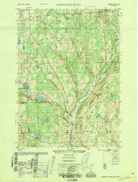
 1948 Smithville Flats1968 Print · USGSChenango County's rural heartland is captured here in the late 1940s, showing a landscape defined by creek-side villages and upland farmsteads. Researchers can trace ancestral lines through family-named sites like Knickerbocker Cem, Wilcox Corners, and the historic schoolhouse at Mariams Sch.3 unique versions available
 - 1948 Map of Binghamton, 1980 Print
 1948 Binghamton1980 Print · USGSCentral New York and the Southern Tier thrive in the late 1940s as a hub of rail traffic and mountain industry. Researchers can trace historic transit lines like the Erie Railroad through Binghamton or find old valley settlements near Oneonta and Delhi.
 - 1949 Map of Tyner, 1963 Print
 1949 Tyner1963 Print · USGSChenango County's upland ridges and river valleys are captured here in the late 1940s as rural life centered on small corners and rail stops. You can trace the Abandoned Canal along the Chenango River or locate family burial sites like Loomis Cem and Moore Cem.3 unique versions available
 - 1950 Map of Binghamton
 1950 Binghamton1950 Print · USGSBinghamton and the surrounding Southern Tier are shown in the mid-century era, highlighting the intricate rail and river networks that drove local industry. Researchers can trace the path of the Erie Railroad and locate landmarks from Otsego Lake to Sidney Mountain.2 unique versions available
 - 1950 Map of Smithville Flats
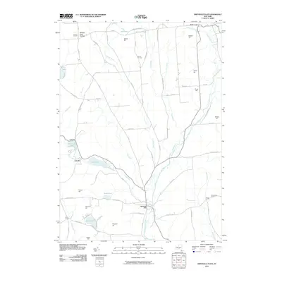
 1950 Smithville Flats1950 Print · USGSMid-century Chenango County remains a landscape of dairy farms and small hamlets before modern development altered the rural character. Trace ancestral roots at Westview Cem, locate vanished schoolhouses like School No 1, and explore the banks of Genegantslet Creek.
 - 1951 Map of Tyner
 1951 Tyner1951 Print · USGSThe Chenango River valley in the early fifties shows a landscape of rural hamlets and deep-rooted family history. You can trace the path of the Abandoned Canal and find numerous family-named burial sites like Moore Cem and Bowles Cem.
 - 1958 Map of Binghamton
 1958 Binghamton1958 Print · USGSCentral New York in the late fifties was a network of manufacturing cities and river valleys connected by vital rail lines. Genealogists and historians can trace family roots in Oneonta, Norwich, and Cooperstown or locate long-standing farms along Schoharie Creek.
 - 1963 Map of Binghamton
 1963 Binghamton1963 Print · USGSThe Southern Tier and Catskill peaks are shown in the early sixties as new reservoirs reshaped the valleys. Trace historic rail corridors like the Erie Lackawanna RR and explore lakeside settlements such as Cooperstown and Oneonta.
 - 1985 Map of Binghamton, 1986 Print
 1985 Binghamton1986 Print · USGSThe Southern Tier during the mid-1980s shows a landscape of river-valley industry and expanding university campuses. Genealogists and local historians can trace family roots through riverside towns like Bainbridge, Sidney, and the Calvary Cem in the Binghamton area.2 unique versions available
 - 2010 Map of Tyner, 2010 Print
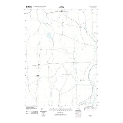 2010 Tyner2010 Print · USGSCovers Smithville, including Greene, Oxford, and other nearby areas
 - 2010 Map of Smithville Flats, 2010 Print
 2010 Smithville Flats2010 Print · USGSCovers Smithville, including Greene, Triangle, and other nearby areas
 - 2013 Map of Tyner, 2013 Print
 2013 Tyner2013 Print · USGSCovers Smithville, including Greene, Oxford, and other nearby areas
 - 2013 Map of Smithville Flats, 2013 Print
 2013 Smithville Flats2013 Print · USGSCovers Smithville, including Greene, Triangle, and other nearby areas
 - 2016 Map of Tyner, 2016 Print
 2016 Tyner2016 Print · USGSCovers Smithville, including Greene, Oxford, and other nearby areas
 - 2016 Map of Smithville Flats, 2016 Print
 2016 Smithville Flats2016 Print · USGSCovers Smithville, including Greene, Triangle, and other nearby areas
 - 2019 Map of Tyner, 2019 Print
 2019 Tyner2019 Print · USGSCovers Smithville, including Greene, Oxford, and other nearby areas
 - 2019 Map of Smithville Flats, 2019 Print
 2019 Smithville Flats2019 Print · USGSCovers Smithville, including Greene, Triangle, and other nearby areas
 - 2023 Map of Tyner, 2023 Print
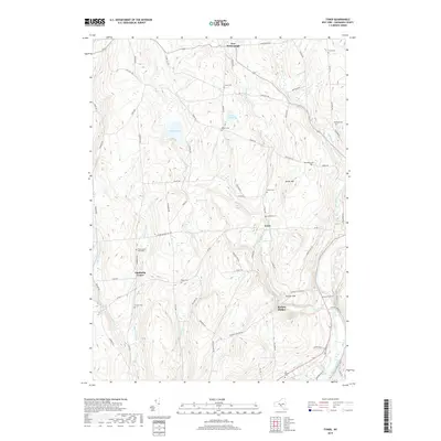
 2023 Tyner2023 Print · USGSChenango County uplands and the river valley are captured here in the early twenty-first century. Researchers can trace family history through numerous burial sites like Beardsley Cem and Stafford Cem or explore the terrain around Buckley Hollow.
 - 2023 Map of Smithville Flats, 2023 Print
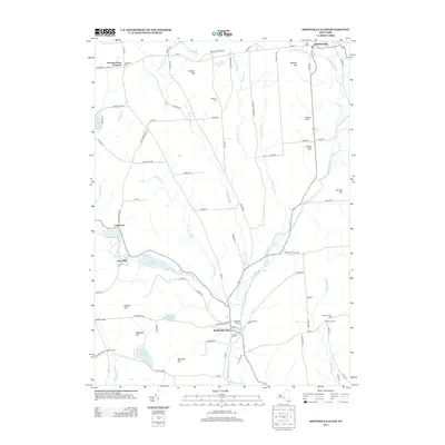
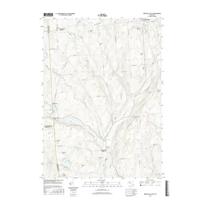
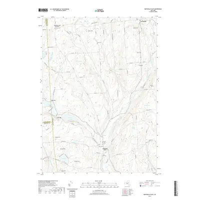
 2023 Smithville Flats2023 Print · USGSThe rural uplands of Chenango County are captured here in recent years, centered on the historic village of Smithville Flats. Genealogists can trace family names through local landmarks like Knickerbocker Cem or the summits of Bolster Hill and Meeker Hill.
End of results
Showing maps 1-22 of 22
Top cities near Smithville
- Chenango historical maps
- Norwich historical maps
- Fenton historical maps
- Greene historical maps
- Maine historical maps
- Colesville historical maps
See more
Top neighborhoods of Smithville
- Smithville Center historical maps
- Tyner historical maps
- Adams Corner historical maps
- Buckley Hollow historical maps
- Dibble Corner historical maps
- Lakeview historical maps
See more
Frequently asked questions
- What are the different types of historical maps available for Smithville?
- What is the oldest map of Smithville?
- Where can I purchase historical maps of Smithville for my home or office?
- Where can I download high-res historical maps of Smithville?
- Are there historical topographic maps available for Smithville?
- Is there historical aerial imagery available for Smithville?
- Where are historical maps of Smithville sourced from?