Old Maps of Beekmantown, New York for Genealogy
Trace your family roots with 37 historic maps of Beekmantown. These high-res maps reveal old neighborhoods, homesites, landmarks, and streets — helping you uncover where your ancestors lived and how the area evolved over time.
- Explore historic neighborhoods: Identify where your relatives may have lived in the 1800s or 1900s.
- Compare maps over time: Trace the changes in streets, buildings, and landmarks for multi-generational research.
- Perfect for genealogy & ancestry research: Used by family historians and researchers to map out lineage and migration.
These maps are an incredible resource for exploring your personal connection to Beekmantown's past.
Beekmantown, NY maps
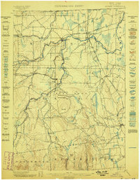
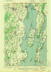
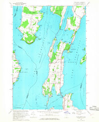
(37)- 1894 Map of Plattsburg
 1894 Plattsburg1894 Print · USGSCovers Beekmantown, including Burlington, South Burlington, and other nearby areas3 unique versions available
 - 1895 Map of Mooers
 1895 Mooers1895 Print · USGSCovers Beekmantown, including Champlain, Chazy, and other nearby areas
 - 1895 Map of Rouse Point
 1895 Rouse Point1895 Print · USGSCovers Beekmantown, including Plattsburgh, Champlain, and other nearby areas3 unique versions available
 - 1899 Map of Mooers
 1899 Mooers1899 Print · USGSCovers Beekmantown, including Champlain, Chazy, and other nearby areas6 unique versions available
 - 1906 Map of Plattsburg
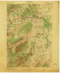
 1906 Plattsburg1906 Print · USGSCovers Beekmantown, including Burlington, South Burlington, and other nearby areas6 unique versions available
 - 1907 Map of Rouse Point
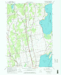
 1907 Rouse Point1907 Print · USGSCovers Beekmantown, including Plattsburgh, Champlain, and other nearby areas5 unique versions available
 - 1913 Map of Dannemora
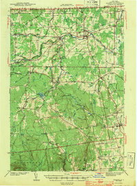
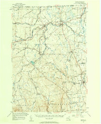
 1913 Dannemora1913 Print · USGSCovers Beekmantown, including Plattsburgh, Peru, and other nearby areas5 unique versions available
 - 1939 Map of Rouses Point
 1939 Rouses Point1939 Print · USGSCovers Beekmantown, including Plattsburgh, Champlain, and other nearby areas4 unique versions available
 - 1939 Map of Plattsburg
 1939 Plattsburg1939 Print · USGSCovers Beekmantown, including Burlington, South Burlington, and other nearby areas
 - 1941 Map of Plattsburg
 1941 Plattsburg1941 Print · USGSCovers Beekmantown, including Burlington, South Burlington, and other nearby areas
 - 1942 Map of Mooers, 1956 Print
 1942 Mooers1956 Print · USGSCovers Beekmantown, including Champlain, Chazy, and other nearby areas
 - 1943 Map of Mooers
 1943 Mooers1943 Print · USGSCovers Beekmantown, including Champlain, Chazy, and other nearby areas2 unique versions available
 - 1943 Map of Rouses Point
 1943 Rouses Point1943 Print · USGSCovers Beekmantown, including Plattsburgh, Champlain, and other nearby areas2 unique versions available
 - 1943 Map of Plattsburg
 1943 Plattsburg1943 Print · USGSCovers Beekmantown, including Burlington, South Burlington, and other nearby areas4 unique versions available
 - 1950 Map of Lake Champlain
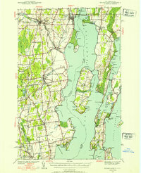
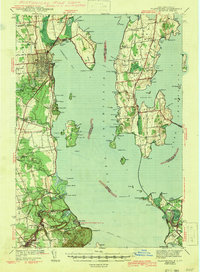
 1950 Lake Champlain1950 Print · USGSCovers Beekmantown, including Burlington, South Burlington, and other nearby areas2 unique versions available
 - 1956 Map of Plattsburgh
 1956 Plattsburgh1956 Print · USGSCovers Beekmantown, including Burlington, South Burlington, and other nearby areas3 unique versions available
 - 1956 Map of Dannemora, 1957 Print
 1956 Dannemora1957 Print · USGSCovers Beekmantown, including Plattsburgh, Peru, and other nearby areas3 unique versions available
 - 1956 Map of Rouses Point, 1958 Print
 1956 Rouses Point1958 Print · USGSCovers Beekmantown, including Plattsburgh, Champlain, and other nearby areas2 unique versions available
 - 1956 Map of Mooers, 1958 Print
 1956 Mooers1958 Print · USGSCovers Beekmantown, including Champlain, Chazy, and other nearby areas3 unique versions available
 - 1958 Map of Lake Champlain
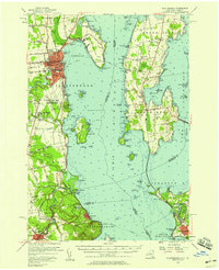
 1958 Lake Champlain1958 Print · USGSCovers Beekmantown, including Burlington, South Burlington, and other nearby areas2 unique versions available
 - 1962 Map of Lake Champlain, 1975 Print
 1962 Lake Champlain1975 Print · USGSCovers Beekmantown, including Burlington, South Burlington, and other nearby areas3 unique versions available
 - 1966 Map of Beekmantown, 1968 Print
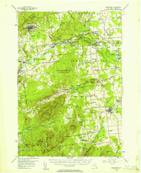
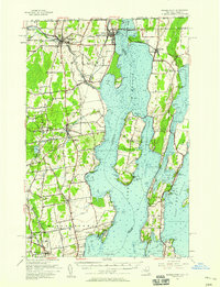
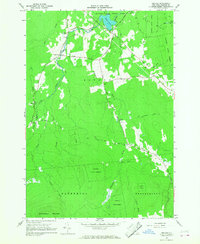
 1966 Beekmantown1968 Print · USGSCovers Beekmantown, including Plattsburgh, Chazy, and other nearby areas2 unique versions available
 - 1966 Map of Morrisonville, 1968 Print
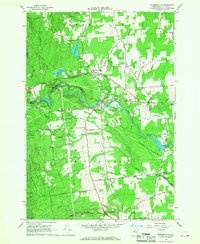 1966 Morrisonville1968 Print · USGSCovers Beekmantown, including Plattsburgh, Peru, and other nearby areas2 unique versions available
 - 1966 Map of North Hero, 1968 Print
 1966 North Hero1968 Print · USGSCovers Beekmantown, including Plattsburgh, Chazy, and other nearby areas3 unique versions available
 - 1966 Map of Jericho, 1968 Print
 1966 Jericho1968 Print · USGSCovers Beekmantown, including Dannemora, Altona, and other nearby areas2 unique versions available
Showing maps 1-25 of 37
Top cities near Beekmantown
- Plattsburgh historical maps
- Colchester historical maps
- Plattsburgh historical maps
- Peru historical maps
- Champlain historical maps
- Schuyler Falls historical maps
See more
Top neighborhoods of Beekmantown
- East Beekmantown historical maps
- Point Au Roche historical maps
- Beartown historical maps
- West Beekmantown historical maps
Frequently asked questions
- What are the different types of historical maps available for Beekmantown?
- What is the oldest map of Beekmantown?
- Where can I purchase historical maps of Beekmantown for my home or office?
- Where can I download high-res historical maps of Beekmantown?
- Are there historical topographic maps available for Beekmantown?
- Is there historical aerial imagery available for Beekmantown?
- Where are historical maps of Beekmantown sourced from?