Old Maps of Saranac, New York
Explore 45 old maps of Saranac, spanning from 1911 to today. These high-resolution historic maps reveal how streets, neighborhoods, landmarks, and natural features evolved over time — perfect for genealogy, metal detecting, research, and local history exploration.
What you can do with these maps:
- See how Saranac changed over time: Compare historical maps to modern-day views to trace roads, homesites, rail lines & more.
- View detailed metadata: Each map includes creators, publishers, year, scale, and archive source.
- Overlay maps with satellite & LiDAR: Visualize the past alongside modern tools to explore terrain & human change.
- Trusted historical sources: Maps sourced from the USGS, Library of Congress, and other archives.
- Access maps your way: View online, download high-res files, or order prints for personal or research use.
Start exploring old maps of Saranac to uncover forgotten places, hidden landmarks, and the deep history beneath your feet.
Saranac, NY maps
(45)- 1911 Map of Lyon Mountain, 1956 Print
 1911 Lyon Mountain1956 Print · USGSThe northern Adirondacks at the peak of the iron era reveal a landscape of mining hamlets and mountain kilns. Genealogists can trace family footprints in Loudell PO, Standish, and Sugarbush, or follow the industrial path of the Delaware and Hudson RR.2 unique versions available
 - 1913 Map of Dannemora
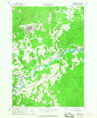
 1913 Dannemora1913 Print · USGSClinton County's industrial and correctional history is frozen in time at the edge of the Adirondacks before the First World War. Trace the Chateaugay Branch rail line to the State Penitentiary or locate old schoolhouses like Grand Hill School.5 unique versions available
 - 1913 Map of Lyon Mountain
 1913 Lyon Mountain1913 Print · USGSThe northern Adirondacks in the pre-war years were a landscape of mountain hamlets and industrial outposts. Genealogists and historians can trace the foundations of Lyon Mountain, locate the Loudell P.O., and follow the Delaware and Hudson RR through the high country.5 unique versions available
 - 1931 Map of Lyon Mountain
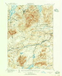
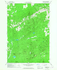
 1931 Lyon Mountain1931 Print · USGSThe northern Adirondack mining and timber lands are shown here in the early 1900s, centered on the heights of Lyon Mountain. Researchers can trace the Chateaugay R.R. as it serves industrial sites like Junction Kilns and the settlement at Standish.
 - 1950 Map of Lake Champlain
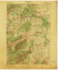
 1950 Lake Champlain1950 Print · USGSThe Lake Champlain valley and its surrounding peaks are captured in detail during the late 1940s, showing the vital rail and road connections between New York and Vermont. Researchers can trace the routes of the Central Vermont Railway or locate old industrial centers like Mineville and Witherbee.2 unique versions available
 - 1956 Map of Dannemora, 1957 Print
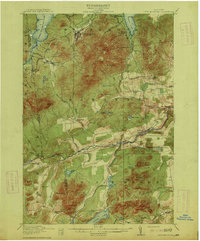
 1956 Dannemora1957 Print · USGSClinton County’s landscape in the mid-fifties centers on the institutional history of Dannemora and the timbered slopes of Terry Mountain. Genealogists and historians can trace numerous rural cemeteries like Quaker Cem and locate historic schools such as Beckwith Sch.3 unique versions available
 - 1958 Map of Lake Champlain
 1958 Lake Champlain1958 Print · USGSThe Champlain Valley and surrounding high peaks are captured here in the late fifties, showcasing the cross-border region from the Adirondacks to the Green Mountains. Researchers can trace historic rail routes like the Rutland Railway or locate old valley settlements such as Keeseville and Vergennes.2 unique versions available
 - 1962 Map of Lake Champlain, 1975 Print
 1962 Lake Champlain1975 Print · USGSLake Champlain and the high peaks of the Adirondacks and Green Mountains are captured here during the mid-twentieth century. Researchers can trace the industrial legacy of the Lyon Mountain Mine and the rail corridors of the Central Vermont RR and Delaware & Hudson RR.3 unique versions available
 - 1966 Map of Dannemora, 1968 Print
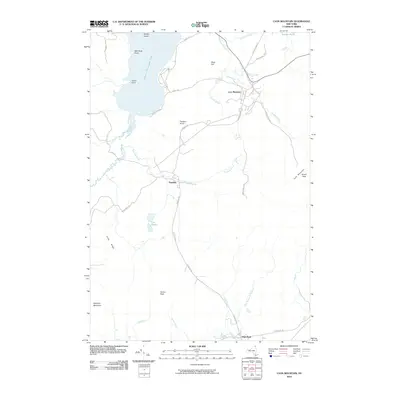
 1966 Dannemora1968 Print · USGSClinton County in the 1960s reveals a unique intersection of state institutional land and river-valley industry. Genealogists and historians can trace the Clinton State Prison grounds, family-named roads, and settlements like Picketts Corners and Cadyville.2 unique versions available
 - 1966 Map of Peasleeville, 1968 Print
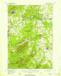
 1966 Peasleeville1968 Print · USGSPeasleeville and the surrounding Adirondack foothills are captured in the mid-sixties, showing a landscape of state forests and mountain peaks. Genealogists and hikers can trace old routes like Military Road and locate local landmarks such as Zion Ch and the Peasleeville Cem.2 unique versions available
 - 1968 Map of Redford, 1970 Print
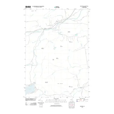
 1968 Redford1970 Print · USGSClinton County during the late 1960s shows a landscape of mountain peaks and river valley settlements. Genealogists and historians can trace the streets of Redford, locate the Assumption of Mary Ch, and find outlying hamlets like Swastika and Hawkeye.
 - 1968 Map of Moffitsville, 1970 Print
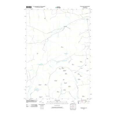
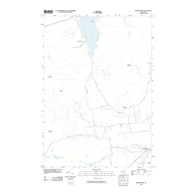
 1968 Moffitsville1970 Print · USGSClinton County’s rugged Adirondack landscape is captured here in the late sixties, where the wilderness of the State Forest Preserve meets small rural outposts. Genealogists and hikers can trace old routes like Napper Rd and locate landmarks from Lyon Mountain to the banks of the Saranac River.
 - 1968 Map of Lyon Mountain, 1970 Print
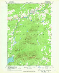
 1968 Lyon Mountain1970 Print · USGSAdirondack mining and wilderness intersect in the late sixties as iron works and rail lines define the rugged terrain. Researchers can trace the industrial layout of Lyon Mountain and Standish, from the St Bernards Ch to the sprawling Mine Dumps.
 - 1968 Map of Alder Brook, 1970 Print
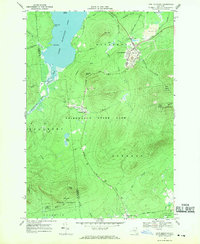
 1968 Alder Brook1970 Print · USGSThe Adirondack wilderness of the late sixties is documented here as the Saranac River system winds through the Clinton and Franklin county line. Researchers can locate remote settlements like Goldsmith and Sugarbush or find family names at St Rose Cem.
 - 1986 Map of Lake Champlain North
 1986 Lake Champlain North1986 Print · USGSThe Lake Champlain borderlands in the mid-1980s show a mix of mountain villages and busy island shorelines. Researchers can trace the Delaware and Hudson RR through Plattsburgh or locate old rural sites like Mooers Forks and St Josephs Cem.2 unique versions available
 - 2010 Map of Alder Brook, 2010 Print
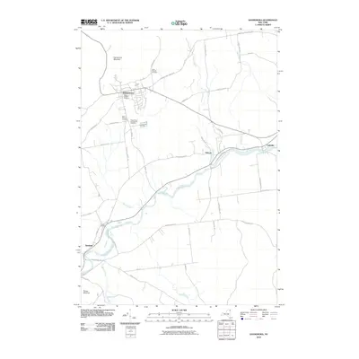
 2010 Alder Brook2010 Print · USGSCovers Saranac, including Black Brook, Franklin, and other nearby areas
 - 2010 Map of Peasleeville, 2010 Print
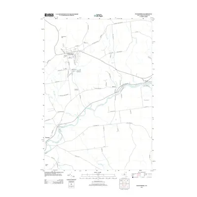
 2010 Peasleeville2010 Print · USGSCovers Saranac, including Peru, Schuyler Falls, and other nearby areas
 - 2010 Map of Redford, 2010 Print
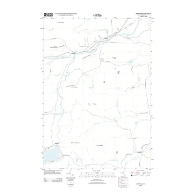
 2010 Redford2010 Print · USGSCovers Saranac, including Black Brook, Redford, and other nearby areas
 - 2010 Map of Moffitsville, 2010 Print
 2010 Moffitsville2010 Print · USGSCovers Saranac, including Dannemora, Lyon Mountain, and other nearby areas
 - 2010 Map of Lyon Mountain, 2010 Print
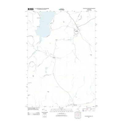
 2010 Lyon Mountain2010 Print · USGSCovers Saranac, including Dannemora, Bellmont, and other nearby areas
 - 2010 Map of Dannemora, 2010 Print
 2010 Dannemora2010 Print · USGSCovers Saranac, including Plattsburgh, Beekmantown, and other nearby areas
 - 2013 Map of Dannemora, 2013 Print
 2013 Dannemora2013 Print · USGSCovers Saranac, including Plattsburgh, Beekmantown, and other nearby areas
 - 2013 Map of Redford, 2013 Print
 2013 Redford2013 Print · USGSCovers Saranac, including Black Brook, Redford, and other nearby areas
 - 2013 Map of Alder Brook, 2013 Print
 2013 Alder Brook2013 Print · USGSCovers Saranac, including Black Brook, Franklin, and other nearby areas
 - 2013 Map of Lyon Mountain, 2013 Print
 2013 Lyon Mountain2013 Print · USGSCovers Saranac, including Dannemora, Bellmont, and other nearby areas
Showing maps 1-25 of 45
Top cities near Saranac
- Plattsburgh historical maps
- Peru historical maps
- Beekmantown historical maps
- Schuyler Falls historical maps
- Dannemora historical maps
- Dannemora historical maps
See more
Top neighborhoods of Saranac
- Elsinore historical maps
- High Bank historical maps
- Standish historical maps
- Clayburg historical maps
- Moffitsville historical maps
- Russia historical maps
See more
Frequently asked questions
- What are the different types of historical maps available for Saranac?
- What is the oldest map of Saranac?
- Where can I purchase historical maps of Saranac for my home or office?
- Where can I download high-res historical maps of Saranac?
- Are there historical topographic maps available for Saranac?
- Is there historical aerial imagery available for Saranac?
- Where are historical maps of Saranac sourced from?