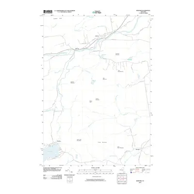
2010 Map of Redford
USGS Topo · Published 2010About this map
The Saranac River and its North Branch converge near Clayburg, forming a central waterway for this pocket of the Adirondack Park. Small hamlets such as Redford and Swastika are linked by a network of local roads including Swastika Rd and Goodrich Mills Rd, reflecting the scattered settlement patterns characteristic of the northeast Adirondacks. The landscape is defined by significant elevations, notably the Silver Lake Mountains and Potter Mountains, which rise above valley features like Silver Lake and Keniston Meadows. The presence of Ore Pond and Ore Bed Rd near Columbe Mountain suggests a history of local resource extraction, while numerous brooks like Blake Brook and Taylor Pond Outlet underscore the drainage complexity of this mountainous terrain.
Find a feature on this map
52 named features on this map. Tap any name to fly to it.
Don’t see what you’re looking for? This feature index may not catch every label — zoom into the map to look around manually.
Map Details
Editions of this 2010 Redford Map
This is the sole edition of this map. No revisions or reprints were ever made.
Other maps of this area

1895 · Ausable
USGS Topo · 1:62,500

1896 · Lake Placid
USGS Topo · 1:62,500

1898 · Lake Placid
USGS Topo · 1:62,500

1903 · Ausable
USGS Topo · 1:62,500

1911 · Lyon Mountain
USGS Topo · 1:62,500

1913 · Dannemora
USGS Topo · 1:62,500

1913 · Lyon Mountain
USGS Topo · 1:62,500

1931 · Lyon Mountain
USGS Topo · 1:62,500

1950 · Lake Champlain
USGS Topo · 1:250,000

1953 · Lake Placid
USGS Topo · 1:62,500