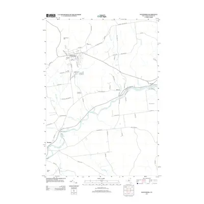
2013 Map of Dannemora
USGS Topo · Published 2013About this map
Dannemora Mtn and the steep slopes of the Clinton County landscape define this area, where state institutions and rural hamlets intersect at the edge of the Adirondack Park Preserve. The town of Dannemora is central to the map, showing a dense street grid including McPhilomy Rd and Emmons St situated near several institutional burial grounds. These include the State Prison Cem and the State Hospital Cem, reflecting the village's long history as a center for correctional and medical facilities.
Find a feature on this map
78 named features on this map. Tap any name to fly to it.
Don’t see what you’re looking for? This feature index may not catch every label — zoom into the map to look around manually.
Map Details
Editions of this 2013 Dannemora Map
This is the sole edition of this map. No revisions or reprints were ever made.
Other maps of this area

1895 · Mooers
USGS Topo · 1:62,500

1899 · Mooers
USGS Topo · 1:62,500

1911 · Lyon Mountain
USGS Topo · 1:62,500

1913 · Dannemora
USGS Topo · 1:62,500

1913 · Lyon Mountain
USGS Topo · 1:62,500

1915 · Churubusco
USGS Topo · 1:62,500

1931 · Lyon Mountain
USGS Topo · 1:62,500

1942 · Mooers
USGS Topo · 1:62,500

1943 · Churubusco
USGS Topo · 1:62,500

1943 · Mooers
USGS Topo · 1:62,500