Old Maps of Valcour, Peru for Metal Detecting
Plan your next treasure hunt with 16 historic maps of Valcour. Find old homesites, ghost towns, trails, and gathering spots that may be lost to time — perfect for identifying promising metal detecting locations.
- Locate forgotten sites: Uncover places like long-lost settlements, abandoned rail lines, or gathering spots.
- Plan better hunts: Use map overlays combined with LiDAR or satellite views to narrow in on historically rich areas.
- Made for detectorists: Thousands of hobbyists use these maps to discover relics, coins, and hidden history.
Use these historic maps to boost your research and find new opportunities beneath the surface of Valcour.
Valcour, Peru maps
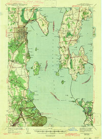
(16)- 1894 Map of Plattsburg
 1894 Plattsburg1894 Print · USGSLake Champlain was a bustling corridor of steamer routes and rail lines in the 1890s. Researchers can trace the layout of Plattsburg Barracks, find the Hotel Champlain at Bluff Point, and explore the islands of GRAND ISLE and South Hero.3 unique versions available
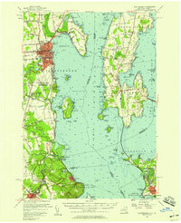
 - 1906 Map of Plattsburg
 1906 Plattsburg1906 Print · USGSLake Champlain's northern waters are captured here in the early 1900s, showing the vital maritime and rail corridors of Clinton County and the islands of Vermont. Genealogists and historians can trace the Plattsburg Barracks, find old stops like Grand Isle Sta., and locate lighthouses such as Valcour L.H..6 unique versions available
 - 1939 Map of Plattsburg
 1939 Plattsburg1939 Print · USGSLake Champlain was a vital corridor for rail and military activity just before the second World War. Genealogists and historians can trace the Plattsburg Barracks, the Rutland Railroad on Grand Isle, and landmarks like Hotel Champlain.
 - 1941 Map of Plattsburg
 1941 Plattsburg1941 Print · USGSLake Champlain was a critical corridor of military and transport activity in the years leading into the war. Researchers can trace the legacy of the Plattsburg Barracks, the winding Rutland rail line, and the geological site at Ausable Chasm.
 - 1943 Map of Plattsburg
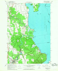
 1943 Plattsburg1943 Print · USGSLake Champlain was a bustling corridor of rail and water traffic in the early 1940s, connecting the Adirondack foothills to the Vermont islands. Genealogists and researchers can trace the old schoolhouses of Beekmantown, the Rutland railroad stops, and historic sites like Hotel Champlain.4 unique versions available
 - 1950 Map of Lake Champlain
 1950 Lake Champlain1950 Print · USGSThe Lake Champlain valley and its surrounding peaks are captured in detail during the late 1940s, showing the vital rail and road connections between New York and Vermont. Researchers can trace the routes of the Central Vermont Railway or locate old industrial centers like Mineville and Witherbee.2 unique versions available
 - 1956 Map of Plattsburgh
 1956 Plattsburgh1956 Print · USGSLake Champlain and its island communities are captured here in the mid-fifties, just as the region's rail and water networks faced the rise of the jet age. Genealogists and historians can trace the foundations of Plattsburgh Air Force Base, old Vermont stations like Grand Isle Sta, and landmarks like Ausable Chasm.3 unique versions available
 - 1958 Map of Lake Champlain
 1958 Lake Champlain1958 Print · USGSThe Champlain Valley and surrounding high peaks are captured here in the late fifties, showcasing the cross-border region from the Adirondacks to the Green Mountains. Researchers can trace historic rail routes like the Rutland Railway or locate old valley settlements such as Keeseville and Vergennes.2 unique versions available
 - 1962 Map of Lake Champlain, 1975 Print
 1962 Lake Champlain1975 Print · USGSLake Champlain and the high peaks of the Adirondacks and Green Mountains are captured here during the mid-twentieth century. Researchers can trace the industrial legacy of the Lyon Mountain Mine and the rail corridors of the Central Vermont RR and Delaware & Hudson RR.3 unique versions available
 - 1966 Map of Keeseville, 1968 Print
 1966 Keeseville1968 Print · USGSLake Champlain's western shore in the mid-1960s reveals a mix of rugged Adirondack river gorges and quiet lakeside hamlets. Genealogists and local historians can trace the paths of the Delaware and Hudson RR through Port Kent or locate family sites near Blockhouse Cem and Ausable Chasm.2 unique versions available
 - 1986 Map of Lake Champlain North
 1986 Lake Champlain North1986 Print · USGSThe Lake Champlain borderlands in the mid-1980s show a mix of mountain villages and busy island shorelines. Researchers can trace the Delaware and Hudson RR through Plattsburgh or locate old rural sites like Mooers Forks and St Josephs Cem.2 unique versions available
 - 2011 Map of Keeseville, 2011 Print
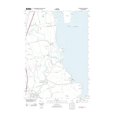
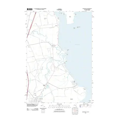 2011 Keeseville2011 Print · USGSCovers Valcour, including Plattsburgh, Peru, and other nearby areas
 - 2013 Map of Keeseville, 2013 Print
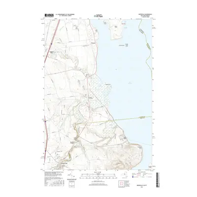
 2013 Keeseville2013 Print · USGSCovers Valcour, including Plattsburgh, Peru, and other nearby areas
 - 2016 Map of Keeseville, 2016 Print
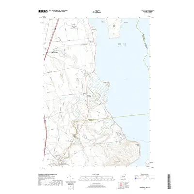
 2016 Keeseville2016 Print · USGSCovers Valcour, including Plattsburgh, Peru, and other nearby areas
 - 2019 Map of Keeseville, 2019 Print
 2019 Keeseville2019 Print · USGSCovers Valcour, including Plattsburgh, Peru, and other nearby areas
 - 2023 Map of Keeseville, 2023 Print
 2023 Keeseville2023 Print · USGSLake Champlain's western shore comes alive in this survey of the northern Adirondack foothills and the Ausable River delta. Researchers can trace historic cemeteries like Blockhouse Cem, the iconic geology of Ausable Chasm, and the quiet waterfront at Port Kent.
End of results
Showing maps 1-16 of 16
Top cities near Valcour
- Burlington historical maps
- South Burlington historical maps
- Plattsburgh historical maps
- Colchester historical maps
- Plattsburgh historical maps
- Shelburne historical maps
See more
Frequently asked questions
- What are the different types of historical maps available for Valcour?
- What is the oldest map of Valcour?
- Where can I purchase historical maps of Valcour for my home or office?
- Where can I download high-res historical maps of Valcour?
- Are there historical topographic maps available for Valcour?
- Is there historical aerial imagery available for Valcour?
- Where are historical maps of Valcour sourced from?