Old Maps of Cortlandville, New York for Genealogy
Trace your family roots with 28 historic maps of Cortlandville. These high-res maps reveal old neighborhoods, homesites, landmarks, and streets — helping you uncover where your ancestors lived and how the area evolved over time.
- Explore historic neighborhoods: Identify where your relatives may have lived in the 1800s or 1900s.
- Compare maps over time: Trace the changes in streets, buildings, and landmarks for multi-generational research.
- Perfect for genealogy & ancestry research: Used by family historians and researchers to map out lineage and migration.
These maps are an incredible resource for exploring your personal connection to Cortlandville's past.
Cortlandville, NY maps
(28)- 1898 Map of Moravia
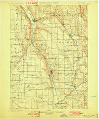
 1898 Moravia1898 Print · USGSCentral New York at the close of the nineteenth century is captured here as a landscape of valley railroads and hilltop hamlets. You can trace the Lehigh Valley line through Moravia, find family land near Benson Corners, or locate Morse Mill and Lake Como.
 - 1902 Map of Moravia
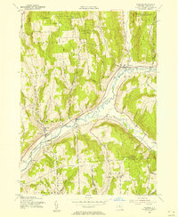
 1902 Moravia1902 Print · USGSThe rural landscapes of Cayuga and Tompkins counties are captured here at the start of the twentieth century, when small hamlets thrived along the rail lines. Genealogists can trace family names and vanished post offices at Goosetree, Morse Mill, and Grotto.7 unique versions available
 - 1903 Map of Cortland
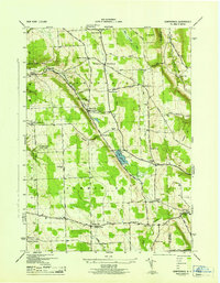
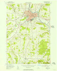
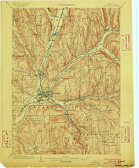 1903 Cortland1903 Print · USGSCortland County at the turn of the century was a bustling hub of rail activity and river-valley industry. Researchers can trace the early layout of Cortland and Homer, or locate vanished operations at Crains Mills and Blodgett Mills.7 unique versions available
 - 1942 Map of Groton, 1956 Print
 1942 Groton1956 Print · USGSTompkins County rural life is captured here during the early war years, showing a landscape defined by small hamlets and a remarkable number of local schools. Trace the old Lehigh Valley rail line and locate landmarks like the George Junior Republic or Red Mills.2 unique versions available
 - 1943 Map of Groton
 1943 Groton1943 Print · USGSTompkins County during the 1940s is mapped here in detail, showing a landscape of established dairy farms and rail-dependent villages. Genealogists can trace family land via numerous crossroads like Jones Corners and find old schoolhouses including the Mud Schoolhouse Corners.
 - 1943 Map of Sempronius, 1953 Print
 1943 Sempronius1953 Print · USGSThe rural uplands of Cayuga County come alive in this wartime survey of the Finger Lakes region. Genealogists and local historians can locate several district schools and family landmarks like Morse Mill, Lake Como, and Sand Hill Cem.2 unique versions available
 - 1944 Map of Homer
 1944 Homer1944 Print · USGSThe Tioughnioga River valleys in the 1940s were centers of agriculture and rail transport. Genealogists can trace family footprints at Atwater Cem or locate old schoolhouses like School No 10 and the former County Farm.
 - 1944 Map of Cortland
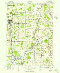
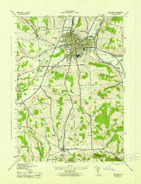 1944 Cortland1944 Print · USGSMid-century Cortland and Homer are depicted here at a peak of rail-based industry and civic growth. Genealogists and local historians can trace family roots through numerous district schools, cemeteries like Rural Cem, and the rural community around Virgil.
 - 1944 Map of Mc Graw
 1944 Mc Graw1944 Print · USGSCortland County upland farms and valley villages are captured here during the mid-forties, showing the area's transition between agricultural and rail-based commerce. Researchers can locate many district schoolhouses like Old Stone Sch and cemeteries such as Atwood Cem.
 - 1944 Map of Truxton
 1944 Truxton1944 Print · USGSCortland County agriculture and rail transit are captured in the mid-1940s as the river valleys supported thriving rural hamlets. Researchers can trace the Lehigh Valley tracks past Crains Mills and find several district schoolhouses like Log Sch.
 - 1950 Map of Elmira
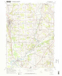
 1950 Elmira1950 Print · USGSThe Finger Lakes region thrived in the late 1940s as a hub of industry and transport. Trace family roots and vanished landmarks near Seneca Lake or explore the rail lines of the Erie RR and the sprawling Seneca Ordnance Depot.2 unique versions available
 - 1955 Map of Homer, 1956 Print
 1955 Homer1956 Print · USGSCortland County during the mid-fifties reveals a busy landscape of river-valley rail towns and upland dairy country. Researchers can trace family sites near Homer and Slab City, or locate specific rural institutions like Central High Sch and Glenwood Cem.2 unique versions available
 - 1955 Map of Mc Graw, 1956 Print
 1955 Mc Graw1956 Print · USGSMid-state New York hill country comes into focus in the mid-fifties, showing the intersection of rail transport and rural township life. Genealogists and historians can trace family plots at McGrawville Rural Cem or locate old mill sites like Maybury Mills and Blodgett Mills.4 unique versions available
 - 1955 Map of Cortland, 1956 Print
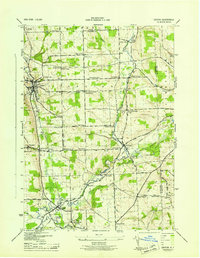
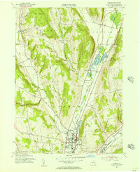
 1955 Cortland1956 Print · USGSCortland and Homer are shown in the mid-1950s as thriving valley centers at the confluence of the Tioughnioga branches. Genealogists and local researchers can trace early schoolhouses like Blodgett Mills School No 11, family cemeteries, and landmarks such as the State College.4 unique versions available
 - 1955 Map of Truxton, 1956 Print
 1955 Truxton1956 Print · USGSMid-century Cortland County comes alive in this survey of the Tioughnioga Valley's rail and reforestation corridor. Genealogists and local historians can trace the Lehigh Valley line through old settlements like Crains Mills and East River.4 unique versions available
 - 1958 Map of Elmira
 1958 Elmira1958 Print · USGSThe New York Finger Lakes during the late fifties reveal a complex landscape of glacial geology and industrial growth. Researchers can trace historic transport corridors like the Erie Canal and Erie RR, or locate institutional landmarks like Cornell University.2 unique versions available
 - 1962 Map of Elmira, 1969 Print
 1962 Elmira1969 Print · USGSThe Finger Lakes region and Southern Tier are captured here during a period of industrial maturity and highway expansion. Researchers can trace the path of the Erie Canal, the footprint of the Seneca Army Depot, and legacy rail lines through Elmira and Ithaca.4 unique versions available
 - 1965 Map of Elmira
 1965 Elmira1965 Print · USGSThe Finger Lakes and Southern Tier regions are captured in the mid-sixties, showcasing a landscape of deep glacial valleys and heavy rail infrastructure. Trace old railroad corridors like the Pennsylvania RR or visit landmarks like Letchworth State Park and the Seneca Army Depot.
 - 1970 Map of Groton, 1974 Print
 1970 Groton1974 Print · USGSThe rural crossroads of Tompkins and Cortland counties are captured in the early 1970s, showing the enduring agricultural character of the region. Researchers can trace the Lehigh Valley rail line or locate family-named settlements like Morton Corners and Lacy Corners.2 unique versions available
 - 1971 Map of Sempronius, 1974 Print
 1971 Sempronius1974 Print · USGSThe hills along the Cayuga and Cortland county line in the early seventies remain a landscape of deep gulfs and upland forests. Genealogists and hikers can trace the original locations of Morse Mill, Summer Hill Ch, and the Lickville Cem.
 - 1978 Map of Homer, 1979 Print
 1978 Homer1979 Print · USGSCortland County in the late seventies reveals a landscape of valley settlements and upland reforestation areas. Researchers can trace family history at Atwater Cem or explore the rural character of Slab City and Little York.
 - 1986 Map of Auburn
 1986 Auburn1986 Print · USGSThe Finger Lakes region in the mid-eighties shows a landscape of deep glacial waters and significant military sites. Trace the layout of the Seneca Army Depot, find the campus of Wells College, and follow the historic Lehigh Valley RR lines.2 unique versions available
 - 2023 Map of Cortland, 2023 Print
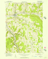
 2023 Cortland2023 Print · USGSCentral New York’s valley settlements and upland trails are captured here in the early twenty-first century. Researchers can trace family sites at Cortland Rural Cem or explore the geography of Blodgett Mills and SUNY Cortland.
 - 2023 Map of Sempronius, 2023 Print
 2023 Sempronius2023 Print · USGSThe eastern uplands of Cayuga County come into focus in this contemporary survey of the Sempronius area. Researchers can trace historic family-named cemeteries like Atwater-Reynolds Cem, the waters of Lake Como, and the steep ravines of Sherman Gulf.
 - 2023 Map of Groton, 2023 Print
 2023 Groton2023 Print · USGSThe Finger Lakes uplands come into focus in this recent survey of the hamlets and waterways north of Ithaca. Genealogists and historians can trace local family landmarks at Groton Rural Cem, McLean Cem, and the historic industrial site at Red Mills.
Showing maps 1-25 of 28
Top cities near Cortlandville
- Cortland historical maps
- Dryden historical maps
- Homer historical maps
- Groton historical maps
- Caroline historical maps
- Moravia historical maps
See more
Top neighborhoods of Cortlandville
- Gracie historical maps
- Loring Crossing historical maps
- South Cortland historical maps
- Polkville historical maps
- Munsons Corners historical maps
- Cortland West historical maps
See more
Frequently asked questions
- What are the different types of historical maps available for Cortlandville?
- What is the oldest map of Cortlandville?
- Where can I purchase historical maps of Cortlandville for my home or office?
- Where can I download high-res historical maps of Cortlandville?
- Are there historical topographic maps available for Cortlandville?
- Is there historical aerial imagery available for Cortlandville?
- Where are historical maps of Cortlandville sourced from?