1990s Maps of Dutchess County, New York
Explore 7 historic maps of Dutchess County from the 1990s. These maps offer a rare glimpse into what life looked like during the 1990s — showing old roads, neighborhoods, homes, and landmarks that have changed or disappeared over time.
Whether you're researching your family's past, planning a metal detecting trip, or studying how Dutchess County's landscape evolved across the 1990s, these high-resolution maps are a powerful tool for exploring the history of this region.
- Focus on a specific era: All maps on this page are from the 1990s, giving you a focused view of this time period.
- See what’s changed: Compare century-old streets, trails, and buildings to today's modern landscape using overlays and satellite layers.
- Research with precision: Use these maps for genealogy, historical research, land use analysis, or educational projects.
- View, download, or print: Maps are fully viewable online in high resolution, and can be downloaded or printed for your own records.
Start exploring Dutchess County's history through authentic maps from the 1990s. This is your window into the past.
Dutchess County, NY maps
(7)- 1993 Map of Waterbury
 1993 Waterbury1993 Print · USGSWestern Connecticut and the Hudson Valley appear in the early nineties as a landscape of established industrial cities and deep forest preserves. Researchers can trace the rail corridors of the Metro-North Railroad or locate family sites near the Taft School and Riverside Cemetery.
 - 1994 Map of Cornwall-on-Hudson, 2000 Print
 1994 Cornwall-on-Hudson2000 Print · USGSThe Hudson Highlands meet the river in the mid-1990s, where steep ridgelines overlook a landscape shaped by military history and regional infrastructure. Genealogists and historians can trace institutional sites like the N Y Mil Academy, Epiphany Apostolic College, and burial grounds at Calvary Cemetery.
 - 1995 Map of Poughkeepsie, 1998 Print
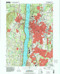 1995 Poughkeepsie1998 Print · USGSPoughkeepsie and the Hudson River valley are shown in the mid-nineties as the region's academic and medical campuses expanded. Researchers can trace the grounds of Vassar College, family plots in St Peters Cemetery, and the historic landing at Highland Landing.
 - 1997 Map of Ashley Falls, 1999 Print
 1997 Ashley Falls1999 Print · USGSThe Housatonic Valley at the tri-state border shows a landscape of deep forests and river towns in the late 1990s. Genealogists and hikers can locate the Appalachian Trail, family Cem sites, and early institutions like the Berkshire Sch.
 - 1997 Map of Saugerties, 2000 Print
 1997 Saugerties2000 Print · USGSThe Hudson River valley at the close of the century reveals a landscape of historic riverfront estates and industrial roots. Trace the grounds of Bard College, the legacy of the Clermont State Historic Site, and old cemeteries like Trinity Cem.
 - 1998 Map of Pawling, 2000 Print
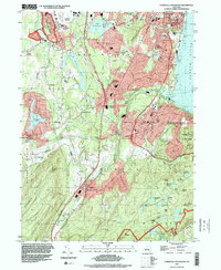
 1998 Pawling2000 Print · USGSThe Harlem Valley and Quaker Hill highlands come into focus at the end of the century, showing the borderlands between New York and Connecticut. Researchers can trace the path of the Appalachian National Scenic Trail or locate family roots near Hurd Corners and Akins Corners.
 - 1998 Map of Dover Plains, 2001 Print
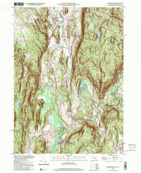 1998 Dover Plains2001 Print · USGSThe Harlem Valley and the Connecticut borderlands are captured here in the late twentieth century, showing a landscape of steep ridges and riverside villages. Researchers can trace the path of the Metro North rail line through Dover Plains, find the historic The Stone Church, and locate the Schaghticoke Indian Reservation.
End of results
Showing maps 1-7 of 7
Top cities of Dutchess County
- Poughkeepsie historical maps
- Poughkeepsie historical maps
- East Fishkill historical maps
- Wappinger historical maps
- Fishkill historical maps
- Hyde Park historical maps
See more
Frequently asked questions
- What are the different types of historical maps available for Dutchess County?
- What is the oldest map of Dutchess County?
- Where can I purchase historical maps of Dutchess County for my home or office?
- Where can I download high-res historical maps of Dutchess County?
- Are there historical topographic maps available for Dutchess County?
- Is there historical aerial imagery available for Dutchess County?
- Where are historical maps of Dutchess County sourced from?