1900s (20th Century) Maps of Dutchess County, New York
Explore 95 historic maps of Dutchess County from the 1900s (20th Century). These maps offer a rare glimpse into what life looked like during the 1900s — showing old roads, neighborhoods, homes, and landmarks that have changed or disappeared over time.
Whether you're researching your family's past, planning a metal detecting trip, or studying how Dutchess County's landscape evolved across the 1900s, these high-resolution maps are a powerful tool for exploring the history of this region.
- Focus on a specific era: All maps on this page are from the 1900s, giving you a focused view of this time period.
- See what’s changed: Compare century-old streets, trails, and buildings to today's modern landscape using overlays and satellite layers.
- Research with precision: Use these maps for genealogy, historical research, land use analysis, or educational projects.
- View, download, or print: Maps are fully viewable online in high resolution, and can be downloaded or printed for your own records.
Start exploring Dutchess County's history through authentic maps from the 1900s. This is your window into the past.
Dutchess County, NY maps
(95)- 1900 Map of Housatonic
 1900 Housatonic1900 Print · USGSThe Berkshires and the Housatonic Valley are captured here at a moment of industrial and social transition during the late Victorian era. Genealogists and historians can trace the early rail networks of the Boston and Albany R.R. through old settlements like Shaker Village and Lenox Furnace.5 unique versions available
 - 1901 Map of West Point
 1901 West Point1901 Print · USGSThe Hudson Highlands and West Point are shown at the turn of the century, when river railroads and mountain mines defined the local economy. Genealogists can trace family landmarks and hamlets like Nelsonville, Mahopac Mines, and Yorktown Heights.12 unique versions available
 - 1901 Map of Clove
 1901 Clove1901 Print · USGSDutchess County and the Connecticut borderlands are captured here at the close of the nineteenth century as the rail corridors began to shape local commerce. Genealogists can trace family holdings and old junctions from Dover Plains to Stormville and Moores Mill.11 unique versions available
 - 1902 Map of Millbrook
 1902 Millbrook1902 Print · USGSEastern Dutchess County at the turn of the century was a bustling corridor of intersecting railroads and valley settlements. Genealogists and rail historians can trace the paths of the Central New England R. R. and find local landmarks like Lithgow, Shekomeko, and Hammertown.10 unique versions available
 - 1902 Map of Schunemunk
 1902 Schunemunk1902 Print · USGSOrange County at the turn of the century shows a landscape defined by the rise of the railroad and the enduring presence of the Highlands. Genealogists and historians can trace old homesteads and industrial sites like Bull Mine, Oxford Depot, and the riverfront at Cornwall Landing.10 unique versions available
 - 1902 Map of Copake, 1954 Print
 1902 Copake1954 Print · USGSColumbia County at the turn of the century shows a landscape defined by industry and iron, before modern highways bypassed these hillside hamlets. Trace the rail-and-mine economy through Copake Ironworks, the Weed Mines, and the busy junction at Boston Corners.
 - 1903 Map of Poughkeepsie
 1903 Poughkeepsie1903 Print · USGSDutchess and Ulster Counties thrive at the turn of the century as a major corridor of river commerce and rail expansion. Genealogists and historians can trace institutional history at the Hudson River State Hospital or locate lost rail stops at Clove Branch Junction and Diddell.11 unique versions available
 - 1903 Map of Cornwall
 1903 Cornwall1903 Print · USGSNorthwestern Connecticut at the dawn of the twentieth century shows a landscape of iron-mining hamlets and river-valley rail lines. Genealogists and historians can trace the foundations of Ore Hill, the streets of Salisbury, and the path of the Central New England RR.9 unique versions available
 - 1904 Map of Copake
 1904 Copake1904 Print · USGSColumbia County at the turn of the century shows a landscape defined by deep-rooted industry and an extensive rail network. Researchers can trace the legacy of mining and milling at Ancram Leadmines, Weed Mines, and the Spaulding Furnace along the Roeliff Jansen Kill.7 unique versions available
 - 1904 Map of Litchfield
 1904 Litchfield1904 Print · USGSThe Litchfield Hills at the turn of the century are shown here as a landscape of iron heritage and river-powered industry. Genealogists and historians can locate old industrial sites like Kent Furnace, ancestral homes near Sharon Valley, and early rail stops at Limerock Sta..3 unique versions available
 - 1930 Map of Schunemunk
 1930 Schunemunk1930 Print · USGSOrange County's rail and river landscapes come into sharp focus during the late Prohibition era. Researchers can trace historic district schoolhouses like Elmwood No. 6 School and the critical junction points of the ERIE RR near Vails Gate Junction.3 unique versions available
 - 1934 Map of Rhinebeck
 1934 Rhinebeck1934 Print · USGSDutchess and Ulster Counties meet along the Hudson River during the mid-1930s as the rail and river economy persists. Researchers can locate river landmarks like the Astor Tunnel and Kingston Point, or trace local roots at the Quaker Meeting House and Stone Church.2 unique versions available
 - 1934 Map of Catskill, 1960 Print
 1934 Catskill1960 Print · USGSThe Hudson Valley during the mid-1930s shows a landscape of riverfront commerce and deep-rooted rural townships. Genealogists and local historians can locate country schools like Schuylerhook Sch and historic landmarks like the Birthplace of Robert Livingston.2 unique versions available
 - 1935 Map of Schunemunk
 1935 Schunemunk1935 Print · USGSOrange County in the mid-1930s is a crossroads of heavy rail and Hudson River commerce. Genealogists and historians can trace defunct rail sidings, old school sites like Quaker Hill Sch, and industrial landmarks from Bull Mine to Firthcliffe.4 unique versions available
 - 1936 Map of West Point
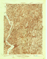 1936 West Point1936 Print · USGSThe Hudson Highlands in the mid-1930s reveal a landscape of strategic military grounds and evolving state parks. Genealogists and historians can trace old family burial grounds like Halstead Cem, the workings of the Mahopac Mines, and the early layout of West Point.2 unique versions available
 - 1936 Map of Poughkeepsie
 1936 Poughkeepsie1936 Print · USGSDutchess County in the mid-thirties reveals a landscape of massive riverside institutions and early aviation fields along the Hudson River. Local historians can trace family roots through numerous country schools like Fairview Sch or locate the old Poughkeepsie Landing (Air Field).
 - 1938 Map of Catskill
 1938 Catskill1938 Print · USGSThe Hudson Valley in the late thirties remains a landscape of river-side industry and deep colonial heritage. Researchers can trace family sites from Kiskatom Ch to the Birthplace of Robert Livingston or locate vanished local landmarks like Walker Mill.2 unique versions available
 - 1939 Map of Rhinebeck
 1939 Rhinebeck1939 Print · USGSDutchess and Ulster Counties flank the Hudson River in the late 1930s, revealing a landscape defined by riverside rail travel and rural hamlets. Genealogists can locate numerous local landmarks including Clinton Corners, Washington Hollow, and the Kingston Point Lighthouse.3 unique versions available
 - 1941 Map of West Point
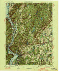 1941 West Point1941 Print · USGSThe Hudson Highlands were undergoing significant change in the years leading up to the war, blending heavy industry with expanding military installations. Genealogists can trace family lines through Continental Village, Hillside Cem, and the various schools like Manitou Sch.3 unique versions available
 - 1941 Map of Catskill, 1945 Print
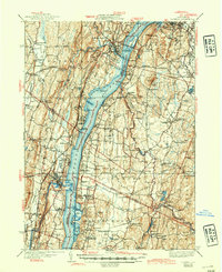 1941 Catskill1945 Print · USGSThe Hudson River valley at the start of the Second World War shows a landscape defined by historic estates and new river crossings. Genealogists and historians can trace the foundations of Bard College, locate the Birthplace of Robert Livingston, and explore early hamlets like Katsbaan and Cheviot.
 - 1941 Map of West Point, 1951 Print
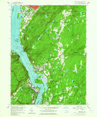 1941 West Point1951 Print · USGSThe Hudson Highlands are captured here in the mid-1950s as the river-and-rail economy defined life in Beacon and Cold Spring. Researchers can trace the grounds of the U S Military Academy West Point, locating the U S Silver Depository and Constitution Island.
 - 1943 Map of Poughkeepsie
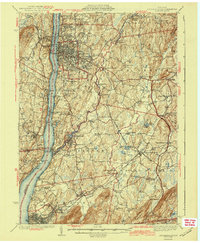 1943 Poughkeepsie1943 Print · USGSThe mid-Hudson valley is captured here in the years during the Second World War, showing the busy corridor between Poughkeepsie and Beacon. Researchers can trace old institutional lands like Vassar College or locate vanished rural schools such as Swede Sch and Devine Sch.3 unique versions available
 - 1943 Map of Housatonic
 1943 Housatonic1943 Print · USGSThe Berkshires and the Housatonic Valley are captured during the war years, showing a landscape of traditional Shaker settlements and growing industrial centers. Trace the routes of the NY NH & H RR and explore sites like Shaker Village, Richmond Furnace, and Rockdale Mills.
 - 1944 Map of Dover Plains, 1956 Print
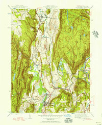 1944 Dover Plains1956 Print · USGSDutchess County at the close of the Second World War was a landscape of fertile valleys and mountain ridges. Genealogists and historians can trace rail-side life and local landmarks like Dover Plains, the Appalachian Trail, and the Schaghticoke Indian Reservation.2 unique versions available
 - 1945 Map of Pawling, 1956 Print
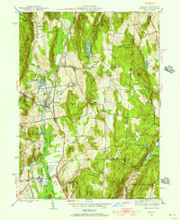 1945 Pawling1956 Print · USGSDutchess County at the close of the Second World War reveals a landscape of high ridges and significant wetlands along the New York-Connecticut border. Genealogists and local historians can trace legacy landmarks including the Quaker Hill Meeting House, the village of Pawling, and the vast expanse of The Great Swamp.2 unique versions available
Showing maps 1-25 of 95
Top cities of Dutchess County
- Poughkeepsie historical maps
- Poughkeepsie historical maps
- East Fishkill historical maps
- Wappinger historical maps
- Fishkill historical maps
- Hyde Park historical maps
See more
Frequently asked questions
- What are the different types of historical maps available for Dutchess County?
- What is the oldest map of Dutchess County?
- Where can I purchase historical maps of Dutchess County for my home or office?
- Where can I download high-res historical maps of Dutchess County?
- Are there historical topographic maps available for Dutchess County?
- Is there historical aerial imagery available for Dutchess County?
- Where are historical maps of Dutchess County sourced from?