1900s (20th Century) Maps of Fishkill, New York
Explore 35 historic maps of Fishkill from the 1900s (20th Century). These maps offer a rare glimpse into what life looked like during the 1900s — showing old roads, neighborhoods, homes, and landmarks that have changed or disappeared over time.
Whether you're researching your family's past, planning a metal detecting trip, or studying how Fishkill's landscape evolved across the 1900s, these high-resolution maps are a powerful tool for exploring the history of this region.
- Focus on a specific era: All maps on this page are from the 1900s, giving you a focused view of this time period.
- See what’s changed: Compare century-old streets, trails, and buildings to today's modern landscape using overlays and satellite layers.
- Research with precision: Use these maps for genealogy, historical research, land use analysis, or educational projects.
- View, download, or print: Maps are fully viewable online in high resolution, and can be downloaded or printed for your own records.
Start exploring Fishkill's history through authentic maps from the 1900s. This is your window into the past.
Fishkill, NY maps
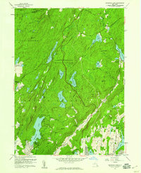
(35)- 1901 Map of West Point
 1901 West Point1901 Print · USGSThe Hudson Highlands and West Point are shown at the turn of the century, when river railroads and mountain mines defined the local economy. Genealogists can trace family landmarks and hamlets like Nelsonville, Mahopac Mines, and Yorktown Heights.12 unique versions available
 - 1902 Map of Schunemunk
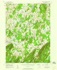
 1902 Schunemunk1902 Print · USGSOrange County at the turn of the century shows a landscape defined by the rise of the railroad and the enduring presence of the Highlands. Genealogists and historians can trace old homesteads and industrial sites like Bull Mine, Oxford Depot, and the riverfront at Cornwall Landing.10 unique versions available
 - 1903 Map of Poughkeepsie
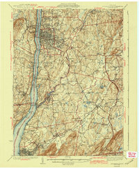
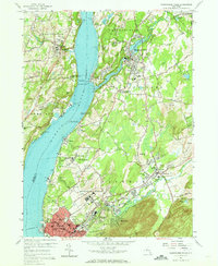
 1903 Poughkeepsie1903 Print · USGSDutchess and Ulster Counties thrive at the turn of the century as a major corridor of river commerce and rail expansion. Genealogists and historians can trace institutional history at the Hudson River State Hospital or locate lost rail stops at Clove Branch Junction and Diddell.11 unique versions available
 - 1930 Map of Schunemunk
 1930 Schunemunk1930 Print · USGSOrange County's rail and river landscapes come into sharp focus during the late Prohibition era. Researchers can trace historic district schoolhouses like Elmwood No. 6 School and the critical junction points of the ERIE RR near Vails Gate Junction.3 unique versions available
 - 1935 Map of Schunemunk
 1935 Schunemunk1935 Print · USGSOrange County in the mid-1930s is a crossroads of heavy rail and Hudson River commerce. Genealogists and historians can trace defunct rail sidings, old school sites like Quaker Hill Sch, and industrial landmarks from Bull Mine to Firthcliffe.4 unique versions available
 - 1936 Map of West Point
 1936 West Point1936 Print · USGSThe Hudson Highlands in the mid-1930s reveal a landscape of strategic military grounds and evolving state parks. Genealogists and historians can trace old family burial grounds like Halstead Cem, the workings of the Mahopac Mines, and the early layout of West Point.2 unique versions available
 - 1936 Map of Poughkeepsie
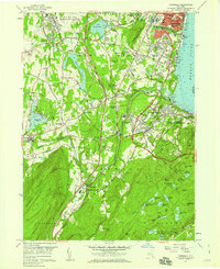
 1936 Poughkeepsie1936 Print · USGSDutchess County in the mid-thirties reveals a landscape of massive riverside institutions and early aviation fields along the Hudson River. Local historians can trace family roots through numerous country schools like Fairview Sch or locate the old Poughkeepsie Landing (Air Field).
 - 1941 Map of West Point
 1941 West Point1941 Print · USGSThe Hudson Highlands were undergoing significant change in the years leading up to the war, blending heavy industry with expanding military installations. Genealogists can trace family lines through Continental Village, Hillside Cem, and the various schools like Manitou Sch.3 unique versions available
 - 1941 Map of West Point, 1951 Print
 1941 West Point1951 Print · USGSThe Hudson Highlands are captured here in the mid-1950s as the river-and-rail economy defined life in Beacon and Cold Spring. Researchers can trace the grounds of the U S Military Academy West Point, locating the U S Silver Depository and Constitution Island.
 - 1943 Map of Poughkeepsie
 1943 Poughkeepsie1943 Print · USGSThe mid-Hudson valley is captured here in the years during the Second World War, showing the busy corridor between Poughkeepsie and Beacon. Researchers can trace old institutional lands like Vassar College or locate vanished rural schools such as Swede Sch and Devine Sch.3 unique versions available
 - 1947 Map of West Point
 1947 West Point1947 Print · USGSPost-war Orange and Putnam Counties appear here during a period of steady highland growth along the river. Trace the old village footprints of Cold Spring and Garrison, or locate family landmarks like Mekeel Corners and St Marys Ch.
 - 1947 Map of West Point
 1947 West Point1947 Print · USGSThe Hudson Highlands and the Peekskill waterfront are captured just before the post-war boom, showing the critical junction of river, rail, and early parkways. Genealogists can trace family landmarks and burial sites like Cold Spring Cem, Amawalk Cem, and the historic Mahopac Mines.
 - 1947 Map of Cornwall
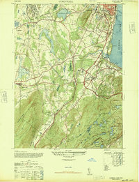 1947 Cornwall1947 Print · USGSOrange County near the Hudson River is shown here just after the war, featuring the major expansion of Stewart AAF and local rail activity. Trace the routes of the Erie Railroad through industrial Salisbury Mills or locate the rural Mt Airy School.2 unique versions available
 - 1947 Map of Wappinger Falls
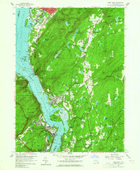
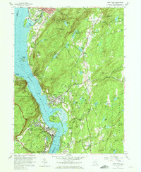
 1947 Wappinger Falls1947 Print · USGSThe Hudson River corridor in the late 1940s is shown here at its post-war industrial height, from the busy streets of Beacon to the mills of Wappingers Falls. Researchers can trace the legacy of major institutions like Matteawan State Hospital or locate local landmarks such as Danskammer Light and Cedar Cliff School.2 unique versions available
 - 1947 Map of Hartford, 1955 Print
 1947 Hartford1955 Print · USGSSouthern New England and the Hudson Valley are shown in detail during the post-war expansion era. Genealogists and researchers can trace local landmarks from the State Capitol and Yale University to the Stratford Lighthouse and Woodlawn Cem.2 unique versions available
 - 1948 Map of Hartford
 1948 Hartford1948 Print · USGSSouthern New England is captured here in the late 1940s, showcasing a landscape of thriving industrial cities and developing parkways. Genealogists and historians can trace the rail networks of the New York New Haven and Hartford RR or locate coastal defense sites like Fort Terry and Camp Shanks.2 unique versions available
 - 1950 Map of Scranton, 1952 Print
 1950 Scranton1952 Print · USGSMid-century Northeast Pennsylvania and the Hudson Valley come alive in this survey of the tri-state region. Genealogists and historians can trace the dense rail networks of the Erie RR and DL&W RR between industrial hubs like Scranton and Wilkes-Barre.
 - 1953 Map of Scranton
 1953 Scranton1953 Print · USGSNortheastern Pennsylvania and the Catskills are shown in great detail during the early fifties, a time when rail lines and river valleys dictated the region's growth. Genealogists and historians can trace the industrial hearts of Scranton and Wilkes-Barre or locate remote landmarks like High Point and Lake Wallenpaupack.
 - 1956 Map of Oscawana Lake, 1959 Print
 1956 Oscawana Lake1959 Print · USGSThe mid-fifties landscape of Putnam County reveals a dense network of Hudson Valley reservoirs and parks centered around Oscawana Lake. Researchers can trace old mountain roads to the Mahopac Mines, Free Grave Cemetery, and the Fahnestock Ski Slope.4 unique versions available
 - 1956 Map of Wappingers Falls, 1965 Print
 1956 Wappingers Falls1965 Print · USGSThe mid-Hudson Valley is captured here in the mid-fifties, showing the industrial riverfront and established villages before suburban expansion. Genealogists can trace family names at St Joachims Cem, locate the Red Sch, or study institutional grounds like Matteawan State Hospital.3 unique versions available
 - 1957 Map of Hopewell Junction, 1959 Print
 1957 Hopewell Junction1959 Print · USGSMid-century Dutchess County is captured here as a landscape of rural hamlets and rising parkways. Genealogists and local historians can trace family landmarks like Van Wyck Cem and the rail corridors of the New York New Haven and Hartford Railroad.3 unique versions available
 - 1957 Map of Cornwall, 1959 Print
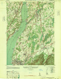
 1957 Cornwall1959 Print · USGSThe western banks of the Hudson River thrive in the late fifties, where industrial towns meet military outposts and mountain parks. Genealogists can trace family roots at Woodlawn Cemetery or locate historic sites like Orrs Mill and Knox Headquarters.5 unique versions available
 - 1957 Map of West Point, 1965 Print
 1957 West Point1965 Print · USGSThe Hudson Highlands were a hub of military education and river-bound industry during the late fifties. You can trace the detailed campus of the U S Military Academy at West Point, explore the streets of Cold Spring, and locate the U S Silver Depository.4 unique versions available
 - 1959 Map of Scranton
 1959 Scranton1959 Print · USGSThe northern coalfields and the Hudson Valley meet in this mid-century survey of the Pennsylvania and New York borderlands. Genealogists and historians can trace the intricate rail networks of the Erie Railroad and the vast waters of Lake Wallenpaupack.2 unique versions available
 - 1961 Map of Hartford
 1961 Hartford1961 Print · USGSSouthern New England and the Hudson Valley are shown here in the mid-fifties, capturing a landscape of booming coastal cities and interior hill towns. Researchers can trace the legacy of the New York New Haven and Hartford rail corridor and find strategic sites like Camp Shanks and Fort Michie.
Showing maps 1-25 of 35
Top cities near Fishkill
- Poughkeepsie historical maps
- Cortlandt historical maps
- Yorktown historical maps
- Carmel historical maps
- Newburgh historical maps
- Poughkeepsie historical maps
See more
Top neighborhoods of Fishkill
- Groveville historical maps
- Beacon Hills historical maps
- Dutchess Junction historical maps
- Brockway historical maps
- Glenham historical maps
- Brinckerhoff historical maps
See more
Frequently asked questions
- What are the different types of historical maps available for Fishkill?
- What is the oldest map of Fishkill?
- Where can I purchase historical maps of Fishkill for my home or office?
- Where can I download high-res historical maps of Fishkill?
- Are there historical topographic maps available for Fishkill?
- Is there historical aerial imagery available for Fishkill?
- Where are historical maps of Fishkill sourced from?