Old Maps of Pleasant Valley, New York for Genealogy
Trace your family roots with 47 historic maps of Pleasant Valley. These high-res maps reveal old neighborhoods, homesites, landmarks, and streets — helping you uncover where your ancestors lived and how the area evolved over time.
- Explore historic neighborhoods: Identify where your relatives may have lived in the 1800s or 1900s.
- Compare maps over time: Trace the changes in streets, buildings, and landmarks for multi-generational research.
- Perfect for genealogy & ancestry research: Used by family historians and researchers to map out lineage and migration.
These maps are an incredible resource for exploring your personal connection to Pleasant Valley's past.
Pleasant Valley, NY maps
(47)- 1893 Map of Clove
 1893 Clove1893 Print · USGSDutchess County and the Connecticut border come to life in the 1890s, when iron furnaces and rural depots still defined the landscape. Trace the tracks of the Columbia and Clove R.R. and find old family landmarks like Crouse Store and Moore Mill.
 - 1893 Map of Poughkeepsie
 1893 Poughkeepsie1893 Print · USGSDutchess and Ulster counties thrive during the late Victorian era as a hub of river commerce, rail junctions, and major state institutions. Researchers can trace the 1890s footprints of Vassar College, the busy Hampton Ferry, and the rail lines meeting at Hopewell Junction.
 - 1894 Map of Clove
 1894 Clove1894 Print · USGSDutchess County at the close of the nineteenth century was a land of steep ridges and vital rail corridors. Genealogists and local historians can trace family locations near Dover Furnace, Clove Valley, and rural landmarks like Crouse Store.
 - 1894 Map of Poughkeepsie
 1894 Poughkeepsie1894 Print · USGSThe Hudson Valley in the early 1890s was a bustling corridor of rail and river commerce connecting POUGHKEEPSIE to the industrial south. Genealogists and historians can trace old homesteads near Vassar College, find early river landings like Carthage Landing, or locate the junction at Hopewell Junction.3 unique versions available
 - 1898 Map of Clove
 1898 Clove1898 Print · USGSDutchess County and the Connecticut borderlands are captured here in the late nineteenth century as railroads fueled the growth of valley towns. Genealogists and historians can trace family locations in Verbank Village, Stormville, and near landmarks like Bulls Bridge.
 - 1898 Map of Rhinebeck
 1898 Rhinebeck1898 Print · USGSThe Hudson River valley at the close of the nineteenth century was a bustling network of rail lines and river landings. Genealogists and historians can trace the foundations of Hyde Park, find the riverside Esopus Light, or locate rail junctions like Rhinecliff.9 unique versions available
 - 1899 Map of Millbrook, 1956 Print
 1899 Millbrook1956 Print · USGSDutchess County enters a period of high rail connectivity in the late nineteenth century, as iron and agriculture drive local growth. Genealogists and historians can trace the paths of four railroads through hamlets like Millerton, Bangall, and Amenia Union.
 - 1901 Map of Clove
 1901 Clove1901 Print · USGSDutchess County and the Connecticut borderlands are captured here at the close of the nineteenth century as the rail corridors began to shape local commerce. Genealogists can trace family holdings and old junctions from Dover Plains to Stormville and Moores Mill.11 unique versions available
 - 1902 Map of Millbrook
 1902 Millbrook1902 Print · USGSEastern Dutchess County at the turn of the century was a bustling corridor of intersecting railroads and valley settlements. Genealogists and rail historians can trace the paths of the Central New England R. R. and find local landmarks like Lithgow, Shekomeko, and Hammertown.10 unique versions available
 - 1903 Map of Poughkeepsie
 1903 Poughkeepsie1903 Print · USGSDutchess and Ulster Counties thrive at the turn of the century as a major corridor of river commerce and rail expansion. Genealogists and historians can trace institutional history at the Hudson River State Hospital or locate lost rail stops at Clove Branch Junction and Diddell.11 unique versions available
 - 1934 Map of Rhinebeck
 1934 Rhinebeck1934 Print · USGSDutchess and Ulster Counties meet along the Hudson River during the mid-1930s as the rail and river economy persists. Researchers can locate river landmarks like the Astor Tunnel and Kingston Point, or trace local roots at the Quaker Meeting House and Stone Church.2 unique versions available
 - 1936 Map of Poughkeepsie
 1936 Poughkeepsie1936 Print · USGSDutchess County in the mid-thirties reveals a landscape of massive riverside institutions and early aviation fields along the Hudson River. Local historians can trace family roots through numerous country schools like Fairview Sch or locate the old Poughkeepsie Landing (Air Field).
 - 1939 Map of Rhinebeck
 1939 Rhinebeck1939 Print · USGSDutchess and Ulster Counties flank the Hudson River in the late 1930s, revealing a landscape defined by riverside rail travel and rural hamlets. Genealogists can locate numerous local landmarks including Clinton Corners, Washington Hollow, and the Kingston Point Lighthouse.3 unique versions available
 - 1943 Map of Poughkeepsie
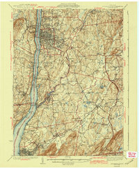 1943 Poughkeepsie1943 Print · USGSThe mid-Hudson valley is captured here in the years during the Second World War, showing the busy corridor between Poughkeepsie and Beacon. Researchers can trace old institutional lands like Vassar College or locate vanished rural schools such as Swede Sch and Devine Sch.3 unique versions available
 - 1946 Map of Verbank
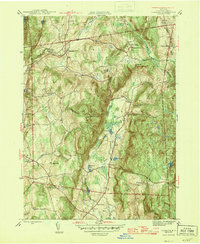 1946 Verbank1946 Print · USGSDutchess County is captured here in the mid-1940s, showing a landscape of interior ridges and tight-knit valley settlements. Genealogists and local historians can trace the footprint of the Greer School at Hope Farm, the Oswego Ch, and small rural schoolhouses like Sunnyside Sch.3 unique versions available
 - 1947 Map of Millbrook
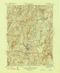 1947 Millbrook1947 Print · USGSDutchess County in the late 1940s reveals a landscape of established villages and institutional landmarks centered on Millbrook. Researchers can trace old property boundaries near South Millbrook, locate the Nine Partners Cem, and find the rural Littlerest Sch.2 unique versions available
 - 1947 Map of Hartford, 1955 Print
 1947 Hartford1955 Print · USGSSouthern New England and the Hudson Valley are shown in detail during the post-war expansion era. Genealogists and researchers can trace local landmarks from the State Capitol and Yale University to the Stratford Lighthouse and Woodlawn Cem.2 unique versions available
 - 1948 Map of Hartford
 1948 Hartford1948 Print · USGSSouthern New England is captured here in the late 1940s, showcasing a landscape of thriving industrial cities and developing parkways. Genealogists and historians can trace the rail networks of the New York New Haven and Hartford RR or locate coastal defense sites like Fort Terry and Camp Shanks.2 unique versions available
 - 1957 Map of Pleasant Valley, 1958 Print
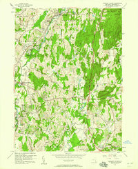 1957 Pleasant Valley1958 Print · USGSDutchess County is shown during a period of mid-century growth as new subdivisions began to border historic rural crossroads. Researchers can trace family sites near LaGrange Cem, find old schoolhouses like LaGrange Sch, or follow the Old Railroad Grade.3 unique versions available
 - 1960 Map of Millbrook, 1962 Print
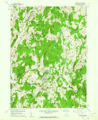 1960 Millbrook1962 Print · USGSDutchess County's pastoral character is beautifully documented in the early sixties as the village of Millbrook serves as a regional center for education and society. Researchers can trace historic cemeteries like Nine Partners Cem, local institutions like Bennett College, and the winding paths of Wappinger Creek.4 unique versions available
 - 1960 Map of Verbank, 1962 Print
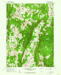 1960 Verbank1962 Print · USGSCentral Dutchess County was still a landscape of tight-knit hamlets and rugged ridges in the early sixties. Genealogists can trace family names at Moores Mill and Crouses Store, or locate the Historic Stone Tower and Clove Spring near the valley floor.3 unique versions available
 - 1961 Map of Hartford
 1961 Hartford1961 Print · USGSSouthern New England and the Hudson Valley are shown here in the mid-fifties, capturing a landscape of booming coastal cities and interior hill towns. Researchers can trace the legacy of the New York New Haven and Hartford rail corridor and find strategic sites like Camp Shanks and Fort Michie.
 - 1962 Map of Hartford, 1971 Print
 1962 Hartford1971 Print · USGSSouthern New England and the Hudson Valley are shown in the early sixties, as suburban growth reached into the foothills. Trace the path of the New York New Haven & Hartford RR and find landmarks like Camp Nathan Hale and Gillette Castle State Park.3 unique versions available
 - 1963 Map of Salt Point, 1964 Print
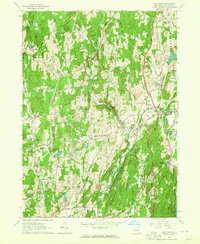 1963 Salt Point1964 Print · USGSDutchess County remains largely rural in the early sixties, with farming hamlets connected by winding turnpikes. Genealogists can trace family names at Netherwood Sch, St Josephs Ch, and old settlements like Clinton Corners.3 unique versions available
 - 1965 Map of Hartford
 1965 Hartford1965 Print · USGSSouthern New England and the Hudson Valley are shown here during the mid-sixties expansion of the Interstate era. Trace the path of the New York New Haven & Hartford RR or locate historic landmarks like West Point Military Reservation and the Merritt Parkway.2 unique versions available
Showing maps 1-25 of 47
Top cities near Pleasant Valley
- Poughkeepsie historical maps
- Newburgh historical maps
- Poughkeepsie historical maps
- East Fishkill historical maps
- Wappinger historical maps
- Fishkill historical maps
See more
Top neighborhoods of Pleasant Valley
- Gretna historical maps
- Netherwood historical maps
- Clark Heights historical maps
- Timothy Heights historical maps
- Washington Hollow historical maps
- Salt Point historical maps
Frequently asked questions
- What are the different types of historical maps available for Pleasant Valley?
- What is the oldest map of Pleasant Valley?
- Where can I purchase historical maps of Pleasant Valley for my home or office?
- Where can I download high-res historical maps of Pleasant Valley?
- Are there historical topographic maps available for Pleasant Valley?
- Is there historical aerial imagery available for Pleasant Valley?
- Where are historical maps of Pleasant Valley sourced from?