Old Maps of Barrytown, Red Hook for Hiking & Exploration
Hike through history with 33 historic maps of Barrytown. Explore old trails, ghost towns, and forgotten backroads — perfect for outdoor adventurers and local explorers.
- Rediscover forgotten places: Map out old mining camps, roads, and footpaths that no longer exist on modern maps.
- Layer with modern tools: Combine with LiDAR or satellite views to plan hikes through historical terrain.
- Made for exploration: Popular among hikers, overlanders, and local history lovers.
Use these maps to find adventure and explore the hidden past of Barrytown.
Barrytown, Red Hook maps
(33)- 1895 Map of Catskill
 1895 Catskill1895 Print · USGSThe Hudson River valley at the close of the 19th century was a landscape of bustling river ports and expanding rail lines. Genealogists and researchers can trace family lands near Saugerties, locate the old Burden Dock, or follow the route of the Catskill Mountain and Cairo R. R.10 unique versions available
 - 1898 Map of Rhinebeck
 1898 Rhinebeck1898 Print · USGSThe Hudson River valley at the close of the nineteenth century was a bustling network of rail lines and river landings. Genealogists and historians can trace the foundations of Hyde Park, find the riverside Esopus Light, or locate rail junctions like Rhinecliff.9 unique versions available
 - 1934 Map of Rhinebeck
 1934 Rhinebeck1934 Print · USGSDutchess and Ulster Counties meet along the Hudson River during the mid-1930s as the rail and river economy persists. Researchers can locate river landmarks like the Astor Tunnel and Kingston Point, or trace local roots at the Quaker Meeting House and Stone Church.2 unique versions available
 - 1934 Map of Catskill, 1960 Print
 1934 Catskill1960 Print · USGSThe Hudson Valley during the mid-1930s shows a landscape of riverfront commerce and deep-rooted rural townships. Genealogists and local historians can locate country schools like Schuylerhook Sch and historic landmarks like the Birthplace of Robert Livingston.2 unique versions available
 - 1938 Map of Catskill
 1938 Catskill1938 Print · USGSThe Hudson Valley in the late thirties remains a landscape of river-side industry and deep colonial heritage. Researchers can trace family sites from Kiskatom Ch to the Birthplace of Robert Livingston or locate vanished local landmarks like Walker Mill.2 unique versions available
 - 1939 Map of Rhinebeck
 1939 Rhinebeck1939 Print · USGSDutchess and Ulster Counties flank the Hudson River in the late 1930s, revealing a landscape defined by riverside rail travel and rural hamlets. Genealogists can locate numerous local landmarks including Clinton Corners, Washington Hollow, and the Kingston Point Lighthouse.3 unique versions available
 - 1941 Map of Catskill, 1945 Print
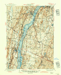 1941 Catskill1945 Print · USGSThe Hudson River valley at the start of the Second World War shows a landscape defined by historic estates and new river crossings. Genealogists and historians can trace the foundations of Bard College, locate the Birthplace of Robert Livingston, and explore early hamlets like Katsbaan and Cheviot.
 - 1947 Map of Hartford, 1955 Print
 1947 Hartford1955 Print · USGSSouthern New England and the Hudson Valley are shown in detail during the post-war expansion era. Genealogists and researchers can trace local landmarks from the State Capitol and Yale University to the Stratford Lighthouse and Woodlawn Cem.2 unique versions available
 - 1948 Map of Hartford
 1948 Hartford1948 Print · USGSSouthern New England is captured here in the late 1940s, showcasing a landscape of thriving industrial cities and developing parkways. Genealogists and historians can trace the rail networks of the New York New Haven and Hartford RR or locate coastal defense sites like Fort Terry and Camp Shanks.2 unique versions available
 - 1948 Map of Albany, 1951 Print
 1948 Albany1951 Print · USGSThe Hudson and Connecticut River valleys are captured here in the late 1940s, showing the vital rail and water corridors of the Northeast. You can trace the Boston and Maine tracks past Mt Greylock or locate early settlements like Great Barrington and Bennington.
 - 1956 Map of Albany, 1968 Print
 1956 Albany1968 Print · USGSThe industrial heart of the Northeast is revealed in the mid-1950s, from the Hudson Valley to the Connecticut River. Researchers can trace the legacy of the Quabbin Reservoir, locate Westover Air Force Base, or follow the Rutland RR through the Green Mountains.2 unique versions available
 - 1957 Map of Albany
 1957 Albany1957 Print · USGSThe Tri-State region and Connecticut River Valley are captured here during a period of significant postwar growth and infrastructure expansion. Genealogists and historians can trace the rail-and-river economy through landmarks like the Boston and Maine railroad, Quabbin Reservoir, and Westover Air Force Base.
 - 1959 Map of Albany
 1959 Albany1959 Print · USGSThe Hudson and Connecticut River valleys are captured here during the late fifties, showing the region's dense rail networks and massive water projects. Researchers can trace the New York State Thruway or locate local landmarks like Mt Greylock and the Quabbin Reservoir.
 - 1961 Map of Hartford
 1961 Hartford1961 Print · USGSSouthern New England and the Hudson Valley are shown here in the mid-fifties, capturing a landscape of booming coastal cities and interior hill towns. Researchers can trace the legacy of the New York New Haven and Hartford rail corridor and find strategic sites like Camp Shanks and Fort Michie.
 - 1962 Map of Albany
 1962 Albany1962 Print · USGSThe Hudson and Connecticut River valleys meet the Green Mountains and Berkshires in this mid-century overview of the Northeast. Genealogists and historians can trace the industrial hearts of Albany and Springfield or locate features like Quabbin Reservoir and Westover Air Force Base.
 - 1962 Map of Hartford, 1971 Print
 1962 Hartford1971 Print · USGSSouthern New England and the Hudson Valley are shown in the early sixties, as suburban growth reached into the foothills. Trace the path of the New York New Haven & Hartford RR and find landmarks like Camp Nathan Hale and Gillette Castle State Park.3 unique versions available
 - 1963 Map of Kingston East, 1965 Print
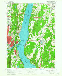 1963 Kingston East1965 Print · USGSMid-century life along the Hudson River is captured here just as the Kingston-Rhinecliff Bridge transformed local travel. Genealogists can trace family names at St Marys Cemetery or locate schools like the Cardinal Farley Military Academy and Wygant Sch.5 unique versions available
 - 1963 Map of Saugerties, 1965 Print
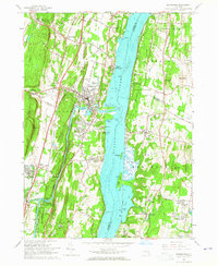 1963 Saugerties1965 Print · USGSThe Hudson River waterfront near Saugerties is captured here in the early 1960s, showing a landscape of historic estates and river-oriented industry. Genealogists can trace family sites in Malden-on-Hudson, locate the Birthplace of Robert Livingston, or find St Marys Ch.5 unique versions available
 - 1965 Map of Hartford
 1965 Hartford1965 Print · USGSSouthern New England and the Hudson Valley are shown here during the mid-sixties expansion of the Interstate era. Trace the path of the New York New Haven & Hartford RR or locate historic landmarks like West Point Military Reservation and the Merritt Parkway.2 unique versions available
 - 1985 Map of Waterbury, 1986 Print
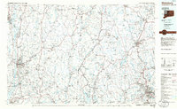 1985 Waterbury1986 Print · USGSThe Western Connecticut highlands and the Hudson Valley are captured in the mid-1980s, showing a landscape of deep forests and industrial river towns. Genealogists can trace family connections from Waterbury up through Litchfield and Torrington, while exploring the vast Barkhamsted Reservoir and Candlewood Lake basins.
 - 1986 Map of Pittsfield
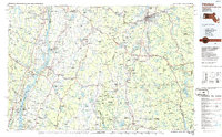 1986 Pittsfield1986 Print · USGSThe Berkshires and the Hudson Valley meet in the mid-1980s, documenting a cross-border landscape of mountain forests and river towns. Genealogists and historians can trace the paths of Conrail and the Taconic State Parkway as they pass through Stockbridge, Great Barrington, and Kinderhook.2 unique versions available
 - 1993 Map of Waterbury
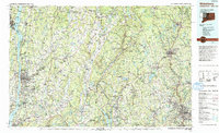 1993 Waterbury1993 Print · USGSWestern Connecticut and the Hudson Valley appear in the early nineties as a landscape of established industrial cities and deep forest preserves. Researchers can trace the rail corridors of the Metro-North Railroad or locate family sites near the Taft School and Riverside Cemetery.
 - 1997 Map of Saugerties, 2000 Print
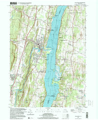 1997 Saugerties2000 Print · USGSThe Hudson River valley at the close of the century reveals a landscape of historic riverfront estates and industrial roots. Trace the grounds of Bard College, the legacy of the Clermont State Historic Site, and old cemeteries like Trinity Cem.
 - 2010 Map of Saugerties, 2010 Print
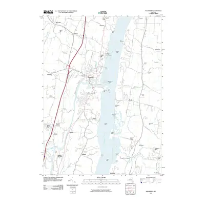 2010 Saugerties2010 Print · USGSThe Hudson River valley around Saugerties and Tivoli is documented here in the early twenty-first century. Researchers can trace historical family sites and local landmarks like Potts Farm, Mount View Cemetery, and the riverfront at Malden-on-Hudson.
 - 2010 Map of Kingston East, 2010 Print
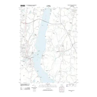 2010 Kingston East2010 Print · USGSThe Hudson River valley at the start of the twenty-first century reveals a landscape of maritime history and sprawling orchards. Trace family history through the Old Rhinebeck Cemetery and Riverview Cemetery, or locate regional landmarks like the Rondout Creek Light and Dutchess County Fairgrounds.
Showing maps 1-25 of 33
Top cities near Barrytown
- Kingston historical maps
- Hyde Park historical maps
- Saugerties historical maps
- New Paltz historical maps
- Ulster historical maps
- Catskill historical maps
See more
Frequently asked questions
- What are the different types of historical maps available for Barrytown?
- What is the oldest map of Barrytown?
- Where can I purchase historical maps of Barrytown for my home or office?
- Where can I download high-res historical maps of Barrytown?
- Are there historical topographic maps available for Barrytown?
- Is there historical aerial imagery available for Barrytown?
- Where are historical maps of Barrytown sourced from?