Old Maps of Essex, New York for Genealogy
Trace your family roots with 27 historic maps of Essex. These high-res maps reveal old neighborhoods, homesites, landmarks, and streets — helping you uncover where your ancestors lived and how the area evolved over time.
- Explore historic neighborhoods: Identify where your relatives may have lived in the 1800s or 1900s.
- Compare maps over time: Trace the changes in streets, buildings, and landmarks for multi-generational research.
- Perfect for genealogy & ancestry research: Used by family historians and researchers to map out lineage and migration.
These maps are an incredible resource for exploring your personal connection to Essex's past.
Essex, NY maps
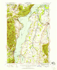
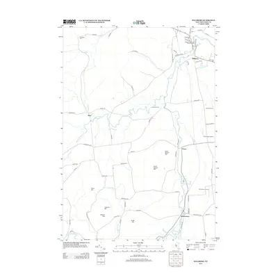
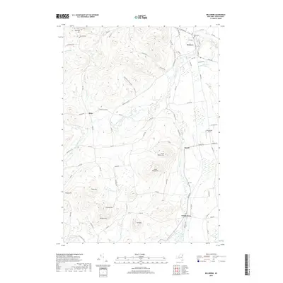
(27)- 1894 Map of Port Henry
 1894 Port Henry1894 Print · USGSLake Champlain was a bustling corridor of steamships and rail lines during the 1890s, bridging the gap between New York and Vermont. Historians can trace the strategic layout of Crown Point, locate the French Fort Ruins, and explore industrial sites like Wadhams Mills.
 - 1895 Map of Willsboro
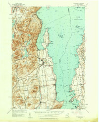
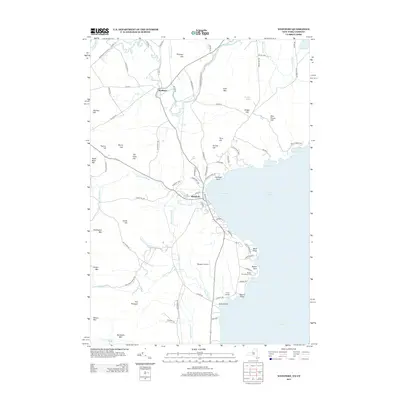
 1895 Willsboro1895 Print · USGSLake Champlain and its late 19th-century transport networks are detailed here, showing the era when ferries and steamships linked New York and Vermont. Genealogists and historians can trace old homesteads and landings near Keeseville, the McNeil Ferry, and the tracks of the Central Vermont R. R.7 unique versions available
 - 1898 Map of Port Henry
 1898 Port Henry1898 Print · USGSLake Champlain and its historic shores are captured in the late nineteenth century as steam and rail networks connected these borderlands. Researchers can locate the French Fort Ruins, trace the Central Vermont line, and explore old industrial sites like Wadhams Mills.10 unique versions available
 - 1941 Map of Willsboro
 1941 Willsboro1941 Print · USGSLake Champlain's shores in New York and Vermont are captured here just before the war, showing a landscape defined by lakefront landings and busy railroads. Trace the routes of the Delaware and Hudson and find local landmarks like Craterclub, Whallonsburg, and St Josephs Ch.2 unique versions available
 - 1943 Map of Willsboro
 1943 Willsboro1943 Print · USGSThe Lake Champlain shoreline in the early 1940s reveals a landscape of mountain-backed villages and vital cross-lake rail connections. Genealogists and researchers can trace local landmarks like St Josephs Ch, Lakeview Cem, and the path of the Delaware and Hudson railroad.3 unique versions available
 - 1945 Map of Port Henry, 1958 Print
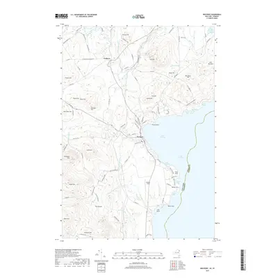
 1945 Port Henry1958 Print · USGSMid-century life along the Vermont and New York border is centered on the waters of Lake Champlain and its historic defenses. Researchers can trace the ruins of Fort Crown Point or locate family roots at Gage Cemetery and Smith School.5 unique versions available
 - 1947 Map of Port Henry
 1947 Port Henry1947 Print · USGSLake Champlain sits at the heart of this late 1940s survey of the New York and Vermont borderlands. Genealogists and local historians can trace legacy sites like the Fort St Frederic Ruins, the Rutland RR corridor, and a high density of country schools including Crane Sch and Smith Sch.2 unique versions available
 - 1950 Map of Lake Champlain
 1950 Lake Champlain1950 Print · USGSThe Lake Champlain valley and its surrounding peaks are captured in detail during the late 1940s, showing the vital rail and road connections between New York and Vermont. Researchers can trace the routes of the Central Vermont Railway or locate old industrial centers like Mineville and Witherbee.2 unique versions available
 - 1956 Map of Willsboro, 1958 Print
 1956 Willsboro1958 Print · USGSLake Champlain and the eastern Adirondacks come alive in the mid-1950s, showing the intricate shoreline from New York to Vermont. Genealogists can trace family roots through sites like Whallon Bay Sch, Boardman Cem, and the Lady of Hope Shrine.4 unique versions available
 - 1958 Map of Lake Champlain
 1958 Lake Champlain1958 Print · USGSThe Champlain Valley and surrounding high peaks are captured here in the late fifties, showcasing the cross-border region from the Adirondacks to the Green Mountains. Researchers can trace historic rail routes like the Rutland Railway or locate old valley settlements such as Keeseville and Vergennes.2 unique versions available
 - 1962 Map of Lake Champlain, 1975 Print
 1962 Lake Champlain1975 Print · USGSLake Champlain and the high peaks of the Adirondacks and Green Mountains are captured here during the mid-twentieth century. Researchers can trace the industrial legacy of the Lyon Mountain Mine and the rail corridors of the Central Vermont RR and Delaware & Hudson RR.3 unique versions available
 - 1980 Map of Willsboro
 1980 Willsboro1980 Print · USGSThe Lake Champlain shoreline at the edge of the Adirondacks was a bustling corridor of rail and water transport in the late twentieth century. Researchers can trace the Delaware and Hudson line between Willsboro and Essex, or locate family sites like Brookfield Cem and St Josephs Ch.
 - 1980 Map of Westport, 1981 Print
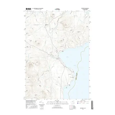
 1980 Westport1981 Print · USGSLake Champlain divides the New York Adirondacks from the Vermont plains in the early eighties, showing a landscape defined by water and rail. Researchers can trace family sites at Riverside Cem and Prospect Cem, or locate landmarks like Camp Dudley and the Delaware and Hudson railroad.3 unique versions available
 - 1986 Map of Lake Champlain South
 1986 Lake Champlain South1986 Print · USGSIn the mid-1980s, the shores of Lake Champlain linked the Adirondack high peaks with the Vermont valley. Genealogists and researchers can trace the rail lines of the Delaware & Hudson RR or locate historic settlements like Mineville and Au Sable Forks.2 unique versions available
 - 1999 Map of Willsboro, 2000 Print
 1999 Willsboro2000 Print · USGSSettled along the shores of Lake Champlain at the close of the twentieth century, this area features historic villages and mountain peaks. Genealogists can trace family names at Boardman Cem and Barber Cem or locate the Covered Bridge and St Philip Ch.
 - 1999 Map of Westport, 2000 Print
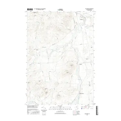
 1999 Westport2000 Print · USGSLake Champlain and the Adirondack foothills met in the final years of the millennium, showing a landscape shaped by recreation and river drainage. Researchers can find lakeside landmarks like Camp Dudley, family burial sites at Riverside Cem, and the winding course of the Boquet River.
 - 2010 Map of Willsboro, 2010 Print
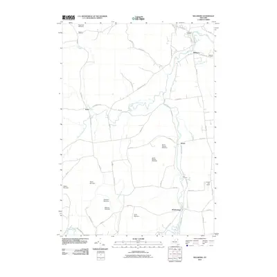 2010 Willsboro2010 Print · USGSCovers Essex, including Willsboro, Westport, and other nearby areas
 - 2012 Map of Westport, 2012 Print
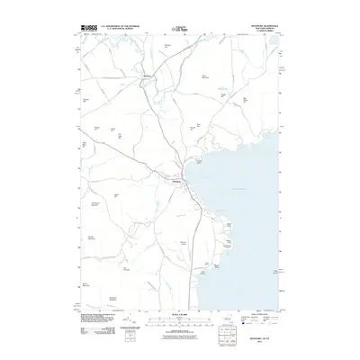 2012 Westport2012 Print · USGSCovers Essex, including Ferrisburgh, Westport, and other nearby areas
 - 2013 Map of Willsboro, 2013 Print
 2013 Willsboro2013 Print · USGSCovers Essex, including Willsboro, Westport, and other nearby areas
 - 2013 Map of Westport, 2013 Print
 2013 Westport2013 Print · USGSCovers Essex, including Ferrisburgh, Westport, and other nearby areas
 - 2016 Map of Westport, 2016 Print
 2016 Westport2016 Print · USGSCovers Essex, including Ferrisburgh, Westport, and other nearby areas
 - 2016 Map of Willsboro, 2016 Print
 2016 Willsboro2016 Print · USGSCovers Essex, including Willsboro, Westport, and other nearby areas
 - 2019 Map of Willsboro, 2019 Print
 2019 Willsboro2019 Print · USGSCovers Essex, including Willsboro, Westport, and other nearby areas
 - 2019 Map of Westport, 2019 Print
 2019 Westport2019 Print · USGSCovers Essex, including Ferrisburgh, Westport, and other nearby areas
 - 2023 Map of Willsboro, 2023 Print
 2023 Willsboro2023 Print · USGSThe Boquet River valley comes alive in this 2023 survey of eastern Essex County. Researchers can trace family history through sites like Boardman Cem and Burt Cem, or locate landmarks such as Bonebender Airport and the hamlet of Whallonsburg.
Showing maps 1-25 of 27
Top cities near Essex
- Burlington historical maps
- South Burlington historical maps
- Colchester historical maps
- Winooski historical maps
- Shelburne historical maps
- Moriah historical maps
See more
Top neighborhoods of Essex
Frequently asked questions
- What are the different types of historical maps available for Essex?
- What is the oldest map of Essex?
- Where can I purchase historical maps of Essex for my home or office?
- Where can I download high-res historical maps of Essex?
- Are there historical topographic maps available for Essex?
- Is there historical aerial imagery available for Essex?
- Where are historical maps of Essex sourced from?