2020s Maps of Jay, New York
Explore 5 historic maps of Jay from the 2020s. These maps offer a rare glimpse into what life looked like during the 2020s — showing old roads, neighborhoods, homes, and landmarks that have changed or disappeared over time.
Whether you're researching your family's past, planning a metal detecting trip, or studying how Jay's landscape evolved across the 2020s, these high-resolution maps are a powerful tool for exploring the history of this region.
- Focus on a specific era: All maps on this page are from the 2020s, giving you a focused view of this time period.
- See what’s changed: Compare century-old streets, trails, and buildings to today's modern landscape using overlays and satellite layers.
- Research with precision: Use these maps for genealogy, historical research, land use analysis, or educational projects.
- View, download, or print: Maps are fully viewable online in high resolution, and can be downloaded or printed for your own records.
Start exploring Jay's history through authentic maps from the 2020s. This is your window into the past.
Jay, NY maps
(5)- 2023 Map of Keene, 2023 Print
 2023 Keene2023 Print · USGSThe High Peaks region of Essex County is documented here in the early twenty-first century, showing the mountain-and-river geography of the Adirondacks. Trace family sites near Ingalls Cem or explore the rugged paths of the Jackrabbit Ski Trl and High Falls Gorge.
 - 2023 Map of Wilmington, 2023 Print
 2023 Wilmington2023 Print · USGSThe Wilmington valley and the high peaks of the Adirondacks appear here in the early twenty-first century. Genealogists and hikers can trace local landmarks like Haselton Cem, the Catalano Airfield, and the Wilmington Snowmobile Trl.
 - 2023 Map of Jay Mountain, 2023 Print
 2023 Jay Mountain2023 Print · USGSThe Adirondack high country near Jay comes into focus in this recent survey, showcasing the complex ridge systems and remote basins of the northeastern peaks. Hikers and local historians can trace the Jay Mountain Trl over Jay Mountain or locate the Central Cem near the East Branch Ausable River.
 - 2023 Map of Clintonville, 2023 Print
 2023 Clintonville2023 Print · USGSThe Ausable River valley comes into sharp focus in this recent survey of the Clinton and Essex County border. Genealogists and hikers can trace old valley roads to sites like Clintonville Old Cem or follow the Ranger Trl toward Pokamoonshine Mountain.
 - 2023 Map of Au Sable Forks, 2023 Print
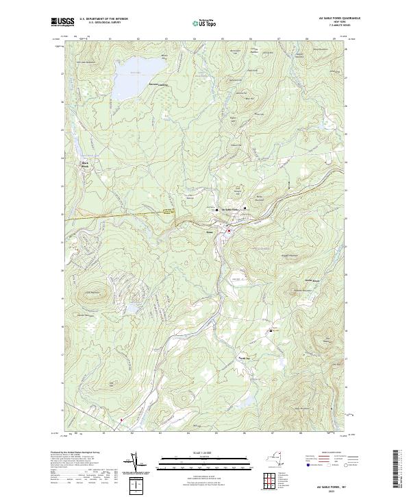 2023 Au Sable Forks2023 Print · USGSAu Sable Forks and the surrounding Adirondack foothills are captured here in the early 2020s, showing the intersection of river life and mountain terrain. Genealogists can trace family locations near North Jay, Stevens Landing, and cemeteries like Holy Name Cem.
End of results
Showing maps 1-5 of 5
Top cities near Jay
- North Elba historical maps
- Peru historical maps
- AuSable historical maps
- Keeseville historical maps
- Chesterfield historical maps
- Willsboro historical maps
See more
Top neighborhoods of Jay
Frequently asked questions
- What are the different types of historical maps available for Jay?
- What is the oldest map of Jay?
- Where can I purchase historical maps of Jay for my home or office?
- Where can I download high-res historical maps of Jay?
- Are there historical topographic maps available for Jay?
- Is there historical aerial imagery available for Jay?
- Where are historical maps of Jay sourced from?