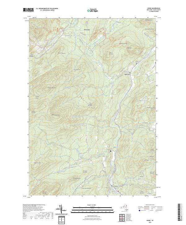
2023 Map of Keene
USGS Topo · Published 2023About this map
The East Branch Ausable River and West Branch Ausable River dominate this Adirondack landscape, carving deep valleys between massive formations like the Sentinel Range and Pitchoff Mountain. The settlement of Keene sits at the southern confluence of mountain streams, while Upper Jay and Wilmington follow the river corridors to the north. These waterways define the historic travel and timber patterns of Essex County, with the dramatic descent of High Falls Gorge and The Flume marking the West Branch's path. Cultural landmarks like Mountain View Cem and Ingalls Cem provide touchpoints for genealogical research near the valley floors. High-elevation terrain includes Sentinel Mountain and Kilburn Mountain, accessible via historic routes like the Jackrabbit Ski Trl and Ausable Nature Trl. The map details a landscape where steep ridges like Eisenglass Mountain and Hiccock Mountain constrain development to narrow strips along Hulls Falls Rd and Styles Brook Rd.
Find a feature on this map
94 named features on this map. Tap any name to fly to it.
Don’t see what you’re looking for? This feature index may not catch every label — zoom into the map to look around manually.
Map Details
Editions of this 2023 Keene Map
This is the sole edition of this map. No revisions or reprints were ever made.
Other maps of this area

1894 · Elizabethtown
USGS Topo · 1:62,500

1895 · Elizabethtown
USGS Topo · 1:62,500

1895 · Mt. Marcy
USGS Topo · 1:62,500

1895 · Ausable
USGS Topo · 1:62,500

1896 · Lake Placid
USGS Topo · 1:62,500

1898 · Lake Placid
USGS Topo · 1:62,500

1901 · Elizabethtown
USGS Topo · 1:62,500

1902 · Mt. Marcy
USGS Topo · 1:62,500

1903 · Ausable
USGS Topo · 1:62,500

1950 · Lake Champlain
USGS Topo · 1:250,000