
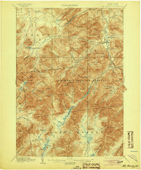
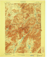
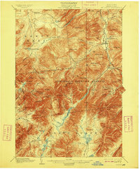
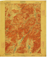
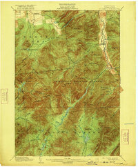
1902 Map of Mt. Marcy
USGS Topo · Published 1902About this map
Mt. Marcy and the surrounding High Peaks dominate this 1902 survey of the central Adirondacks, capturing a moment when the region's recreation and conservation history was firmly taking root. The map identifies the expansive Adirondack Mountain Reserve and the legendary Adirondack Lodge, a primary gateway for mountaineers of the era. The topography detail reveals the complex drainage systems of the Opalescent River and West Br. Ausable River, alongside high-altitude features like Lake Tear. In the valleys, the established settlements of Keene Valley and Beede are shown as they existed at the turn of the century, providing a clear view of the early roads and trails such as Hunters Pass that first connected these mountain communities and wilderness lodges.
Find a feature on this map
94 named features on this map. Tap any name to fly to it.
Don’t see what you’re looking for? This feature index may not catch every label — zoom into the map to look around manually.
Map Details
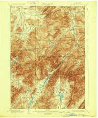
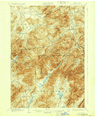
Editions of this 1902 Mt. Marcy Map
10 editions found


Other maps of this area

1894 · Elizabethtown
USGS Topo · 1:62,500

1895 · Elizabethtown
USGS Topo · 1:62,500

1895 · Mt. Marcy
USGS Topo · 1:62,500

1895 · Ausable
USGS Topo · 1:62,500

1895 · Paradox Lake
USGS Topo · 1:62,500

1896 · Lake Placid
USGS Topo · 1:62,500

1897 · Paradox Lake
USGS Topo · 1:62,500

1897 · Schroon Lake
USGS Topo · 1:62,500

1898 · Newcomb
USGS Topo · 1:62,500

1898 · Lake Placid
USGS Topo · 1:62,500