Old Maps of Gloversville, New York for Genealogy
Trace your family roots with 25 historic maps of Gloversville. These high-res maps reveal old neighborhoods, homesites, landmarks, and streets — helping you uncover where your ancestors lived and how the area evolved over time.
- Explore historic neighborhoods: Identify where your relatives may have lived in the 1800s or 1900s.
- Compare maps over time: Trace the changes in streets, buildings, and landmarks for multi-generational research.
- Perfect for genealogy & ancestry research: Used by family historians and researchers to map out lineage and migration.
These maps are an incredible resource for exploring your personal connection to Gloversville's past.
Gloversville, NY maps
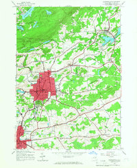
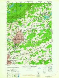
(25)- 1903 Map of Gloversville
 1903 Gloversville1903 Print · USGSGloversville and Johnstown anchor this turn-of-the-century survey as the region's industrial heart, surrounded by the growing Adirondack resort and timber lands. Genealogists and historians can trace the Electric R.R. or locate historic markers like the Battle Monument and old hamlets like Bleecker Center.8 unique versions available
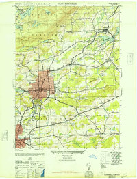
 - 1943 Map of Gloversville
 1943 Gloversville1943 Print · USGSGloversville and Johnstown serve as the industrial anchors of this Adirondack foothills region during the early twentieth century. Genealogists and historians can trace the paths of the Electric R. R. and locate family landmarks like Kingsboro, Bleecker, and the Battle Monument.
 - 1945 Map of Gloversville, 1966 Print
 1945 Gloversville1966 Print · USGSGloversville and Johnstown are shown in high detail during the mid-forties, capturing the industrial and civic heart of Fulton County. Researchers can trace family roots at St Patricks Cem, locate the old County Home, or find vanished schoolhouses like Hale Mills School.
 - 1946 Map of Gloversville
 1946 Gloversville1946 Print · USGSFulton County industrial centers and rural outskirts are captured here just after the war. Local historians can trace the F J & G RR through Gloversville, find family plots at Prospect Hill Cem, or locate rural landmarks like Dennies Crossing.
 - 1946 Map of Peck Lake
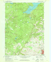
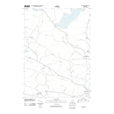
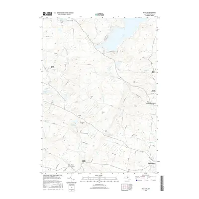
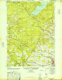 1946 Peck Lake1946 Print · USGSFulton County settlements and the southern Adirondacks are captured here in the years following the war. Researchers can trace the rural networks around Peck Lake, locating family burial sites like Boshart Cem and early schools including Clip Hill Sch.
 - 1950 Map of Utica, 1951 Print
 1950 Utica1951 Print · USGSCentral New York in the post-war era showcases the industrial Mohawk Valley and the pristine Adirondack interior. Researchers can trace transportation networks like the New York Central Railroad and find early Cold War sites such as Griffiss Air Force Base.
 - 1957 Map of Utica
 1957 Utica1957 Print · USGSCentral New York and the Adirondack foothills are captured here in the mid-fifties, showing a landscape defined by the Mohawk River corridor and the growing highway system. Genealogists and researchers can trace the rail lines of the New York Central and locate communities from Lowville to Gloversville.
 - 1962 Map of Peck Lake
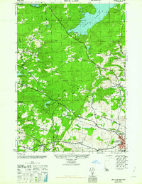 1962 Peck Lake1962 Print · USGSFulton County’s southern Adirondack foothills were well-established rural communities by the mid-1940s. Genealogists and local historians can trace family sites like Kecks Center Cem or follow the old Turnpike Road to the Wemple Sch.
 - 1962 Map of Utica
 1962 Utica1962 Print · USGSCentral New York and the Adirondack wilderness are captured here during the mid-century era of highway and industrial expansion. Genealogists and historians can trace the development of the New York State Thruway and local rail lines connecting Utica, Rome, and Gloversville.3 unique versions available
 - 1963 Map of Gloversville
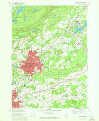
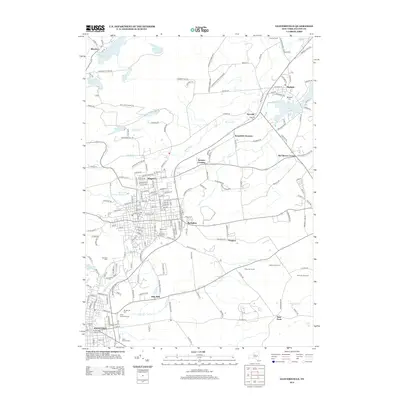
 1963 Gloversville1963 Print · USGSGloversville and Johnstown stand at the height of their industrial era, linked by the Fonda Johnstown and Gloversville RR. Researchers can trace family roots at Fern Dale Cem or locate old neighborhood landmarks like Lexington Sch and the Littauer Hospital.
 - 1964 Map of Utica
 1964 Utica1964 Print · USGSCentral New York and the high wilderness of the Adirondacks are captured here during the post-war era of infrastructure expansion. Researchers can trace the development of the New York State Thruway alongside historic corridors like the Oneida Lake (Barge Canal Route) and the N. Y. Central railroad.
 - 1967 Map of Utica
 1967 Utica1967 Print · USGSCentral New York's industrial Mohawk Valley meets the Adirondack wilderness in the 1960s, showing the region's transition from manufacturing hubs to state-managed parklands. Trace historic settlements and sites like Griffiss Air Force Base, Colgate University, and the Lyons Falls Paper Mill.
 - 1970 Map of Gloversville, 1972 Print
 1970 Gloversville1972 Print · USGSGloversville and Johnstown are shown in detail during the early 1970s, from the urban manufacturing core to the Adirondack foothills. Trace local history at the F J & G RR, Tryon State School for Boys, and Prospect Hill Cem.
 - 1970 Map of Peck Lake, 1972 Print
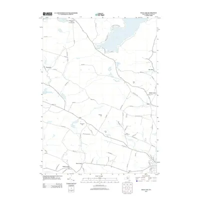
 1970 Peck Lake1972 Print · USGSThe Fulton County countryside in the 1970s shows the meeting of the Adirondack wilderness and the growing outskirts of Gloversville. Locate family landmarks like Eppie Corners, the Boshart Cem, and North Bush.
 - 1985 Map of Gloversville, 1986 Print
 1985 Gloversville1986 Print · USGSThe southern Adirondacks meet the Mohawk Valley industrial corridor during the mid-eighties, showcasing a landscape of high-country lakes and riverside manufacturing towns. Trace the historical alignment of the Erie Canal and Conrail lines or locate landmarks like the Herkimer Home State Historic Site.2 unique versions available
 - 2010 Map of Gloversville, 2010 Print
 2010 Gloversville2010 Print · USGSCovers Gloversville, including Johnstown, Johnstown, and other nearby areas
 - 2010 Map of Peck Lake, 2010 Print
 2010 Peck Lake2010 Print · USGSCovers Gloversville, including Johnstown, Johnstown, and other nearby areas
 - 2013 Map of Gloversville, 2013 Print
 2013 Gloversville2013 Print · USGSCovers Gloversville, including Johnstown, Johnstown, and other nearby areas
 - 2013 Map of Peck Lake, 2013 Print
 2013 Peck Lake2013 Print · USGSCovers Gloversville, including Johnstown, Johnstown, and other nearby areas
 - 2016 Map of Peck Lake, 2016 Print
 2016 Peck Lake2016 Print · USGSCovers Gloversville, including Johnstown, Johnstown, and other nearby areas
 - 2016 Map of Gloversville, 2016 Print
 2016 Gloversville2016 Print · USGSCovers Gloversville, including Johnstown, Johnstown, and other nearby areas
 - 2019 Map of Gloversville, 2019 Print
 2019 Gloversville2019 Print · USGSCovers Gloversville, including Johnstown, Johnstown, and other nearby areas
 - 2019 Map of Peck Lake, 2019 Print
 2019 Peck Lake2019 Print · USGSCovers Gloversville, including Johnstown, Johnstown, and other nearby areas
 - 2023 Map of Peck Lake, 2023 Print
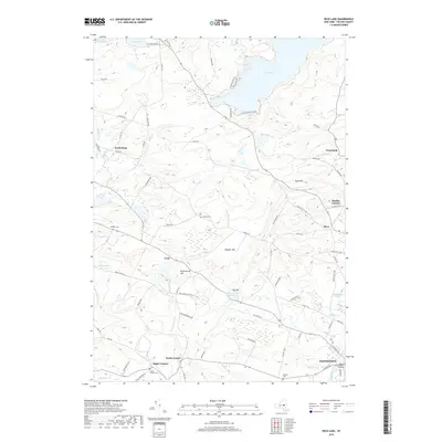
 2023 Peck Lake2023 Print · USGSThe Adirondack foothills of Fulton County appear here in detail, showing the rural uplands and vital reservoirs of the modern era. Genealogists and historians can locate old family burial sites like Rhodes Cem and Boshart Cem or trace the small hamlets of Kecks Center and Cork.
 - 2023 Map of Gloversville, 2023 Print
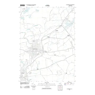
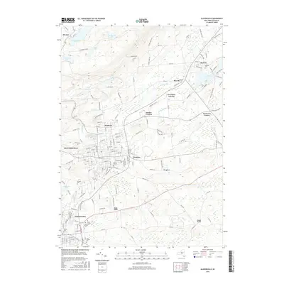
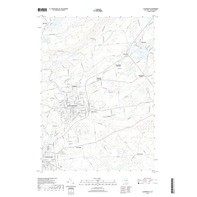
 2023 Gloversville2023 Print · USGSGloversville and Johnstown are shown in the 2020s as established industrial and residential hubs at the edge of the southern Adirondacks. Genealogists can locate family sites at Prospect Hill Cem, Israel Cem, and Mount Carmel Cem near the banks of Hale Creek.
End of results
Showing maps 1-25 of 25
Top cities near Gloversville
- Amsterdam historical maps
- Johnstown historical maps
- Johnstown historical maps
- Mayfield historical maps
- Duanesburg historical maps
- Amsterdam historical maps
See more
Top neighborhoods of Gloversville
- Ward 2 historical maps
- Ward 3 historical maps
- Ward 4 historical maps
- Ward 5 historical maps
- Ward 6 historical maps
- Ward 1 historical maps
See more
Frequently asked questions
- What are the different types of historical maps available for Gloversville?
- What is the oldest map of Gloversville?
- Where can I purchase historical maps of Gloversville for my home or office?
- Where can I download high-res historical maps of Gloversville?
- Are there historical topographic maps available for Gloversville?
- Is there historical aerial imagery available for Gloversville?
- Where are historical maps of Gloversville sourced from?