1900s (20th Century) Maps of Round Top, Cairo
Explore 22 historic maps of Round Top from the 1900s (20th Century). These maps offer a rare glimpse into what life looked like during the 1900s — showing old roads, neighborhoods, homes, and landmarks that have changed or disappeared over time.
Whether you're researching your family's past, planning a metal detecting trip, or studying how Round Top's landscape evolved across the 1900s, these high-resolution maps are a powerful tool for exploring the history of this region.
- Focus on a specific era: All maps on this page are from the 1900s, giving you a focused view of this time period.
- See what’s changed: Compare century-old streets, trails, and buildings to today's modern landscape using overlays and satellite layers.
- Research with precision: Use these maps for genealogy, historical research, land use analysis, or educational projects.
- View, download, or print: Maps are fully viewable online in high resolution, and can be downloaded or printed for your own records.
Start exploring Round Top's history through authentic maps from the 1900s. This is your window into the past.
Round Top, Cairo maps
(22)- 1903 Map of Kaaterskill, 1906 Print
 1903 Kaaterskill1906 Print · USGSThe Catskills come alive in the early twentieth century through this record of mountain resorts and steep-grade rail lines. Researchers can trace the legendary Mountain House, the Otis Elevating R.R., and the remote Dutch Settlement.10 unique versions available
 - 1929 Map of Coxsackie
 1929 Coxsackie1929 Print · USGSThe Hudson River valley in the late twenties was a bustling corridor of rail lines and river landings between Albany and Catskill. Genealogists and historians can trace family locations through dozens of numbered schoolhouses, the industrial works at Stottville, and the transit hubs of Schodack Landing and West Coxsackie.4 unique versions available
 - 1934 Map of Catskill, 1960 Print
 1934 Catskill1960 Print · USGSThe Hudson Valley during the mid-1930s shows a landscape of riverfront commerce and deep-rooted rural townships. Genealogists and local historians can locate country schools like Schuylerhook Sch and historic landmarks like the Birthplace of Robert Livingston.2 unique versions available
 - 1938 Map of Catskill
 1938 Catskill1938 Print · USGSThe Hudson Valley in the late thirties remains a landscape of river-side industry and deep colonial heritage. Researchers can trace family sites from Kiskatom Ch to the Birthplace of Robert Livingston or locate vanished local landmarks like Walker Mill.2 unique versions available
 - 1941 Map of Catskill, 1945 Print
 1941 Catskill1945 Print · USGSThe Hudson River valley at the start of the Second World War shows a landscape defined by historic estates and new river crossings. Genealogists and historians can trace the foundations of Bard College, locate the Birthplace of Robert Livingston, and explore early hamlets like Katsbaan and Cheviot.
 - 1943 Map of Freehold, 1964 Print
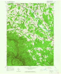 1943 Freehold1964 Print · USGSThe northern Catskills met the valley settlements of Greene County in the 1940s, showing a landscape of high peaks and rural villages. Researchers can trace family sites near St Marys Ch, Taylor Cem, or along the banks of Catskill Creek.2 unique versions available
 - 1945 Map of Freehold, 1946 Print
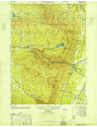
 1945 Freehold1946 Print · USGSGreene County is shown here in the mid-1940s, where the agricultural valleys of the Catskill foothills meet the high peaks of the Escarpment. Researchers can trace family history through local landmarks like Snyder Cem, St Edmunds Chapel, and the hamlets of East Durham and Freehold.
 - 1946 Map of Kaaterskill
 1946 Kaaterskill1946 Print · USGSThe northern Catskills appear in great detail just after the war, showing the classic resort landscape from Tannersville to Palenville. Genealogists and hikers can trace the original paths to the Mountain House and locate family names at the Shoub Cem.7 unique versions available
 - 1948 Map of Albany, 1951 Print
 1948 Albany1951 Print · USGSThe Hudson and Connecticut River valleys are captured here in the late 1940s, showing the vital rail and water corridors of the Northeast. You can trace the Boston and Maine tracks past Mt Greylock or locate early settlements like Great Barrington and Bennington.
 - 1948 Map of Binghamton, 1980 Print
 1948 Binghamton1980 Print · USGSCentral New York and the Southern Tier thrive in the late 1940s as a hub of rail traffic and mountain industry. Researchers can trace historic transit lines like the Erie Railroad through Binghamton or find old valley settlements near Oneonta and Delhi.
 - 1950 Map of Binghamton
 1950 Binghamton1950 Print · USGSBinghamton and the surrounding Southern Tier are shown in the mid-century era, highlighting the intricate rail and river networks that drove local industry. Researchers can trace the path of the Erie Railroad and locate landmarks from Otsego Lake to Sidney Mountain.2 unique versions available
 - 1953 Map of Leeds, 1955 Print
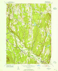 1953 Leeds1955 Print · USGSGreene County’s agricultural and creek-side landscapes are captured here in the early fifties, showing a region defined by its family lineages and early transport routes. Genealogists can locate numerous small burial sites like Weekes Cem and trace the path of the Mohican Trail near South Cairo.4 unique versions available
 - 1956 Map of Albany, 1968 Print
 1956 Albany1968 Print · USGSThe industrial heart of the Northeast is revealed in the mid-1950s, from the Hudson Valley to the Connecticut River. Researchers can trace the legacy of the Quabbin Reservoir, locate Westover Air Force Base, or follow the Rutland RR through the Green Mountains.2 unique versions available
 - 1957 Map of Albany
 1957 Albany1957 Print · USGSThe Tri-State region and Connecticut River Valley are captured here during a period of significant postwar growth and infrastructure expansion. Genealogists and historians can trace the rail-and-river economy through landmarks like the Boston and Maine railroad, Quabbin Reservoir, and Westover Air Force Base.
 - 1958 Map of Binghamton
 1958 Binghamton1958 Print · USGSCentral New York in the late fifties was a network of manufacturing cities and river valleys connected by vital rail lines. Genealogists and historians can trace family roots in Oneonta, Norwich, and Cooperstown or locate long-standing farms along Schoharie Creek.
 - 1959 Map of Albany
 1959 Albany1959 Print · USGSThe Hudson and Connecticut River valleys are captured here during the late fifties, showing the region's dense rail networks and massive water projects. Researchers can trace the New York State Thruway or locate local landmarks like Mt Greylock and the Quabbin Reservoir.
 - 1962 Map of Albany
 1962 Albany1962 Print · USGSThe Hudson and Connecticut River valleys meet the Green Mountains and Berkshires in this mid-century overview of the Northeast. Genealogists and historians can trace the industrial hearts of Albany and Springfield or locate features like Quabbin Reservoir and Westover Air Force Base.
 - 1963 Map of Binghamton
 1963 Binghamton1963 Print · USGSThe Southern Tier and Catskill peaks are shown in the early sixties as new reservoirs reshaped the valleys. Trace historic rail corridors like the Erie Lackawanna RR and explore lakeside settlements such as Cooperstown and Oneonta.
 - 1963 Map of Cementon, 1965 Print
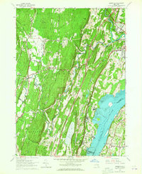 1963 Cementon1965 Print · USGSThe Hudson Valley in the early sixties reveals a landscape of industrial river towns and mountain-edge settlements. Researchers can trace the riverfront rail economy through Cementon and Alsen or locate historic landmarks like Kiskatom Ch and the Old Kings Road.4 unique versions available
 - 1986 Map of Pepacton Reservoir
 1986 Pepacton Reservoir1986 Print · USGSThe Catskills in the mid-eighties show a landscape shaped by the Pepacton Reservoir and protected wilderness. Local historians can trace mountain rail corridors like the Delaware & Ulster RR and locate high-elevation landmarks from Slide Mountain to Hunter Mountain.2 unique versions available
 - 1986 Map of Pittsfield
 1986 Pittsfield1986 Print · USGSThe Berkshires and the Hudson Valley meet in the mid-1980s, documenting a cross-border landscape of mountain forests and river towns. Genealogists and historians can trace the paths of Conrail and the Taconic State Parkway as they pass through Stockbridge, Great Barrington, and Kinderhook.2 unique versions available
 - 1997 Map of Kaaterskill Clove, 2001 Print
 1997 Kaaterskill Clove2001 Print · USGSThe eastern escarpment of the Catskills is captured here at the close of the millennium, showing the dense network of peaks and ravines that shaped Greene County history. Researchers can trace the Old Railroad Grade through the clove or locate sites like Twilight Park and Mountain House.
End of results
Showing maps 1-22 of 22
Top cities near Round Top
- Saugerties historical maps
- Catskill historical maps
- Red Hook historical maps
- Coxsackie historical maps
- Coeymans historical maps
- Cairo historical maps
See more
Frequently asked questions
- What are the different types of historical maps available for Round Top?
- What is the oldest map of Round Top?
- Where can I purchase historical maps of Round Top for my home or office?
- Where can I download high-res historical maps of Round Top?
- Are there historical topographic maps available for Round Top?
- Is there historical aerial imagery available for Round Top?
- Where are historical maps of Round Top sourced from?