Old Maps of Greenville, New York for Academic Research
Study the evolution of Greenville with 44 high-resolution historic maps. Whether you're teaching, researching, or modeling changes in land use, these maps provide essential visual documentation of urban, environmental, and geographic change.
- Analyze long-term change: Track patterns in development, transportation, and natural features.
- Ideal for environmental or urban studies: Support academic projects with primary historical map data.
- Use in the classroom or lab: Educators and researchers rely on these maps to bring historical context to life.
These maps are a powerful tool for teaching, research, and visualizing how Greenville has changed over the decades.
Greenville, NY maps
(44)- 1893 Map of Coxsackie
 1893 Coxsackie1893 Print · USGSThe Hudson River valley at the close of the 19th century shows a landscape defined by waterborne trade and expanding rail networks. Genealogists and local historians can trace family-named landmarks like Stanton Hill, ferry landings at Nuttenhook, and rail hubs like Coeyman Junction.
 - 1893 Map of Durham
 1893 Durham1893 Print · USGSThe northern Catskill foothills and the Greene-Albany county line appear here in the early 1890s, when valley farming and small-scale industry defined the region. Genealogists and hikers can trace the original paths to Union Society, Cairo Forge, and the high peaks of the Black Head Mountains.
 - 1894 Map of Coxsackie
 1894 Coxsackie1894 Print · USGSThe Hudson River valley at the close of the 19th century was a hub of rail and river transit between Greene and Columbia counties. Genealogists can trace family names at Stanton Hill and Stephensville or locate long-lost stops like New Baltimore Sta. and Coxsackie Station.8 unique versions available
 - 1894 Map of Durham
 1894 Durham1894 Print · USGSThe northern Catskills transition from rolling valley farms to high mountain peaks in the late nineteenth century. Genealogists and hikers can trace old routes between Preston Hollow, Hensonville, and the summits of the Black Head Mountains.10 unique versions available
 - 1929 Map of Coxsackie
 1929 Coxsackie1929 Print · USGSThe Hudson River valley in the late twenties was a bustling corridor of rail lines and river landings between Albany and Catskill. Genealogists and historians can trace family locations through dozens of numbered schoolhouses, the industrial works at Stottville, and the transit hubs of Schodack Landing and West Coxsackie.4 unique versions available
 - 1943 Map of Freehold, 1964 Print
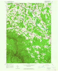 1943 Freehold1964 Print · USGSThe northern Catskills met the valley settlements of Greene County in the 1940s, showing a landscape of high peaks and rural villages. Researchers can trace family sites near St Marys Ch, Taylor Cem, or along the banks of Catskill Creek.2 unique versions available
 - 1945 Map of Freehold, 1946 Print
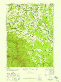 1945 Freehold1946 Print · USGSGreene County is shown here in the mid-1940s, where the agricultural valleys of the Catskill foothills meet the high peaks of the Escarpment. Researchers can trace family history through local landmarks like Snyder Cem, St Edmunds Chapel, and the hamlets of East Durham and Freehold.
 - 1945 Map of Greenville, 1960 Print
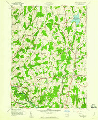 1945 Greenville1960 Print · USGSThe Catskill foothills of Albany and Greene Counties appear here at the end of the war, showing a landscape of tight-knit rural hamlets. Researchers can trace family history through landmarks like Smith Corner, Westerlo Central Cem, and School No 6.2 unique versions available
 - 1946 Map of Greenville
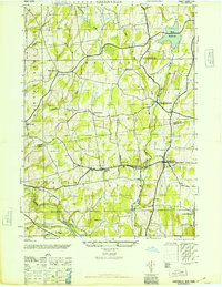 1946 Greenville1946 Print · USGSThe rural landscapes of Albany and Greene Counties are captured here in the mid-1940s, showing the quiet transition from farmland to foothills. Genealogists can locate family landmarks like O'Hara Corners, Stone Bridge Cem, and various rural schoolhouses.
 - 1948 Map of Albany, 1951 Print
 1948 Albany1951 Print · USGSThe Hudson and Connecticut River valleys are captured here in the late 1940s, showing the vital rail and water corridors of the Northeast. You can trace the Boston and Maine tracks past Mt Greylock or locate early settlements like Great Barrington and Bennington.
 - 1948 Map of Binghamton, 1980 Print
 1948 Binghamton1980 Print · USGSCentral New York and the Southern Tier thrive in the late 1940s as a hub of rail traffic and mountain industry. Researchers can trace historic transit lines like the Erie Railroad through Binghamton or find old valley settlements near Oneonta and Delhi.
 - 1950 Map of Binghamton
 1950 Binghamton1950 Print · USGSBinghamton and the surrounding Southern Tier are shown in the mid-century era, highlighting the intricate rail and river networks that drove local industry. Researchers can trace the path of the Erie Railroad and locate landmarks from Otsego Lake to Sidney Mountain.2 unique versions available
 - 1953 Map of Leeds, 1955 Print
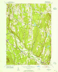 1953 Leeds1955 Print · USGSGreene County’s agricultural and creek-side landscapes are captured here in the early fifties, showing a region defined by its family lineages and early transport routes. Genealogists can locate numerous small burial sites like Weekes Cem and trace the path of the Mohican Trail near South Cairo.4 unique versions available
 - 1953 Map of Alcove, 1955 Print
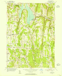 1953 Alcove1955 Print · USGSThe rural borders of Albany and Greene counties are captured here in the mid-fifties, centered on the Alcove Reservoir and its surrounding hamlets. Researchers can trace family roots through numerous sites like Indian Fields Cem, Staco Cem, and the local schools of Coeymans Hollow.3 unique versions available
 - 1956 Map of Albany, 1968 Print
 1956 Albany1968 Print · USGSThe industrial heart of the Northeast is revealed in the mid-1950s, from the Hudson Valley to the Connecticut River. Researchers can trace the legacy of the Quabbin Reservoir, locate Westover Air Force Base, or follow the Rutland RR through the Green Mountains.2 unique versions available
 - 1957 Map of Albany
 1957 Albany1957 Print · USGSThe Tri-State region and Connecticut River Valley are captured here during a period of significant postwar growth and infrastructure expansion. Genealogists and historians can trace the rail-and-river economy through landmarks like the Boston and Maine railroad, Quabbin Reservoir, and Westover Air Force Base.
 - 1958 Map of Binghamton
 1958 Binghamton1958 Print · USGSCentral New York in the late fifties was a network of manufacturing cities and river valleys connected by vital rail lines. Genealogists and historians can trace family roots in Oneonta, Norwich, and Cooperstown or locate long-standing farms along Schoharie Creek.
 - 1959 Map of Albany
 1959 Albany1959 Print · USGSThe Hudson and Connecticut River valleys are captured here during the late fifties, showing the region's dense rail networks and massive water projects. Researchers can trace the New York State Thruway or locate local landmarks like Mt Greylock and the Quabbin Reservoir.
 - 1962 Map of Albany
 1962 Albany1962 Print · USGSThe Hudson and Connecticut River valleys meet the Green Mountains and Berkshires in this mid-century overview of the Northeast. Genealogists and historians can trace the industrial hearts of Albany and Springfield or locate features like Quabbin Reservoir and Westover Air Force Base.
 - 1963 Map of Binghamton
 1963 Binghamton1963 Print · USGSThe Southern Tier and Catskill peaks are shown in the early sixties as new reservoirs reshaped the valleys. Trace historic rail corridors like the Erie Lackawanna RR and explore lakeside settlements such as Cooperstown and Oneonta.
 - 1978 Map of Wilmington, 1979 Print
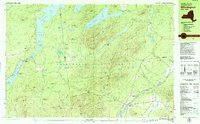 1978 Wilmington1979 Print · USGSThe High Peaks region during the late seventies shows a landscape defined by mountain ranges and river valleys. Researchers can trace historical sites like West Kilns, the Whiteface Memorial Highway, and the Goodspeed Cem.
 - 1980 Map of Greenville, 1981 Print
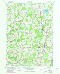 1980 Greenville1981 Print · USGSThe Albany and Greene County borderlands in the early eighties show a landscape of hamlets connected by winding creeks and country roads. Genealogists and historians can trace family burial sites like Locust Cem and rural settlements such as South Westerlo and Norton Hill.
 - 1986 Map of Pepacton Reservoir
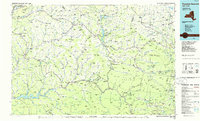 1986 Pepacton Reservoir1986 Print · USGSThe Catskills in the mid-eighties show a landscape shaped by the Pepacton Reservoir and protected wilderness. Local historians can trace mountain rail corridors like the Delaware & Ulster RR and locate high-elevation landmarks from Slide Mountain to Hunter Mountain.2 unique versions available
 - 1986 Map of Pittsfield
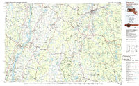 1986 Pittsfield1986 Print · USGSThe Berkshires and the Hudson Valley meet in the mid-1980s, documenting a cross-border landscape of mountain forests and river towns. Genealogists and historians can trace the paths of Conrail and the Taconic State Parkway as they pass through Stockbridge, Great Barrington, and Kinderhook.2 unique versions available
 - 2010 Map of Freehold, 2010 Print
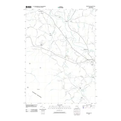 2010 Freehold2010 Print · USGSGreene County is shown here in the early twenty-first century, where the valley floor of Catskill Creek meets the high peaks. Genealogists and local historians can trace burial sites at Taylor Cemetery or explore the rural hubs of Cairo and East Durham.
Showing maps 1-25 of 44
Top cities near Greenville
- Albany historical maps
- Bethlehem historical maps
- Saugerties historical maps
- Catskill historical maps
- New Scotland historical maps
- Coxsackie historical maps
See more
Top neighborhoods of Greenville
- Greenville Center historical maps
- Freehold historical maps
- Surprise historical maps
- Place Corners historical maps
- Newrys historical maps
- West Greenville historical maps
See more
Frequently asked questions
- What are the different types of historical maps available for Greenville?
- What is the oldest map of Greenville?
- Where can I purchase historical maps of Greenville for my home or office?
- Where can I download high-res historical maps of Greenville?
- Are there historical topographic maps available for Greenville?
- Is there historical aerial imagery available for Greenville?
- Where are historical maps of Greenville sourced from?