Old Maps of Hasbroucks, Long Lake for Genealogy
Trace your family roots with 15 historic maps of Hasbroucks. These high-res maps reveal old neighborhoods, homesites, landmarks, and streets — helping you uncover where your ancestors lived and how the area evolved over time.
- Explore historic neighborhoods: Identify where your relatives may have lived in the 1800s or 1900s.
- Compare maps over time: Trace the changes in streets, buildings, and landmarks for multi-generational research.
- Perfect for genealogy & ancestry research: Used by family historians and researchers to map out lineage and migration.
These maps are an incredible resource for exploring your personal connection to Hasbroucks's past.
Hasbroucks, Long Lake maps
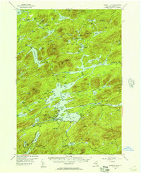
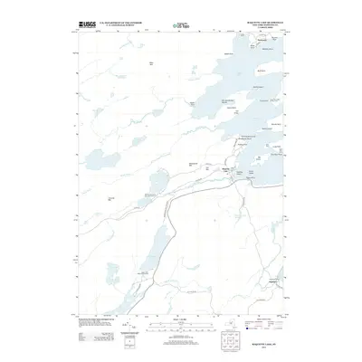
(15)- 1903 Map of Raquette Lake
 1903 Raquette Lake1903 Print · USGSThe Adirondack wilderness of Hamilton County is captured here at the turn of the century, showing a remote landscape of high peaks and vast waterways. Researchers can trace early seasonal outposts like Hasbroucks and St. Hubert I. or follow the historic STEAMBOAT ROUTE across Raquette Lake.13 unique versions available
 - 1950 Map of Utica, 1951 Print
 1950 Utica1951 Print · USGSCentral New York in the post-war era showcases the industrial Mohawk Valley and the pristine Adirondack interior. Researchers can trace transportation networks like the New York Central Railroad and find early Cold War sites such as Griffiss Air Force Base.
 - 1954 Map of Raquette Lake, 1957 Print
 1954 Raquette Lake1957 Print · USGSDeep in the Adirondack Park during the mid-fifties, this survey reveals the remote settlements and intricate waterways of the central New York wilderness. Genealogists and historians can trace local landmarks like St Williams Ch, the Raquette Lake Sch, and family-named features such as Antlers Point.5 unique versions available
 - 1957 Map of Utica
 1957 Utica1957 Print · USGSCentral New York and the Adirondack foothills are captured here in the mid-fifties, showing a landscape defined by the Mohawk River corridor and the growing highway system. Genealogists and researchers can trace the rail lines of the New York Central and locate communities from Lowville to Gloversville.
 - 1962 Map of Utica
 1962 Utica1962 Print · USGSCentral New York and the Adirondack wilderness are captured here during the mid-century era of highway and industrial expansion. Genealogists and historians can trace the development of the New York State Thruway and local rail lines connecting Utica, Rome, and Gloversville.3 unique versions available
 - 1964 Map of Utica
 1964 Utica1964 Print · USGSCentral New York and the high wilderness of the Adirondacks are captured here during the post-war era of infrastructure expansion. Researchers can trace the development of the New York State Thruway alongside historic corridors like the Oneida Lake (Barge Canal Route) and the N. Y. Central railroad.
 - 1967 Map of Utica
 1967 Utica1967 Print · USGSCentral New York's industrial Mohawk Valley meets the Adirondack wilderness in the 1960s, showing the region's transition from manufacturing hubs to state-managed parklands. Trace historic settlements and sites like Griffiss Air Force Base, Colgate University, and the Lyons Falls Paper Mill.
 - 1985 Map of Raquette Lake, 1986 Print
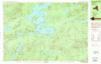
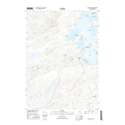
 1985 Raquette Lake1986 Print · USGSThe central Adirondacks are documented here in the mid-1980s, showcasing the complex lake systems and early rail routes that defined the region. Researchers can trace historic landmarks like Sagamore, isolated stops along the Adirondack RR, and the remote layout of Old Forge.2 unique versions available
 - 1989 Map of Raquette Lake
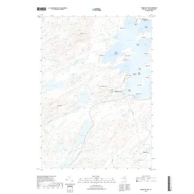
 1989 Raquette Lake1989 Print · USGSHamilton County's waterways are captured here in the late 1980s, showcasing the intricate shoreline of the Adirondack Park. Local historians can trace the footprints of Great Camps at Sagamore and Pine Knot Point or locate the Raquette Lake Reservoir.2 unique versions available
 - 1997 Map of Raquette Lake, 1999 Print
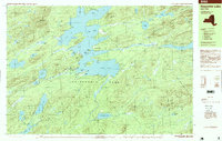 1997 Raquette Lake1999 Print · USGSThe central Adirondacks are mapped here in the late nineties, featuring the sprawling irregular coastline of Raquette Lake. Researchers can trace old routes along Browns Tract and locate historic points like Sagamore and Antlers Point.
 - 2010 Map of Raquette Lake, 2010 Print
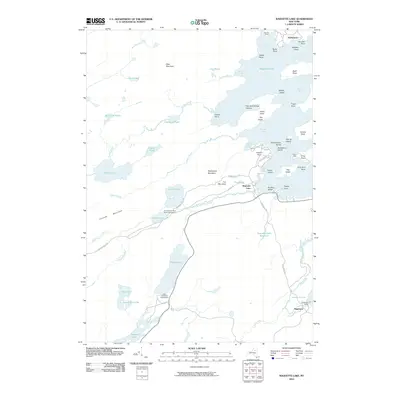 2010 Raquette Lake2010 Print · USGSCovers Hasbroucks, including Long Lake, Inlet, and other nearby areas
 - 2013 Map of Raquette Lake, 2013 Print
 2013 Raquette Lake2013 Print · USGSCovers Hasbroucks, including Long Lake, Inlet, and other nearby areas
 - 2016 Map of Raquette Lake, 2016 Print
 2016 Raquette Lake2016 Print · USGSCovers Hasbroucks, including Long Lake, Inlet, and other nearby areas
 - 2019 Map of Raquette Lake, 2019 Print
 2019 Raquette Lake2019 Print · USGSCovers Hasbroucks, including Long Lake, Inlet, and other nearby areas
 - 2023 Map of Raquette Lake, 2023 Print
 2023 Raquette Lake2023 Print · USGSRaquette Lake in the heart of the Adirondacks retains its character as a wilderness retreat shaped by water and rail. Trace the historic Sagamore area, the Raquette Lake Railroad Trl, and old portage routes like Brown's Tract Canoe Carry Trl.
End of results
Showing maps 1-15 of 15
Top cities near Hasbroucks
- Webb historical maps
- Colton historical maps
- Indian Lake historical maps
- Ohio historical maps
- Lake Pleasant historical maps
- Long Lake historical maps
See more
Frequently asked questions
- What are the different types of historical maps available for Hasbroucks?
- What is the oldest map of Hasbroucks?
- Where can I purchase historical maps of Hasbroucks for my home or office?
- Where can I download high-res historical maps of Hasbroucks?
- Are there historical topographic maps available for Hasbroucks?
- Is there historical aerial imagery available for Hasbroucks?
- Where are historical maps of Hasbroucks sourced from?