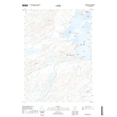
2019 Map of Raquette Lake
USGS Topo · Published 2019About this map
Raquette Lake serves as the focal point of this Adirondack region, defined by its complex shoreline of deep bays and prominent points. The small settlement of Raquette Lake and the nearby Sagamore estate area demonstrate the enduring character of this North Woods landscape. To the north, Hasbroucks sits near the entrance to North Bay, while a series of islands including Saint Hubert Island, Osprey Island, and Needle Island dot the open water. The terrain is marked by significant elevations such as West Mtn, The Crags, and Wadsworth Mtn, which frame the surrounding smaller water bodies like Cranberry Pond and Lone Pond. In the southern portion of the sheet, the connection between Eighth Lake and Seventh Lake via the Seventh Lake Inlet highlights the traditional transport corridors through this mountain terrain. Historic travel routes are further reflected in the naming of the Browns Tract Rd and Old Uncas Rd.
Find a feature on this map
70 named features on this map. Tap any name to fly to it.
Don’t see what you’re looking for? This feature index may not catch every label — zoom into the map to look around manually.
Map Details
Editions of this 2019 Raquette Lake Map
This is the sole edition of this map. No revisions or reprints were ever made.
Other maps of this area

1900 · Canada Lake
USGS Topo · 1:62,500

1901 · Old Forge
USGS Topo · 1:62,500

1903 · Big Moose
USGS Topo · 1:62,500

1903 · West Canada Lakes
USGS Topo · 1:62,500

1903 · Raquette Lake
USGS Topo · 1:62,500

1950 · Utica
USGS Topo · 1:250,000

1954 · Old Forge
USGS Topo · 1:62,500

1954 · West Canada Lakes
USGS Topo · 1:62,500
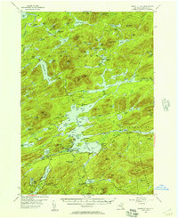
1954 · Raquette Lake
USGS Topo · 1:62,500

1954 · Big Moose
USGS Topo · 1:62,500