Old Maps of Jordanville, Warren for Genealogy
Trace your family roots with 13 historic maps of Jordanville. These high-res maps reveal old neighborhoods, homesites, landmarks, and streets — helping you uncover where your ancestors lived and how the area evolved over time.
- Explore historic neighborhoods: Identify where your relatives may have lived in the 1800s or 1900s.
- Compare maps over time: Trace the changes in streets, buildings, and landmarks for multi-generational research.
- Perfect for genealogy & ancestry research: Used by family historians and researchers to map out lineage and migration.
These maps are an incredible resource for exploring your personal connection to Jordanville's past.
Jordanville, Warren maps
(13)- 1903 Map of Richfield Springs
 1903 Richfield Springs1903 Print · USGSThe northern Otsego County landscape at the turn of the century shows a bustling rural economy centered around the headwaters of the Susquehanna. Researchers can trace the early Steamboat Route on Otsego Lake and explore rail-era depots like Richfield Springs and Cherry Valley.6 unique versions available
 - 1943 Map of Jordanville, 1954 Print
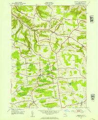 1943 Jordanville1954 Print · USGSHerkimer County's agricultural uplands and spiritual centers are frozen in time during the early 1940s. Genealogists can trace local roots through several family burial grounds like Heath Cem or locate the historic Holy Trinity Monastery near Jordanville.2 unique versions available
 - 1945 Map of Jordanville
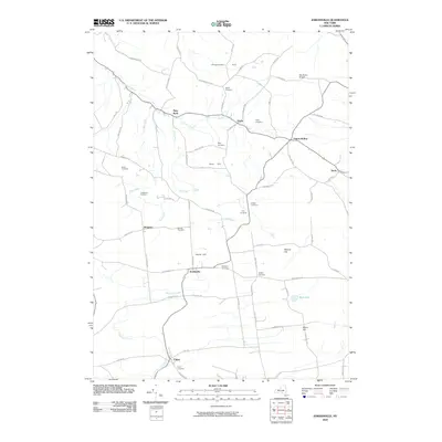
 1945 Jordanville1945 Print · USGSUpper New York state during the mid-forties reveals a landscape of upland farms and monastic tradition. Genealogists can trace family lines through numerous rural sites like Highland Cem, School No 6, and the landmark Holy Trinity Monastery.
 - 1948 Map of Binghamton, 1980 Print
 1948 Binghamton1980 Print · USGSCentral New York and the Southern Tier thrive in the late 1940s as a hub of rail traffic and mountain industry. Researchers can trace historic transit lines like the Erie Railroad through Binghamton or find old valley settlements near Oneonta and Delhi.
 - 1950 Map of Binghamton
 1950 Binghamton1950 Print · USGSBinghamton and the surrounding Southern Tier are shown in the mid-century era, highlighting the intricate rail and river networks that drove local industry. Researchers can trace the path of the Erie Railroad and locate landmarks from Otsego Lake to Sidney Mountain.2 unique versions available
 - 1958 Map of Binghamton
 1958 Binghamton1958 Print · USGSCentral New York in the late fifties was a network of manufacturing cities and river valleys connected by vital rail lines. Genealogists and historians can trace family roots in Oneonta, Norwich, and Cooperstown or locate long-standing farms along Schoharie Creek.
 - 1963 Map of Binghamton
 1963 Binghamton1963 Print · USGSThe Southern Tier and Catskill peaks are shown in the early sixties as new reservoirs reshaped the valleys. Trace historic rail corridors like the Erie Lackawanna RR and explore lakeside settlements such as Cooperstown and Oneonta.
 - 1985 Map of Amsterdam, 1986 Print
 1985 Amsterdam1986 Print · USGSUpstate New York in the mid-1980s reveals a landscape defined by historic river valleys and expanding interstate corridors. Researchers can trace family sites near Stone Arabia Cemetery or explore the civic centers of Amsterdam and Cooperstown near Otsego Lake.2 unique versions available
 - 2010 Map of Jordanville, 2010 Print
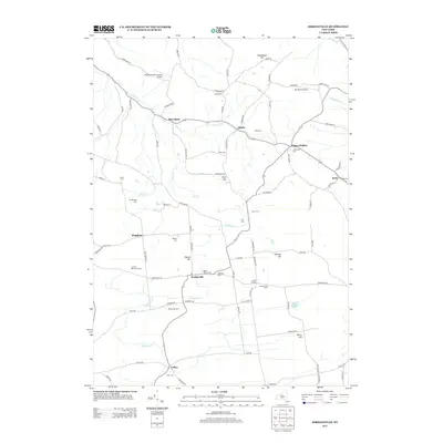
 2010 Jordanville2010 Print · USGSCovers Jordanville, including German Flatts, Columbia, and other nearby areas
 - 2013 Map of Jordanville, 2013 Print
 2013 Jordanville2013 Print · USGSCovers Jordanville, including German Flatts, Columbia, and other nearby areas
 - 2016 Map of Jordanville, 2016 Print
 2016 Jordanville2016 Print · USGSCovers Jordanville, including German Flatts, Columbia, and other nearby areas
 - 2019 Map of Jordanville, 2019 Print
 2019 Jordanville2019 Print · USGSCovers Jordanville, including German Flatts, Columbia, and other nearby areas
 - 2023 Map of Jordanville, 2023 Print
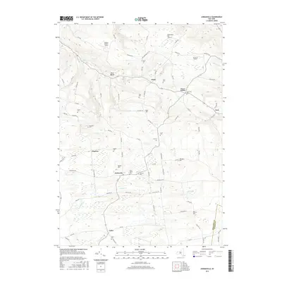
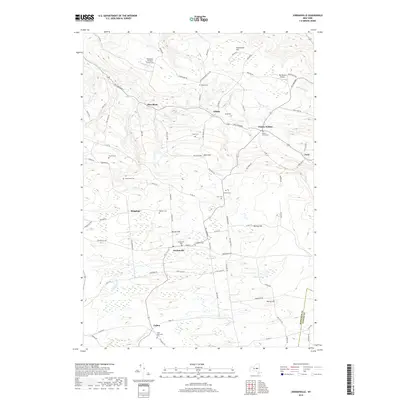
 2023 Jordanville2023 Print · USGSThe quiet crossroads of Jordanville and Paines Hollow are shown here in recent years, surrounded by a dense network of country cemeteries and high points like Harter Hill. Genealogists can trace family burial sites at Piper Cem, Helmer Cem, and the Crain Memorial Cem.
End of results
Showing maps 1-13 of 13
Top cities near Jordanville
- Utica historical maps
- German Flatts historical maps
- Herkimer historical maps
- Ilion historical maps
- Herkimer historical maps
- Frankfort historical maps
See more
Frequently asked questions
- What are the different types of historical maps available for Jordanville?
- What is the oldest map of Jordanville?
- Where can I purchase historical maps of Jordanville for my home or office?
- Where can I download high-res historical maps of Jordanville?
- Are there historical topographic maps available for Jordanville?
- Is there historical aerial imagery available for Jordanville?
- Where are historical maps of Jordanville sourced from?