Old Maps of Depauville, Clayton for Academic Research
Study the evolution of Depauville with 34 high-resolution historic maps. Whether you're teaching, researching, or modeling changes in land use, these maps provide essential visual documentation of urban, environmental, and geographic change.
- Analyze long-term change: Track patterns in development, transportation, and natural features.
- Ideal for environmental or urban studies: Support academic projects with primary historical map data.
- Use in the classroom or lab: Educators and researchers rely on these maps to bring historical context to life.
These maps are a powerful tool for teaching, research, and visualizing how Depauville has changed over the decades.
Depauville, Clayton maps
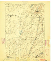
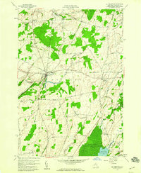
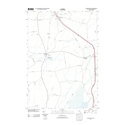
(34)- 1900 Map of Clayton, 1957 Print
 1900 Clayton1957 Print · USGSThe Thousand Islands region and the St. Lawrence riverfront are captured here at the turn of the century, showing a landscape defined by steam and rail. Genealogists can trace family roots in CLAYTON, Chaumont, and Depauville, or follow the path of the Electric R.R. near Dexter.
 - 1903 Map of Clayton
 1903 Clayton1903 Print · USGSJefferson County's Thousand Islands region and Lake Ontario shoreline are documented here just after the turn of the century. Genealogists and historians can trace the rail lines connecting Clayton and Chaumont, or locate old post offices in Depauville and Rosiere.6 unique versions available
 - 1903 Map of Theresa
 1903 Theresa1903 Print · USGSJefferson County at the turn of the century was a bustling network of dairy farms and rail junctions. You can trace the path of the Rome Watertown and Ogdensburg Div. through Evans Mills or locate early settlements like Stone Mills and Leraysville.8 unique versions available
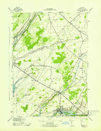
 - 1942 Map of Clayton, 1957 Print
 1942 Clayton1957 Print · USGSThe Thousand Islands region appears at a mid-century peak in this survey of the riverfront and agricultural interior. Local historians can trace the foundations of the community through its many numbered rural schools and family burial sites like Corbin Cem and Dutch Cem.
 - 1943 Map of Dexter
 1943 Dexter1943 Print · USGSJefferson County life in the early 1940s is centered on the riverfront industry and rail connections of the lake plain. Genealogists can locate family burial grounds like Freeman Cem and identify numerous rural schoolhouses including School No 16 and School No 8.
 - 1943 Map of Clayton
 1943 Clayton1943 Print · USGSThe Thousand Islands region and the St. Lawrence riverfront are captured here in the early 1940s. Genealogists and local historians can trace the rural school system and family burial grounds, including School No 2, Dutch Cem, and the village of Depauville.
 - 1943 Map of Lafargeville
 1943 Lafargeville1943 Print · USGSJefferson County was still a landscape of scattered rural schools and rail-fed hamlets during the early years of World War II. Researchers can trace ancestral locations through several family-named burial grounds like Hinman Cem and the rail corridors of the New York Central.
 - 1948 Map of Theresa, 1953 Print
 1948 Theresa1953 Print · USGSJefferson County's rural landscape is captured here in the late 1940s as military expansion and river-based industry shaped the region. Researchers can trace family roots through numerous sites like St Marys Cemetery, Bacon School, and the Pine Camp Military Reservation.
 - 1948 Map of Ogdensburg, 1973 Print
 1948 Ogdensburg1973 Print · USGSThe international border along the St Lawrence River comes to life in the late 1940s, showing the vital rail and water connections between New York and Ontario. Researchers can trace the grounds of St Lawrence University, the massive Camp Drum military reservation, and the historic Rideau River and Canal.2 unique versions available
 - 1951 Map of Ogdensburg
 1951 Ogdensburg1951 Print · USGSThe St. Lawrence frontier and the North Country are captured here during the post-war era, from the river ports to the high Adirondacks. Genealogists and historians can trace the rail-and-river economy through Ogdensburg, the Rutland rail lines, and Potsdam.
 - 1953 Map of Ogdensburg
 1953 Ogdensburg1953 Print · USGSThe North Country and St. Lawrence Valley are shown here in the early fifties, just as the region’s rail-and-river economy remained in full swing. Genealogists and historians can trace family-named corners and rural hubs along the Rutland railroad or locate heritage sites near Ogdensburg, Potsdam, and the St Regis Indian Reservation.
 - 1954 Map of Kingston
 1954 Kingston1954 Print · USGSThe international border at the head of the St. Lawrence comes alive in the mid-fifties, showing the interconnected rail and river systems of Ontario and New York. Trace historical routes like the Canadian National RR or find local landmarks such as Thousand Island Park and Tyendinaga Ind. Res.4 unique versions available
 - 1958 Map of Clayton, 1960 Print
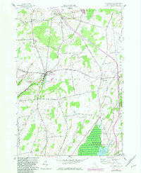
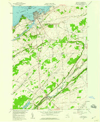 1958 Clayton1960 Print · USGSJefferson County’s riverfront and agricultural interior are captured here in the late fifties, showcasing the transition from the St Lawrence River docks to rural townships. Genealogists and local historians can trace the New York Central Railroad line or locate the Weaver Cem and Corbin Cem.2 unique versions available
 - 1958 Map of Dexter, 1960 Print
 1958 Dexter1960 Print · USGSThe Lake Ontario shoreline near the mouth of the Black River is captured here in the late fifties. Genealogists and local historians can trace the Old Railroad Grade and locate ancestral sites like Freeman Cem and the General Brown High Sch.3 unique versions available
 - 1958 Map of La Fargeville, 1960 Print
 1958 La Fargeville1960 Print · USGSJefferson County farming and rail life are preserved here in the late fifties, centered on the crossroads of La Fargeville. Researchers can trace ancestral locations through numerous burial sites like St Johns Cem or follow the path of the New York Central railroad.
 - 1961 Map of Ogdensburg
 1961 Ogdensburg1961 Print · USGSThe St. Lawrence valley and the Adirondack high country meet in this early sixties survey during a peak era for rail and river commerce. Genealogists and historians can trace the paths of the New York Central railroad through remote settlements like Wanakena, Conifer, and Piercefield.
 - 1982 Map of La Fargeville, 1983 Print
 1982 La Fargeville1983 Print · USGSJefferson County agricultural life and conservation lands are captured here in the early eighties. Genealogists and local historians can trace family burial plots at Beech Ridge Cem or locate former rail routes like the Old Railroad Grade.
 - 1985 Map of Gouverneur
 1985 Gouverneur1985 Print · USGSSt. Lawrence and Jefferson Counties are shown in the mid-eighties as a landscape of river-driven industry and expanding military grounds. Genealogists and historians can trace rail lines through Carthage, find local landmarks like Noble Hospital, and locate the boundaries of the Fort Drum Military Reservation.2 unique versions available
 - 1985 Map of Cape Vincent
 1985 Cape Vincent1985 Print · USGSThe Thousand Islands and the Jefferson County shoreline are documented in the mid-1980s as the river meets the lake. Genealogists and local historians can trace an Old Railroad Grade and explore settlements like Cape Vincent, Clayton, and Rosiere.2 unique versions available
 - 2010 Map of Clayton, 2010 Print
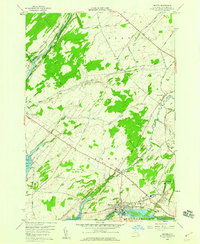
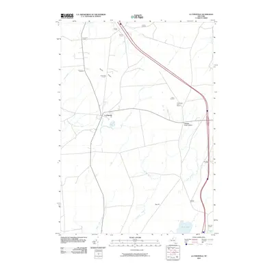
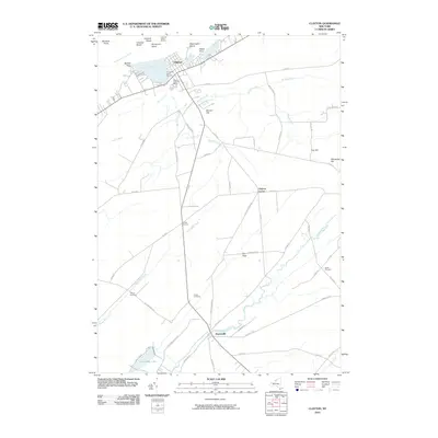 2010 Clayton2010 Print · USGSCovers Depauville, including Clayton, Orleans, and other nearby areas
 - 2010 Map of La Fargeville, 2010 Print
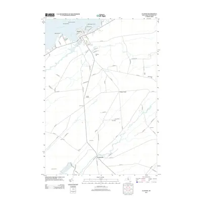
 2010 La Fargeville2010 Print · USGSCovers Depauville, including Le Ray, Clayton, and other nearby areas
 - 2010 Map of Dexter, 2010 Print
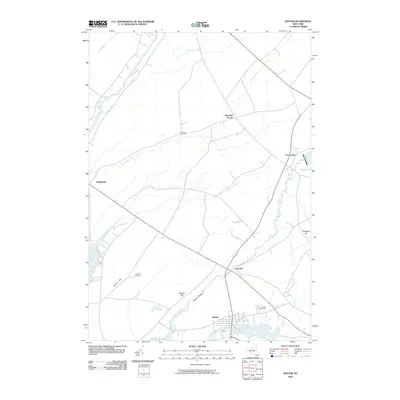 2010 Dexter2010 Print · USGSCovers Depauville, including Brownville, Clayton, and other nearby areas
 - 2013 Map of Clayton, 2013 Print
 2013 Clayton2013 Print · USGSCovers Depauville, including Clayton, Orleans, and other nearby areas
 - 2013 Map of Dexter, 2013 Print
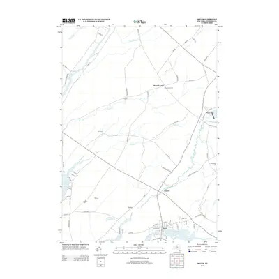 2013 Dexter2013 Print · USGSCovers Depauville, including Brownville, Clayton, and other nearby areas
 - 2013 Map of La Fargeville, 2013 Print
 2013 La Fargeville2013 Print · USGSCovers Depauville, including Le Ray, Clayton, and other nearby areas
Showing maps 1-25 of 34
Top cities near Depauville
- Le Ray historical maps
- Watertown historical maps
- Watertown historical maps
- Brownville historical maps
- Clayton historical maps
- Alexandria historical maps
See more
Frequently asked questions
- What are the different types of historical maps available for Depauville?
- What is the oldest map of Depauville?
- Where can I purchase historical maps of Depauville for my home or office?
- Where can I download high-res historical maps of Depauville?
- Are there historical topographic maps available for Depauville?
- Is there historical aerial imagery available for Depauville?
- Where are historical maps of Depauville sourced from?