Old Maps of Clark Point, Henderson for Academic Research
Study the evolution of Clark Point with 12 high-resolution historic maps. Whether you're teaching, researching, or modeling changes in land use, these maps provide essential visual documentation of urban, environmental, and geographic change.
- Analyze long-term change: Track patterns in development, transportation, and natural features.
- Ideal for environmental or urban studies: Support academic projects with primary historical map data.
- Use in the classroom or lab: Educators and researchers rely on these maps to bring historical context to life.
These maps are a powerful tool for teaching, research, and visualizing how Clark Point has changed over the decades.
Clark Point, Henderson maps
(12)- 1895 Map of Stony Island
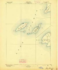 1895 Stony Island1895 Print · USGSLake Ontario's eastern islands and Jefferson County shoreline are documented in the 1890s as critical navigation points. Maritimers and local historians can trace the positions of the Galloup Id. L.H. and Stony Point L.H. among islands like Stony Island.6 unique versions available
 - 1942 Map of Stony Point
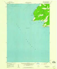
 1942 Stony Point1942 Print · USGSThe Jefferson County shoreline of Lake Ontario is captured here during the early years of World War II. Researchers can locate the Stony Point Light House and the extensive Stony Point Rifle Range along the coast of Henderson.
 - 1958 Map of Stony Point, 1960 Print
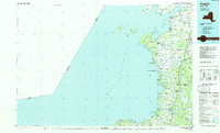
 1958 Stony Point1960 Print · USGSThe Jefferson County shoreline comes into focus in the late 1950s, highlighting the strategic maritime position of this peninsula. Researchers can trace the rural landscape around the Lighthouse and explore the distinct coastal inlets of Gravely Bay and Ray Bay.2 unique versions available
 - 1960 Map of Rochester
 1960 Rochester1960 Print · USGSThe Lake Ontario shoreline in the late fifties was a bustling corridor of rail and water commerce. Genealogists and historians can trace the path of the New York Central through canal towns like Newark or explore the coastal landmarks around Sackets Harbor.2 unique versions available
 - 1961 Map of Rochester, 1973 Print
 1961 Rochester1973 Print · USGSThe Lake Ontario shoreline and Finger Lakes frontier are shown here at the height of the mid-century infrastructure boom. Genealogists and historians can trace the rail-and-road evolution from Sackets Harbor down to the New York State Thruway, passing through centers like Pulaski and Adams Center.3 unique versions available
 - 1965 Map of Rochester
 1965 Rochester1965 Print · USGSUpstate New York's industrial heartland is captured here during a period of significant growth between the Great Lakes and the Finger Lakes. Genealogists and historians can trace the evolution of canal towns and rail hubs from Rochester to Syracuse, noting features like the Erie Canal and the New York State Thruway.
 - 1985 Map of Pulaski
 1985 Pulaski1985 Print · USGSThe eastern shores of Lake Ontario in the mid-1980s showcase a landscape of protected wetlands and historic harbor towns. Trace the paths of the CONRAIL railroad and explore the coastal heritage of Sackets Harbor, Port Ontario, and Selkirk Shores State Park.2 unique versions available
 - 2011 Map of Stony Point, 2011 Print
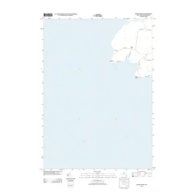
 2011 Stony Point2011 Print · USGSCovers Clark Point, including Ellisburg, Hounsfield, and other nearby areas
 - 2013 Map of Stony Point, 2013 Print
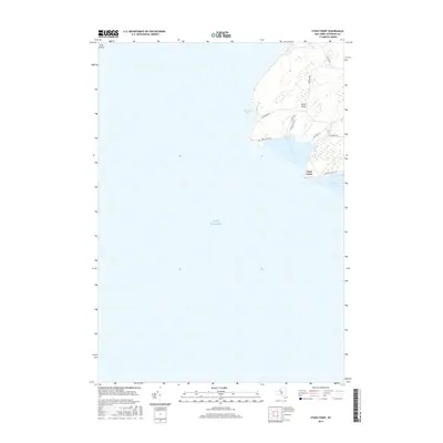
 2013 Stony Point2013 Print · USGSCovers Clark Point, including Ellisburg, Hounsfield, and other nearby areas
 - 2016 Map of Stony Point, 2016 Print
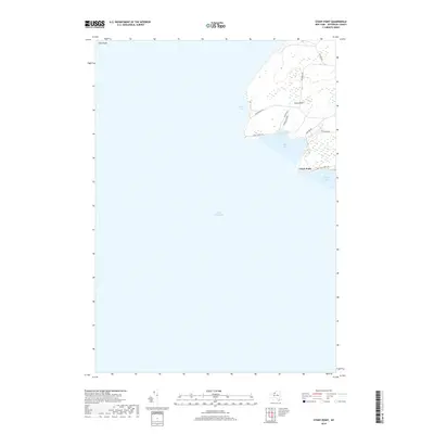
 2016 Stony Point2016 Print · USGSCovers Clark Point, including Ellisburg, Hounsfield, and other nearby areas
 - 2019 Map of Stony Point, 2019 Print
 2019 Stony Point2019 Print · USGSCovers Clark Point, including Ellisburg, Hounsfield, and other nearby areas
 - 2023 Map of Stony Point, 2023 Print
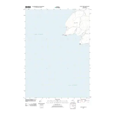
 2023 Stony Point2023 Print · USGSThe Jefferson County coast at Lake Ontario is showcased here in the early twenty-first century. Researchers can trace lakeside properties and coastal access points along Lighthouse Rd and Whale Walk Trl near Stony Point.
End of results
Showing maps 1-12 of 12
Top cities near Clark Point
- Brownville historical maps
- Richland historical maps
- Adams historical maps
- Sandy Creek historical maps
- Ellisburg historical maps
- Hounsfield historical maps
See more
Frequently asked questions
- What are the different types of historical maps available for Clark Point?
- What is the oldest map of Clark Point?
- Where can I purchase historical maps of Clark Point for my home or office?
- Where can I download high-res historical maps of Clark Point?
- Are there historical topographic maps available for Clark Point?
- Is there historical aerial imagery available for Clark Point?
- Where are historical maps of Clark Point sourced from?