Old Maps of Lorraine, New York for Hiking & Exploration
Hike through history with 48 historic maps of Lorraine. Explore old trails, ghost towns, and forgotten backroads — perfect for outdoor adventurers and local explorers.
- Rediscover forgotten places: Map out old mining camps, roads, and footpaths that no longer exist on modern maps.
- Layer with modern tools: Combine with LiDAR or satellite views to plan hikes through historical terrain.
- Made for exploration: Popular among hikers, overlanders, and local history lovers.
Use these maps to find adventure and explore the hidden past of Lorraine.
Lorraine, NY maps
(48)- 1893 Map of Sackets Harbor, 1963 Print
 1893 Sackets Harbor1963 Print · USGSJefferson County’s shoreline at the close of the 19th century reveals a landscape of vital military outposts and thriving rail-side villages. Genealogists can trace family roots through Greens Settlement and Thomas Settlement or locate ancestors at Madison Barracks and Adams Center.
 - 1895 Map of Sacketts Harbor
 1895 Sacketts Harbor1895 Print · USGSJefferson County’s lakefront and military outposts are frozen in time during the late nineteenth century. Genealogists and historians can trace family land near Greens Settlement, locate the old Madison Barracks, or follow the Ogdensburg and Watertown R. R. through the hills.8 unique versions available
 - 1895 Map of Pulaski
 1895 Pulaski1895 Print · USGSCoastal Oswego and Jefferson Counties are captured here in the late 1800s, where the Salmon River meets the lake. Genealogists can trace family roots through settlements like Richland, Pulaski, and the lakeside Life Saving Station.8 unique versions available
 - 1895 Map of Watertown
 1895 Watertown1895 Print · USGSJefferson County in the 1890s centered on the industrial energy of the Black River and a complex web of iron rails. Genealogists and local researchers can trace historic crossroads such as Fields Settlement, Whitford Corner, and Burrs Mills.
 - 1898 Map of Watertown
 1898 Watertown1898 Print · USGSJefferson County at the close of the nineteenth century centers on the growing hub of Watertown and its intricate rail network. Researchers can trace the nineteenth-century landscape of rural hamlets, mills, and family landmarks like Burrs Mills, Honeyville, and Fields Settlement.2 unique versions available
 - 1903 Map of Orwell, 1955 Print
 1903 Orwell1955 Print · USGSOswego and Jefferson counties are documented here at the opening of the twentieth century, showing a landscape defined by the Tug Hill drainages. Genealogists and historians can trace the early footprints of Littlejohn Settlement, Otto Mills, and the falls at Stillwater.
 - 1905 Map of Orwell
 1905 Orwell1905 Print · USGSUpper Oswego and Jefferson counties are shown here in the early nineteen-hundreds as a landscape of remote settlements and river-powered valleys. Genealogists and historians can trace the exact locations of Little John Settlement, the Salmon Falls cataracts, and Bennett Bridge.6 unique versions available
 - 1908 Map of Watertown, 1955 Print
 1908 Watertown1955 Print · USGSWatertown and the rural uplands of the Tug Hill region are captured here in the early twentieth century as the railroad era peaked. Genealogists can trace early post offices like Klondike and Whitesville, or locate family sites near Brookside Cemetery.
 - 1909 Map of Watertown
 1909 Watertown1909 Print · USGSJefferson County was at its industrial and agrarian height in the early twentieth century, centered on the vital rail hub of Watertown. Local historians can trace family roots through the Middle Road Church or locate vanished post offices like Klondike Worth and Tylerville South Rutland.6 unique versions available
 - 1942 Map of Sandy Creek, 1957 Print
 1942 Sandy Creek1957 Print · USGSJefferson and Oswego Counties are shown during the early 1940s, when the New York Central rail line linked thriving rural hamlets. Family historians can locate several numbered schoolhouses and burial sites like Brewster Cem and Wesleyan Cem.
 - 1943 Map of Boylston
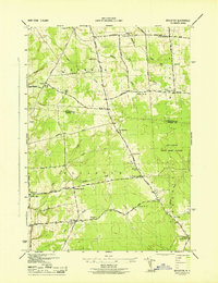 1943 Boylston1943 Print · USGSUpper Oswego County is captured here in the 1940s, showing the rural communities of the Tug Hill plateau before mid-century changes. Researchers can locate numerous one-room schoolhouses, the Littlejohn State Game Refuge, and hamlets like Smartville and Winona.
 - 1943 Map of Adams
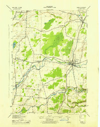 1943 Adams1943 Print · USGSJefferson County's rural heartland is documented here during the early 1940s, showing a landscape defined by small settlements and the Central New York rail line. Researchers can trace ancestral locations at Taylor Settlement, School No 5, and Elmwood Cem.
 - 1943 Map of Rodman
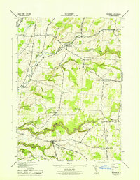 1943 Rodman1943 Print · USGSJefferson County during the Second World War remains a landscape of traditional crossroads and tight-knit rural districts. Genealogists can trace family heritage through numerous burial grounds like Honeyville Cem and Lyman Cem or locate defunct school districts from Tremaines Corners to Gould Corners.
 - 1943 Map of Sandy Creek
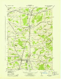 1943 Sandy Creek1943 Print · USGSJefferson and Oswego Counties are captured here during the mid-1940s, showing the vital New York Central Railroad link between thriving villages. Trace family history at Brewster Cem or locate long-standing rural schoolhouses like School No 10.
 - 1950 Map of Utica, 1951 Print
 1950 Utica1951 Print · USGSCentral New York in the post-war era showcases the industrial Mohawk Valley and the pristine Adirondack interior. Researchers can trace transportation networks like the New York Central Railroad and find early Cold War sites such as Griffiss Air Force Base.
 - 1957 Map of Utica
 1957 Utica1957 Print · USGSCentral New York and the Adirondack foothills are captured here in the mid-fifties, showing a landscape defined by the Mohawk River corridor and the growing highway system. Genealogists and researchers can trace the rail lines of the New York Central and locate communities from Lowville to Gloversville.
 - 1958 Map of Sandy Creek, 1960 Print
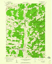 1958 Sandy Creek1960 Print · USGSNorthern New York's agricultural and rail-dependent landscape comes alive in the late fifties as the New York Central Railroad links rural hubs. Researchers can trace ancestral locations from Pierrepont Manor to the Wesleyan Cem or locate the old Fairground near Sandy Creek.4 unique versions available
 - 1959 Map of Rodman, 1961 Print
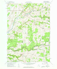 1959 Rodman1961 Print · USGSJefferson County's rural uplands are shown in the late fifties, a time when small hamlets still centered around the deep ravines of the Tug Hill region. Trace family roots and local geography through settlements like Rodman, the Honeyville Cem, and crossroads at Whitford Corners.3 unique versions available
 - 1959 Map of Boylston Center, 1961 Print
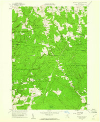 1959 Boylston Center1961 Print · USGSNorth-central New York's Tug Hill plateau transitions into managed forests and quiet hamlets during the late fifties. Genealogists and historians can trace old homesteads and landmarks like Boylston Center, St Josephs Ch, and the rural Phelps Cem.3 unique versions available
 - 1959 Map of Adams, 1961 Print
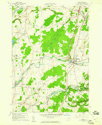 1959 Adams1961 Print · USGSJefferson County was transitioning into the modern highway era in the late fifties as the EMPIRE STATEWAY began to cut through traditional farm country. Genealogists can trace family roots through numerous locations like Wardwell Settlement, St Cecelias Ch, and Giddingsville Cem.3 unique versions available
 - 1960 Map of Rochester
 1960 Rochester1960 Print · USGSThe Lake Ontario shoreline in the late fifties was a bustling corridor of rail and water commerce. Genealogists and historians can trace the path of the New York Central through canal towns like Newark or explore the coastal landmarks around Sackets Harbor.2 unique versions available
 - 1961 Map of Rochester, 1973 Print
 1961 Rochester1973 Print · USGSThe Lake Ontario shoreline and Finger Lakes frontier are shown here at the height of the mid-century infrastructure boom. Genealogists and historians can trace the rail-and-road evolution from Sackets Harbor down to the New York State Thruway, passing through centers like Pulaski and Adams Center.3 unique versions available
 - 1962 Map of Utica
 1962 Utica1962 Print · USGSCentral New York and the Adirondack wilderness are captured here during the mid-century era of highway and industrial expansion. Genealogists and historians can trace the development of the New York State Thruway and local rail lines connecting Utica, Rome, and Gloversville.3 unique versions available
 - 1964 Map of Utica
 1964 Utica1964 Print · USGSCentral New York and the high wilderness of the Adirondacks are captured here during the post-war era of infrastructure expansion. Researchers can trace the development of the New York State Thruway alongside historic corridors like the Oneida Lake (Barge Canal Route) and the N. Y. Central railroad.
 - 1965 Map of Rochester
 1965 Rochester1965 Print · USGSUpstate New York's industrial heartland is captured here during a period of significant growth between the Great Lakes and the Finger Lakes. Genealogists and historians can trace the evolution of canal towns and rail hubs from Rochester to Syracuse, noting features like the Erie Canal and the New York State Thruway.
Showing maps 1-25 of 48
Top cities near Lorraine
- Watertown historical maps
- Watertown historical maps
- Brownville historical maps
- Richland historical maps
- Adams historical maps
- Champion historical maps
See more
Top neighborhoods of Lorraine
Frequently asked questions
- What are the different types of historical maps available for Lorraine?
- What is the oldest map of Lorraine?
- Where can I purchase historical maps of Lorraine for my home or office?
- Where can I download high-res historical maps of Lorraine?
- Are there historical topographic maps available for Lorraine?
- Is there historical aerial imagery available for Lorraine?
- Where are historical maps of Lorraine sourced from?