1940s Maps of Pinckney, New York
Explore 6 historic maps of Pinckney from the 1940s. These maps offer a rare glimpse into what life looked like during the 1940s — showing old roads, neighborhoods, homes, and landmarks that have changed or disappeared over time.
Whether you're researching your family's past, planning a metal detecting trip, or studying how Pinckney's landscape evolved across the 1940s, these high-resolution maps are a powerful tool for exploring the history of this region.
- Focus on a specific era: All maps on this page are from the 1940s, giving you a focused view of this time period.
- See what’s changed: Compare century-old streets, trails, and buildings to today's modern landscape using overlays and satellite layers.
- Research with precision: Use these maps for genealogy, historical research, land use analysis, or educational projects.
- View, download, or print: Maps are fully viewable online in high resolution, and can be downloaded or printed for your own records.
Start exploring Pinckney's history through authentic maps from the 1940s. This is your window into the past.
Pinckney, NY maps
(6)- 1942 Map of Copenhagen, 1960 Print
 1942 Copenhagen1960 Print · USGSUpper New York state is mapped here during the early war years, showing a landscape of small river towns and upland dairy farms. Genealogists can trace family names at Hillside Cem and locate numerous one-room schoolhouses like School No 10.2 unique versions available
 - 1943 Map of Barnes Corners
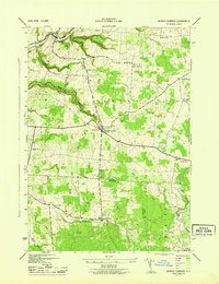 1943 Barnes Corners1943 Print · USGSThe Tug Hill plateau comes alive in the mid-1940s, showcasing a landscape defined by deep ravines and small upland hamlets. Genealogists can trace family roots through numerous schoolhouses and distinct crossroads like 7x9 Corners, Barnes Corners, and Cronk Corners.2 unique versions available
 - 1943 Map of Copenhagen
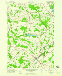
 1943 Copenhagen1943 Print · USGSThe rural uplands of Lewis and Jefferson Counties come into focus during the early 1940s as agricultural life centered around the Deer River. Researchers can locate numerous numbered schoolhouses, the village of Copenhagen, and local landmarks like Pleasant Lake and High Falls.
 - 1943 Map of New Boston
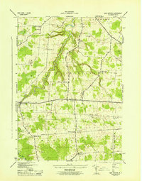 1943 New Boston1943 Print · USGSLewis County rural life is captured here in the early 1940s, showing a landscape of family-named corners and small crossroads settlements. You can trace family history at Battle Cem, locate the former sites of numerous rural schools, or follow old routes like LACY ROAD.4 unique versions available
 - 1943 Map of South Rutland, 1954 Print
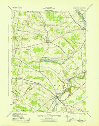
 1943 South Rutland1954 Print · USGSJefferson County farming communities and the Black River valley are captured here in the 1940s. Genealogists can trace family footprints at Middle Road Ch, Maple Hill Cem, and numerous schoolhouses from Burrs Mills to South Rutland.2 unique versions available
 - 1949 Map of Barnes Corners
 1949 Barnes Corners1949 Print · USGSThe Tug Hill plateau at the end of the 1940s reveals a landscape of deep glacial ravines and dispersed rural school districts. Researchers can trace the locations of eleven historic schoolhouses and old crossroads like Barnes Corners, 7x9 Corners, and Newton Cem.
End of results
Showing maps 1-6 of 6
Top cities near Pinckney
- Le Ray historical maps
- Watertown historical maps
- Watertown historical maps
- Brownville historical maps
- Wilna historical maps
- Adams historical maps
See more
Top neighborhoods of Pinckney
Frequently asked questions
- What are the different types of historical maps available for Pinckney?
- What is the oldest map of Pinckney?
- Where can I purchase historical maps of Pinckney for my home or office?
- Where can I download high-res historical maps of Pinckney?
- Are there historical topographic maps available for Pinckney?
- Is there historical aerial imagery available for Pinckney?
- Where are historical maps of Pinckney sourced from?