1940s Maps of West Turin, New York
Explore 10 historic maps of West Turin from the 1940s. These maps offer a rare glimpse into what life looked like during the 1940s — showing old roads, neighborhoods, homes, and landmarks that have changed or disappeared over time.
Whether you're researching your family's past, planning a metal detecting trip, or studying how West Turin's landscape evolved across the 1940s, these high-resolution maps are a powerful tool for exploring the history of this region.
- Focus on a specific era: All maps on this page are from the 1940s, giving you a focused view of this time period.
- See what’s changed: Compare century-old streets, trails, and buildings to today's modern landscape using overlays and satellite layers.
- Research with precision: Use these maps for genealogy, historical research, land use analysis, or educational projects.
- View, download, or print: Maps are fully viewable online in high resolution, and can be downloaded or printed for your own records.
Start exploring West Turin's history through authentic maps from the 1940s. This is your window into the past.
West Turin, NY maps
(10)- 1940 Map of Port Leyden
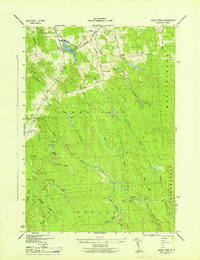
 1940 Port Leyden1940 Print · USGSUpper Lewis County at the start of the 1940s reveals a landscape shaped by the BLACK RIVER and the rail industry. Researchers can trace historic homesteads near Constableville, industrial sites at Goulds Mill, and the riverside Leyden Station PO.
 - 1943 Map of Sears Pond
 1943 Sears Pond1943 Print · USGSLewis County's Tug Hill plateau during the early war years reveals a landscape of isolated rural schools and winding creek networks. Genealogists and historians can trace the foundations of the Hooker settlement and locate vanished schoolhouses like School No 7 and School No 9.5 unique versions available
 - 1943 Map of North Osceola, 1953 Print
 1943 North Osceola1953 Print · USGSThe Tug Hill region in the early 1940s reveals a quiet landscape of winding river forks and rural settlements. Genealogists and researchers can trace the locations of School No 7 and School No 2, or explore the rail-related origins of New Campbellwood Wye.3 unique versions available
 - 1943 Map of High Market, 1960 Print
 1943 High Market1960 Print · USGSLewis County was a landscape of remote timber settlements and isolated schoolhouses during the early 1940s. Genealogists and local historians can trace the rural layout of Michigan Mills, locate Byron Corners, and find the sites of School No 6 and School No 9.3 unique versions available
 - 1943 Map of Page, 1960 Print
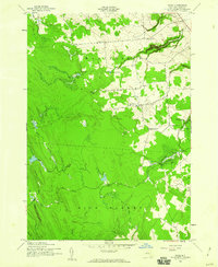 1943 Page1960 Print · USGSLewis County during the early 1940s shows a landscape of district schools and upland farms near the Tug Hill plateau. Genealogists can locate small settlements like Wetmore and Page or trace the steep terrain around Whetstone Gulf State Park.2 unique versions available
 - 1944 Map of Page
 1944 Page1944 Print · USGSLewis County uplands in the mid-1940s show a landscape of small agricultural hamlets and numbered schoolhouses. Genealogists can trace family footprints around McGraw Corners, Maple Ridge Church, and School No 17.
 - 1944 Map of North Osceola
 1944 North Osceola1944 Print · USGSThe town of Osceola during the mid-1940s remains a landscape of remote mountain schools and timber-era settlements. Genealogists can trace family footprints near Stone Pond or locate historic sites like School No 3 and Old Campbellwood.
 - 1944 Map of Highmarket
 1944 Highmarket1944 Print · USGSIn the mid-1940s, the Lewis County uplands supported a network of small settlements and numbered school districts amidst the Tug Hill waterways. Genealogists and local historians can trace family-named routes like Mackey Road and find long-lost sites like School No 5 or the cluster at Michigan Mills.
 - 1946 Map of West Leyden
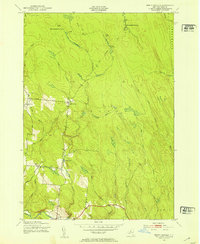
 1946 West Leyden1946 Print · USGSThe rural borderlands of Oneida and Lewis counties come into focus just after the war. Local historians can trace a lost network of rural education and community life through Alger Sch, West Leyden Cem, and the small settlement at Flint Town.
 - 1947 Map of West Leyden
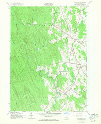
 1947 West Leyden1947 Print · USGSThe rural borders of Lewis and Oneida counties come alive in the mid-1940s, centered on the village of West Leyden and the East Branch Mohawk River. Genealogists can trace family connections at Thornton Cem and explore vanished district schools like Evans Sch or Bates Sch.2 unique versions available
End of results
Showing maps 1-10 of 10
Top cities near West Turin
- Lee historical maps
- Lowville historical maps
- Camden historical maps
- Boonville historical maps
- Lowville historical maps
- New Bremen historical maps
See more
Top neighborhoods of West Turin
- Page historical maps
- Collinsville historical maps
- Mohawk Hill historical maps
- Michigan Mills historical maps
- Constableville historical maps
Frequently asked questions
- What are the different types of historical maps available for West Turin?
- What is the oldest map of West Turin?
- Where can I purchase historical maps of West Turin for my home or office?
- Where can I download high-res historical maps of West Turin?
- Are there historical topographic maps available for West Turin?
- Is there historical aerial imagery available for West Turin?
- Where are historical maps of West Turin sourced from?