Old Maps of Hamilton, New York for Genealogy
Trace your family roots with 41 historic maps of Hamilton. These high-res maps reveal old neighborhoods, homesites, landmarks, and streets — helping you uncover where your ancestors lived and how the area evolved over time.
- Explore historic neighborhoods: Identify where your relatives may have lived in the 1800s or 1900s.
- Compare maps over time: Trace the changes in streets, buildings, and landmarks for multi-generational research.
- Perfect for genealogy & ancestry research: Used by family historians and researchers to map out lineage and migration.
These maps are an incredible resource for exploring your personal connection to Hamilton's past.
Hamilton, NY maps
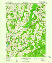
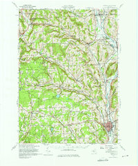
(41)- 1902 Map of Morrisville
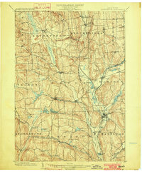 1902 Morrisville1902 Print · USGSMadison County at the turn of the century was a complex network of upland valleys shaped by the Chenango Canal and three major railroads. Genealogists and historians can trace old homesteads and local infrastructure near Morrisville, Hamilton, and the New York Ontario and Western RR.8 unique versions available
 - 1903 Map of Norwich
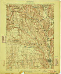 1903 Norwich1903 Print · USGSChenango County at the dawn of the twentieth century was defined by the busy river valleys and rail lines connecting Norwich to Earlville. Researchers can trace the path of the N. Y. O. & W. R. R. through Sherburne Four Corners or locate family-named sites like Irelands Mills and Woods Corners.5 unique versions available
 - 1907 Map of Sangerfield
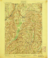 1907 Sangerfield1907 Print · USGSOneida and Madison counties meet at the height of the central New York hills in the early twentieth century. Genealogists and local historians can trace the positions of the Budlong Schoolhouse, the industrial activity at Mains Mills, and the path of the Cherry Valley Turnpike.6 unique versions available
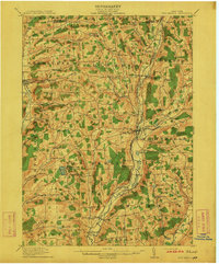
 - 1910 Map of New Berlin, 1963 Print
 1910 New Berlin1963 Print · USGSThe Unadilla and Chenango river valleys are seen here in the early twentieth century as established rail corridors and farming hubs. Researchers can trace the N Y O & W R R line through Holmesville or locate family sites like Kings Settlement and the Dimmick Hollow School.
 - 1912 Map of New Berlin
 1912 New Berlin1912 Print · USGSChenango County's river valleys and dairy uplands are meticulously captured in this pre-war survey of the New Berlin area. Genealogists can locate family-named landmarks and institutions like Columbus Hill Church, Kings Settlement, and the Dimmick Hollow School.4 unique versions available
 - 1943 Map of Hubbardsville, 1960 Print
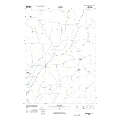
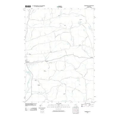
 1943 Hubbardsville1960 Print · USGSMadison County's rural landscape is captured here during the 1940s, centered on the wetlands of Ninemile Swamp. Genealogists and historians can trace dozens of family-named intersections like Sixby Corners and vanished local landmarks like School No 8.2 unique versions available
 - 1943 Map of Sangerfield, 1960 Print
 1943 Sangerfield1960 Print · USGSCentral New York's dairy and rail heartland is meticulously documented here during the mid-forties. Genealogists and local historians can trace family-named crossroads and rural schoolhouses like Doolittle Sch, Brothertown, and Greens Crossing.
 - 1943 Map of Sherburne, 1960 Print
 1943 Sherburne1960 Print · USGSChenango County agriculture and small-town life are documented here during the early 1940s. Genealogists can locate family landmarks such as Tillotson Cem, East Hill Cem, and the numerous rural schoolhouses serving the Sherburne and Columbus districts.4 unique versions available
 - 1943 Map of Earlville, 1960 Print
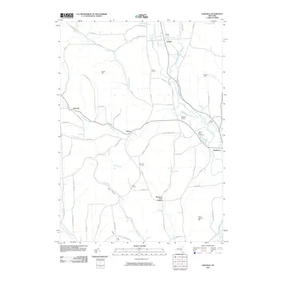
 1943 Earlville1960 Print · USGSChenango and Madison counties are captured here during the mid-forties, showing the vital rail corridor through the Chenango River valley. Genealogists can trace family names and rural locations like Smyrna, Quaker Cem, and the abandoned path of the Chenango Canal.2 unique versions available
 - 1943 Map of Hamilton, 1960 Print
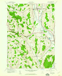
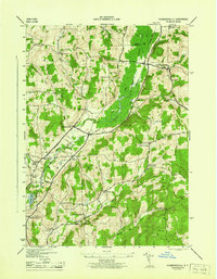
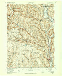
 1943 Hamilton1960 Print · USGSThe Chenango River valley and the campus of Colgate University are captured here during the 1940s. Trace the paths of the New York Ontario and Western RR through Hamilton and locate rural landmarks like Poolville and the Shapley Cem.3 unique versions available
 - 1943 Map of Norwich, 1975 Print
 1943 Norwich1975 Print · USGSChenango County and the Chenango River valley are captured here in the 1940s, a time when rail travel still defined the region's economy. Genealogists can trace family names through dozens of rural landmarks, including Maple Grove Cem, Quaker Ch, and numerous numbered schoolhouses like School No 12.
 - 1944 Map of Hubbardsville
 1944 Hubbardsville1944 Print · USGSCentral New York’s rural landscape is captured here during the 1940s, showing a network of hamlets and family-named hill country. Genealogists can locate specific sites like Cole Hill Cem, Stockwell, and numerous district schools including Black Sch.
 - 1944 Map of Earlville
 1944 Earlville1944 Print · USGSChenango County's river valley and uplands are captured during the mid-forties as a landscape of rail-connected villages and small rural school districts. Genealogists can locate family landmarks like Wilcox Cem, tracing the paths between Earlville, Smyrna, and the Rogers State Game Farm.
 - 1944 Map of Hamilton
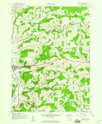
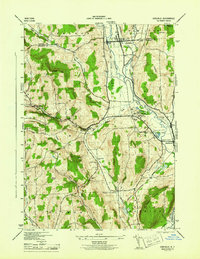
 1944 Hamilton1944 Print · USGSMadison County at the height of the war years reveals a landscape defined by collegiate growth and a dense network of steam-era rail lines. Researchers can trace the legacy of Colgate University or locate family sites at County Home Cem and Shapley Cem.
 - 1944 Map of Norwich, 1960 Print
 1944 Norwich1960 Print · USGSChenango County communities thrive along the river and rail lines during the mid-forties. Genealogists can locate family sites near Otselic Church, Preston Center, and several rural burial grounds like Slater Cem.2 unique versions available
 - 1945 Map of Sherburne
 1945 Sherburne1945 Print · USGSChenango County and the Chenango River valley appear here during the mid-forties, capturing a landscape of upland farms and valley commerce. Researchers can trace the Abandoned Chenango Canal near Sherburne or locate old schoolhouses and cemeteries like Tillotson Cem and School No 13.
 - 1948 Map of Binghamton, 1980 Print
 1948 Binghamton1980 Print · USGSCentral New York and the Southern Tier thrive in the late 1940s as a hub of rail traffic and mountain industry. Researchers can trace historic transit lines like the Erie Railroad through Binghamton or find old valley settlements near Oneonta and Delhi.
 - 1950 Map of Binghamton
 1950 Binghamton1950 Print · USGSBinghamton and the surrounding Southern Tier are shown in the mid-century era, highlighting the intricate rail and river networks that drove local industry. Researchers can trace the path of the Erie Railroad and locate landmarks from Otsego Lake to Sidney Mountain.2 unique versions available
 - 1958 Map of Binghamton
 1958 Binghamton1958 Print · USGSCentral New York in the late fifties was a network of manufacturing cities and river valleys connected by vital rail lines. Genealogists and historians can trace family roots in Oneonta, Norwich, and Cooperstown or locate long-standing farms along Schoharie Creek.
 - 1963 Map of Binghamton
 1963 Binghamton1963 Print · USGSThe Southern Tier and Catskill peaks are shown in the early sixties as new reservoirs reshaped the valleys. Trace historic rail corridors like the Erie Lackawanna RR and explore lakeside settlements such as Cooperstown and Oneonta.
 - 1986 Map of Norwich
 1986 Norwich1986 Print · USGSCentral New York in the mid-eighties was a landscape of deep river valleys and university towns connected by historic rail corridors and state highways. Researchers can trace the rural infrastructure of Norwich and Hamilton, finding landmarks like Colgate University and the Seventh Day Hollow Church.2 unique versions available
 - 2010 Map of Hubbardsville, 2010 Print
 2010 Hubbardsville2010 Print · USGSCovers Hamilton, including Madison, Sangerfield, and other nearby areas
 - 2010 Map of Sherburne, 2010 Print
 2010 Sherburne2010 Print · USGSCovers Hamilton, including Sherburne, New Berlin, and other nearby areas
 - 2010 Map of Earlville, 2010 Print
 2010 Earlville2010 Print · USGSCovers Hamilton, including Sherburne, North Norwich, and other nearby areas
 - 2010 Map of Hamilton, 2010 Print
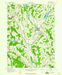
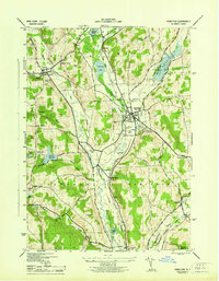
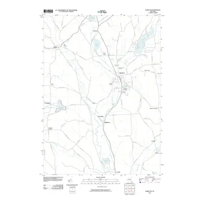 2010 Hamilton2010 Print · USGSCovers Hamilton, including Eaton, Madison, and other nearby areas
Showing maps 1-25 of 41
Top cities near Hamilton
- Kirkland historical maps
- Paris historical maps
- Eaton historical maps
- Hamilton historical maps
- Sherburne historical maps
- Madison historical maps
See more
Top neighborhoods of Hamilton
- Brooks Corner historical maps
- East Hamilton historical maps
- Hubbardsville historical maps
- South Hamilton historical maps
- Poolville historical maps
- Hamilton Center historical maps
Frequently asked questions
- What are the different types of historical maps available for Hamilton?
- What is the oldest map of Hamilton?
- Where can I purchase historical maps of Hamilton for my home or office?
- Where can I download high-res historical maps of Hamilton?
- Are there historical topographic maps available for Hamilton?
- Is there historical aerial imagery available for Hamilton?
- Where are historical maps of Hamilton sourced from?