Old Maps of Nelson, New York for Metal Detecting
Plan your next treasure hunt with 36 historic maps of Nelson. Find old homesites, ghost towns, trails, and gathering spots that may be lost to time — perfect for identifying promising metal detecting locations.
- Locate forgotten sites: Uncover places like long-lost settlements, abandoned rail lines, or gathering spots.
- Plan better hunts: Use map overlays combined with LiDAR or satellite views to narrow in on historically rich areas.
- Made for detectorists: Thousands of hobbyists use these maps to discover relics, coins, and hidden history.
Use these historic maps to boost your research and find new opportunities beneath the surface of Nelson.
Nelson, NY maps
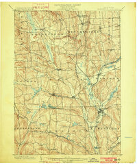
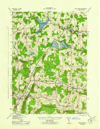
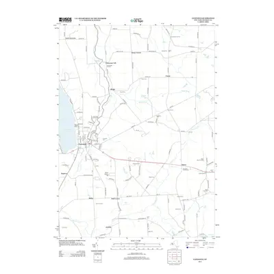
(36)- 1897 Map of Cazenovia, 1953 Print
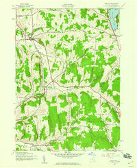
 1897 Cazenovia1953 Print · USGSMadison and Onondaga Counties are shown here just before the turn of the century, revealing a landscape defined by emerging rail lines and historic hamlets. Researchers can trace family roots through the Cowles Settlement, locate the Constine Bridge, or follow the Lehigh Valley R. R. through Delphi Station.
 - 1899 Map of Cazenovia
 1899 Cazenovia1899 Print · USGSMadison and Onondaga Counties are shown here in the late nineteenth century, a landscape defined by emerging lakeside villages and vital railroad junctions. Genealogists can trace early homesteads and hamlets like Cowles Settlement, Quaker Settlement, and Sheds Corners.7 unique versions available
 - 1902 Map of Morrisville
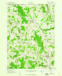
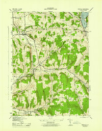
 1902 Morrisville1902 Print · USGSMadison County at the turn of the century was a complex network of upland valleys shaped by the Chenango Canal and three major railroads. Genealogists and historians can trace old homesteads and local infrastructure near Morrisville, Hamilton, and the New York Ontario and Western RR.8 unique versions available
 - 1943 Map of Cazenovia, 1958 Print
 1943 Cazenovia1958 Print · USGSMadison County at the height of the 1940s reveals a landscape of thriving crossroads and lakeside life. Genealogists and historians can trace family-named sites like Abell Corners, local landmarks like Copstine Bridge, and the historic Welsh Ch.4 unique versions available
 - 1943 Map of West Eaton, 1960 Print
 1943 West Eaton1960 Print · USGSMadison County during the early 1940s was a landscape of high-elevation reservoirs and small dairy-country hamlets. Researchers can trace family history through sites like Hawk Cem, School No 1, and the rail-oriented Georgetown Sta.2 unique versions available
 - 1943 Map of Morrisville, 1960 Print
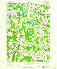
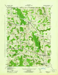
 1943 Morrisville1960 Print · USGSMadison County at the height of World War II reveals a landscape of high hills and deep swamps centered on the villages of Morrisville and Peterboro. Researchers can trace rural landmarks including Roberts Cem, the isolated Swamp Sch, and the unique Electric Light Pond.2 unique versions available
 - 1943 Map of Erieville, 1960 Print
 1943 Erieville1960 Print · USGSMadison County's rural landscapes and railroad villages are frozen in time during the early 1940s. Genealogists can trace family roots through landmarks like Quaker Settlement, Allard Cem, and the old depot at Delphi Sta.2 unique versions available
 - 1944 Map of Erieville
 1944 Erieville1944 Print · USGSMadison County's rolling hills and rail-dependent hamlets are captured here during the 1940s. Genealogists and local historians can trace the Lehigh Valley line through Delphi Station or locate family roots near Quaker Settlement and Allard Cem.
 - 1944 Map of Morrisville
 1944 Morrisville1944 Print · USGSMadison County's rural heartland is meticulously detailed in the mid-1940s, featuring the early grounds of the State Agricultural and Technical Institute. Researchers can trace ancestral property near Peterboro, locate old burial grounds like Payne Cem, or follow the historic Cherry Valley Turnpike through Morrisville.
 - 1944 Map of Cazenovia
 1944 Cazenovia1944 Print · USGSMadison County's rolling farmland and lakefront properties are meticulously captured in the mid-1940s. Genealogists and historians can trace family locations at Rowan Corners, locate rural burial sites like Ballou Cem, and explore the grounds of Chittenango Falls State Park.
 - 1944 Map of West Eaton
 1944 West Eaton1944 Print · USGSMadison County in the 1940s is captured here through its network of upland reservoirs and rural valley townships. Researchers can trace the heritage of local settlements from West Eaton to Georgetown, while locating family-named sites like Niles Cem and Dunhams Pinnacle.
 - 1948 Map of Binghamton, 1980 Print
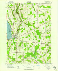
 1948 Binghamton1980 Print · USGSCentral New York and the Southern Tier thrive in the late 1940s as a hub of rail traffic and mountain industry. Researchers can trace historic transit lines like the Erie Railroad through Binghamton or find old valley settlements near Oneonta and Delhi.
 - 1950 Map of Binghamton
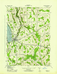
 1950 Binghamton1950 Print · USGSBinghamton and the surrounding Southern Tier are shown in the mid-century era, highlighting the intricate rail and river networks that drove local industry. Researchers can trace the path of the Erie Railroad and locate landmarks from Otsego Lake to Sidney Mountain.2 unique versions available
 - 1958 Map of Binghamton
 1958 Binghamton1958 Print · USGSCentral New York in the late fifties was a network of manufacturing cities and river valleys connected by vital rail lines. Genealogists and historians can trace family roots in Oneonta, Norwich, and Cooperstown or locate long-standing farms along Schoharie Creek.
 - 1963 Map of Binghamton
 1963 Binghamton1963 Print · USGSThe Southern Tier and Catskill peaks are shown in the early sixties as new reservoirs reshaped the valleys. Trace historic rail corridors like the Erie Lackawanna RR and explore lakeside settlements such as Cooperstown and Oneonta.
 - 1986 Map of Norwich
 1986 Norwich1986 Print · USGSCentral New York in the mid-eighties was a landscape of deep river valleys and university towns connected by historic rail corridors and state highways. Researchers can trace the rural infrastructure of Norwich and Hamilton, finding landmarks like Colgate University and the Seventh Day Hollow Church.2 unique versions available
 - 2010 Map of Erieville, 2010 Print
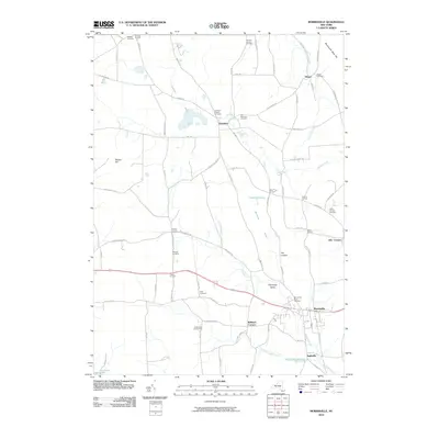
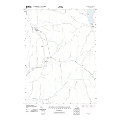 2010 Erieville2010 Print · USGSCovers Nelson, including Cazenovia, DeRuyter, and other nearby areas
 - 2010 Map of West Eaton, 2010 Print
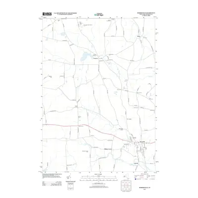
 2010 West Eaton2010 Print · USGSCovers Nelson, including Eaton, Lebanon, and other nearby areas
 - 2010 Map of Cazenovia, 2010 Print
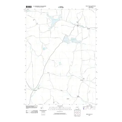
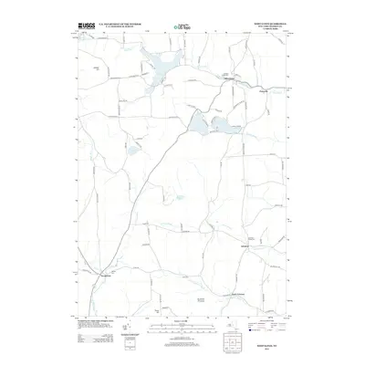
 2010 Cazenovia2010 Print · USGSCovers Nelson, including Cazenovia, Cazenovia, and other nearby areas
 - 2010 Map of Morrisville, 2010 Print
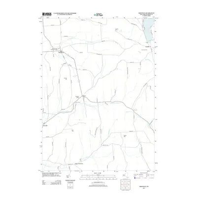
 2010 Morrisville2010 Print · USGSCovers Nelson, including Eaton, Stockbridge, and other nearby areas
 - 2013 Map of Morrisville, 2013 Print
 2013 Morrisville2013 Print · USGSCovers Nelson, including Eaton, Stockbridge, and other nearby areas
 - 2013 Map of Erieville, 2013 Print
 2013 Erieville2013 Print · USGSCovers Nelson, including Cazenovia, DeRuyter, and other nearby areas
 - 2013 Map of West Eaton, 2013 Print
 2013 West Eaton2013 Print · USGSCovers Nelson, including Eaton, Lebanon, and other nearby areas
 - 2013 Map of Cazenovia, 2013 Print
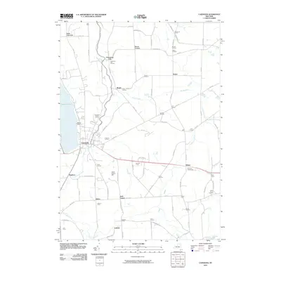
 2013 Cazenovia2013 Print · USGSCovers Nelson, including Cazenovia, Cazenovia, and other nearby areas
 - 2016 Map of Morrisville, 2016 Print
 2016 Morrisville2016 Print · USGSCovers Nelson, including Eaton, Stockbridge, and other nearby areas
Showing maps 1-25 of 36
Top cities near Nelson
- Manlius historical maps
- Sullivan historical maps
- Oneida historical maps
- Lenox historical maps
- Pompey historical maps
- Cazenovia historical maps
See more
Top neighborhoods of Nelson
Frequently asked questions
- What are the different types of historical maps available for Nelson?
- What is the oldest map of Nelson?
- Where can I purchase historical maps of Nelson for my home or office?
- Where can I download high-res historical maps of Nelson?
- Are there historical topographic maps available for Nelson?
- Is there historical aerial imagery available for Nelson?
- Where are historical maps of Nelson sourced from?