Old Maps of Irondequoit, New York for Academic Research
Study the evolution of Irondequoit with 25 high-resolution historic maps. Whether you're teaching, researching, or modeling changes in land use, these maps provide essential visual documentation of urban, environmental, and geographic change.
- Analyze long-term change: Track patterns in development, transportation, and natural features.
- Ideal for environmental or urban studies: Support academic projects with primary historical map data.
- Use in the classroom or lab: Educators and researchers rely on these maps to bring historical context to life.
These maps are a powerful tool for teaching, research, and visualizing how Irondequoit has changed over the decades.
Irondequoit, NY maps
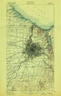
(25)- 1895 Map of Rochester
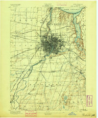 1895 Rochester1895 Print · USGSRochester and its surrounding townships thrived at the end of the century as a hub of canal traffic and steam rail. Genealogists can trace family roots in early settlements like Barnard Crossing, South Greece Station, and the lakeside resort of Glen Haven.
 - 1895 Map of Ontario Beach
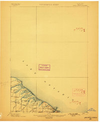
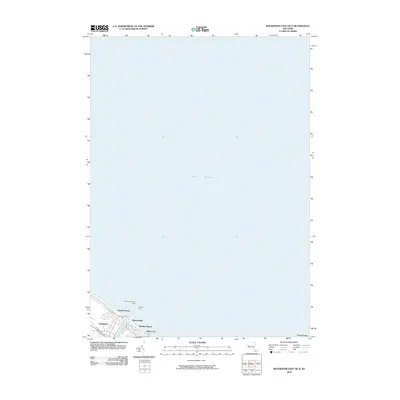
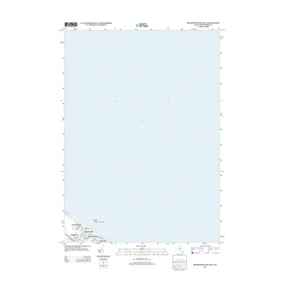
 1895 Ontario Beach1895 Print · USGSMonroe County's lakefront comes alive in the mid-1890s, capturing the early resort and transit infrastructure of the town of Greece. Trace the old Electric R. R. to Ontario Beach or locate nineteenth-century landmarks like Genesee L.H. and Frisbee Hill.
 - 1898 Map of Rochester
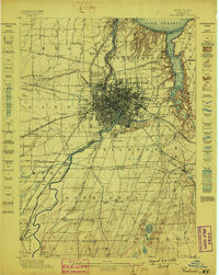 1898 Rochester1898 Print · USGSMonroe County was a burgeoning hub of rail and water commerce in the 1890s, anchored by a dense industrial core. Researchers can trace the original path of the Erie Canal and locate long-lost railway depots at South Greece Station and Henrietta Station.5 unique versions available
 - 1899 Map of Ontario Beach
 1899 Ontario Beach1899 Print · USGSThe Lake Ontario shoreline near the turn of the century shows a unique era of transit and coastal settlement in Monroe County. Trace the route of the Grand View Beach Electric Railroad past Cranberry Pond to the waterfront at Ontario Beach.3 unique versions available
 - 1912 Map of Rochester
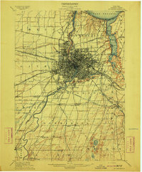 1912 Rochester1912 Print · USGSRochester and its surrounding Monroe County townships are shown here during a transformative era of canal and rail expansion. Genealogists can locate family-named stations and settlements like Maplewood Bealsburg PO, Mortimer, and Barnard along the busy tracks of the Lehigh Valley R. R.2 unique versions available
 - 1912 Map of Ontario Beach
 1912 Ontario Beach1912 Print · USGSThe Lake Ontario shoreline near Rochester was a burgeoning hub of transit and tourism in the early twentieth century. Researchers can trace the path of the Grand View Beach Electric RR or locate landmarks like Genesee L. H. and Manitou Beach.
 - 1920 Map of Rochester
 1920 Rochester1920 Print · USGSRochester and its surrounding townships thrive at the height of the rail and canal era during the early 1920s. Researchers can trace the original routes of the Barge Canal and locate specific sites like the State Industrial School or South Greece Station.5 unique versions available
 - 1931 Map of Rochester East
 1931 Rochester East1931 Print · USGSMonroe County was undergoing a period of rapid residential expansion in the early thirties as the city reached toward the lake. Researchers can find old neighborhood landmarks like the Genesee Lighthouse, Claverhouse PO, and the Riverside Cemetery.
 - 1935 Map of Rochester East
 1935 Rochester East1935 Print · USGSRochester and its eastern suburbs are shown in high detail during the mid-1930s as the city expanded toward the lake. Genealogists can locate family homes near the University of Rochester or trace old lakeside communities like Sea Breeze and White City.3 unique versions available
 - 1952 Map of Rochester East, 1954 Print
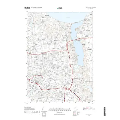
 1952 Rochester East1954 Print · USGSThe Lake Ontario shoreline and the bustling eastern half of Rochester are captured here in the early fifties. Genealogists and local historians can locate specific neighborhood institutions like Indian Landing School, Twelve Corners, and the historic Float Bridge.3 unique versions available
 - 1960 Map of Rochester
 1960 Rochester1960 Print · USGSThe Lake Ontario shoreline in the late fifties was a bustling corridor of rail and water commerce. Genealogists and historians can trace the path of the New York Central through canal towns like Newark or explore the coastal landmarks around Sackets Harbor.2 unique versions available
 - 1961 Map of Rochester, 1973 Print
 1961 Rochester1973 Print · USGSThe Lake Ontario shoreline and Finger Lakes frontier are shown here at the height of the mid-century infrastructure boom. Genealogists and historians can trace the rail-and-road evolution from Sackets Harbor down to the New York State Thruway, passing through centers like Pulaski and Adams Center.3 unique versions available
 - 1965 Map of Rochester
 1965 Rochester1965 Print · USGSUpstate New York's industrial heartland is captured here during a period of significant growth between the Great Lakes and the Finger Lakes. Genealogists and historians can trace the evolution of canal towns and rail hubs from Rochester to Syracuse, noting features like the Erie Canal and the New York State Thruway.
 - 1971 Map of Rochester East, 1974 Print
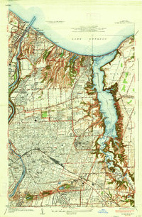
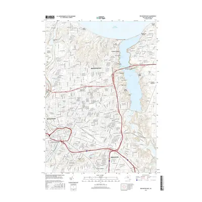
 1971 Rochester East1974 Print · USGSGreater Rochester and the Irondequoit shoreline are shown in the early 1970s, as the city's northern suburbs reached their modern footprint. Genealogists can locate family landmarks from Riverside Cemetery to Brighton or trace the old rail lines of the Penn Central.3 unique versions available
 - 1984 Map of Rochester
 1984 Rochester1984 Print · USGSThe Rochester lakefront and Genesee Valley are shown here in the mid-eighties as suburban growth reached historic canal towns and rural outposts. Genealogists can locate family landmarks like Mud Mills, the Angel Moroni Monument, and Lake View Cemetery.2 unique versions available
 - 2010 Map of Rochester East OE N, 2010 Print
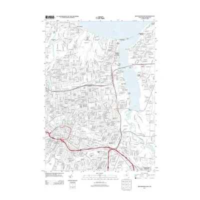
 2010 Rochester East OE N2010 Print · USGSCovers Irondequoit, including Rochester, Greece, and other nearby areas
 - 2010 Map of Rochester East, 2010 Print
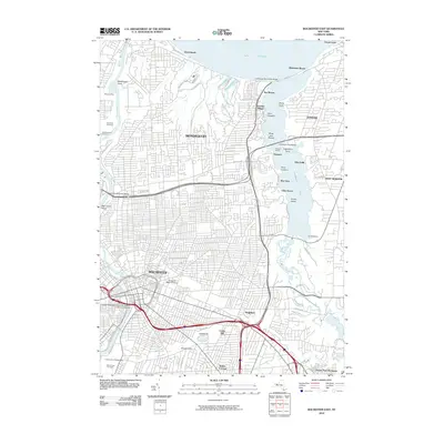 2010 Rochester East2010 Print · USGSCovers Irondequoit, including Rochester, Greece, and other nearby areas
 - 2013 Map of Rochester East OE N, 2013 Print
 2013 Rochester East OE N2013 Print · USGSCovers Irondequoit, including Rochester, Greece, and other nearby areas
 - 2013 Map of Rochester East, 2013 Print
 2013 Rochester East2013 Print · USGSCovers Irondequoit, including Rochester, Greece, and other nearby areas
 - 2016 Map of Rochester East, 2016 Print
 2016 Rochester East2016 Print · USGSCovers Irondequoit, including Rochester, Greece, and other nearby areas
 - 2016 Map of Rochester East OE N, 2016 Print
 2016 Rochester East OE N2016 Print · USGSCovers Irondequoit, including Rochester, Greece, and other nearby areas
 - 2019 Map of Rochester East OE N, 2019 Print
 2019 Rochester East OE N2019 Print · USGSCovers Irondequoit, including Rochester, Greece, and other nearby areas
 - 2019 Map of Rochester East, 2019 Print
 2019 Rochester East2019 Print · USGSCovers Irondequoit, including Rochester, Greece, and other nearby areas
 - 2023 Map of Rochester East, 2023 Print
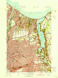
 2023 Rochester East2023 Print · USGSThe Lake Ontario shoreline meets the suburban expansion of Monroe County in this contemporary survey of the Irondequoit area. Researchers can trace local heritage through sites like Saint Casimir's Polish Catholic Cem and the distinctive waterfronts of German Village and Oklahoma Beach.
 - 2023 Map of Rochester East OE N, 2023 Print
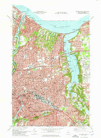
 2023 Rochester East OE N2023 Print · USGSThe northern lakefront of Monroe County is captured here at the contemporary meeting of the river and the Great Lake. Researchers can trace the modern street grids of Charlotte and Windsor Beach near the mouth of the Genesee River.
End of results
Showing maps 1-25 of 25
Top cities near Irondequoit
- Rochester historical maps
- Greece historical maps
- North Greece historical maps
- Perinton historical maps
- Henrietta historical maps
- Webster historical maps
See more
Top neighborhoods of Irondequoit
- Newport historical maps
- Sea Breeze historical maps
- German Village historical maps
- Glen Haven historical maps
- Rock Beach historical maps
- The "Flats" historical maps
See more
Frequently asked questions
- What are the different types of historical maps available for Irondequoit?
- What is the oldest map of Irondequoit?
- Where can I purchase historical maps of Irondequoit for my home or office?
- Where can I download high-res historical maps of Irondequoit?
- Are there historical topographic maps available for Irondequoit?
- Is there historical aerial imagery available for Irondequoit?
- Where are historical maps of Irondequoit sourced from?