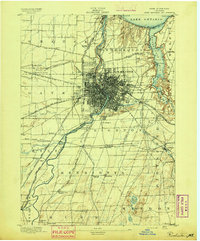
1895 Map of Rochester
USGS Topo · Published 1895About this map
The Genesee River serves as the industrial and geographic spine of this nineteenth-century landscape, flowing through the heart of Rochester toward its mouth at Charlotte on Lake Ontario. This 1895 survey captures the city at a peak of rail and water-based transit, where the massive Erie Canal cuts across the terrain to meet a dense web of iron, including the New York Central and Hudson River R. R. and the Lehigh Valley R. R.. Beyond the urban core, the map reveals a series of distinct rail-stop communities and lakeside destinations such as Windsor Beach and Glen Haven on Irondequoit Bay. The surrounding townships of Greece, Brighton, and Pittsford are still largely agrarian, marked by family-named landmarks like Cobb Hill and vanished junctions such as Barnard Crossing, providing a clear record of the region's development before the expansion of the modern suburban footprint.
Find a feature on this map
74 named features on this map. Tap any name to fly to it.
Don’t see what you’re looking for? This feature index may not catch every label — zoom into the map to look around manually.
Map Details
Editions of this 1895 Rochester Map
This is the sole edition of this map. No revisions or reprints were ever made.
Other maps of this area

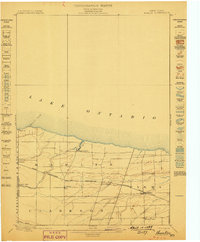
1895 · Ontario Beach
USGS Topo · 1:62,500
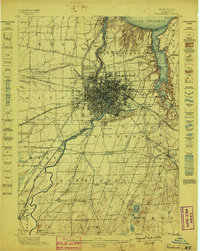
1898 · Rochester
USGS Topo · 1:62,500
1899 · Hamlin
USGS Topo · 1:62,500
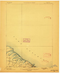
1899 · Ontario Beach
USGS Topo · 1:62,500

1899 · Brockport
USGS Topo · 1:62,500

1900 · Macedon
USGS Topo · 1:62,500

1900 · Canandaigua
USGS Topo · 1:62,500

1901 · Honeoye
USGS Topo · 1:62,500

1903 · Canandaigua
USGS Topo · 1:62,500

1904 · Caledonia
USGS Topo · 1:62,500