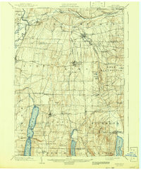
1901 Map of Honeoye
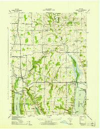
USGS Topo · Published 1954About this map
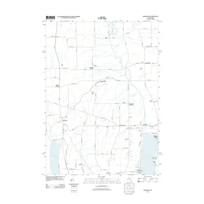
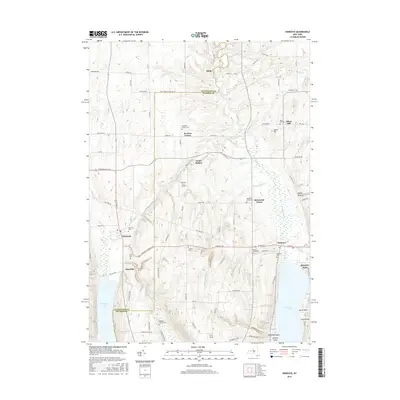
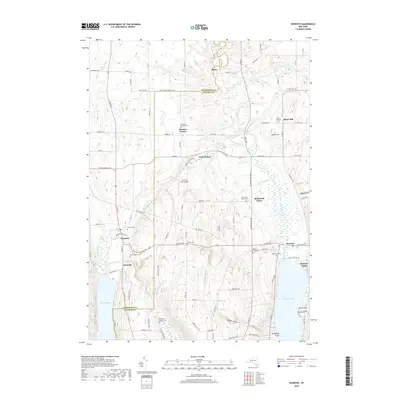
Honeoye Falls and the surrounding Finger Lakes landscape at the turn of the century appear here as a complex network of milling towns and rail intersections. The era's transportation infrastructure is particularly dense, with the Lehigh Valley and Erie RR threading through the glacial valleys. Significant junction points like Rochester Junction and Conesus Lake Junction show how the region's agricultural output reached larger markets. To the south, the deep basins of Conesus Lake, Hemlock Lake, and Honeoye Lake dominate the terrain, their shorelines punctuated by points like Eagle Pt. and Mc Pherson Pt. High-elevation landmarks such as Jakman Hill and Cemetery Hill overlook the smaller hamlets of Richmond Mills and Glenville, capturing the rural character of western New York before mid-century modernization reshaped these valley communities.
Find a feature on this map
69 named features on this map. Tap any name to fly to it.
Don’t see what you’re looking for? This feature index may not catch every label — zoom into the map to look around manually.
Map Details
Editions of this 1901 Honeoye Map
This is the sole edition of this map. No revisions or reprints were ever made.
Historical Maps of Geneseo Through Time
9 maps found