Old Maps of Mendon, New York for Hiking & Exploration
Hike through history with 63 historic maps of Mendon. Explore old trails, ghost towns, and forgotten backroads — perfect for outdoor adventurers and local explorers.
- Rediscover forgotten places: Map out old mining camps, roads, and footpaths that no longer exist on modern maps.
- Layer with modern tools: Combine with LiDAR or satellite views to plan hikes through historical terrain.
- Made for exploration: Popular among hikers, overlanders, and local history lovers.
Use these maps to find adventure and explore the hidden past of Mendon.
Mendon, NY maps
(63)- 1895 Map of Rochester
 1895 Rochester1895 Print · USGSRochester and its surrounding townships thrived at the end of the century as a hub of canal traffic and steam rail. Genealogists can trace family roots in early settlements like Barnard Crossing, South Greece Station, and the lakeside resort of Glen Haven.
 - 1898 Map of Rochester
 1898 Rochester1898 Print · USGSMonroe County was a burgeoning hub of rail and water commerce in the 1890s, anchored by a dense industrial core. Researchers can trace the original path of the Erie Canal and locate long-lost railway depots at South Greece Station and Henrietta Station.5 unique versions available
 - 1900 Map of Macedon
 1900 Macedon1900 Print · USGSMonroe and Wayne counties thrive at the intersection of water and rail transport at the end of the nineteenth century. Genealogists and historians can trace the original paths of the Erie Canal and locate long-standing settlements like Despatch, Fairport, and Webster.8 unique versions available
 - 1900 Map of Canandaigua, 1961 Print
 1900 Canandaigua1961 Print · USGSOntario County at the turn of the century shows a landscape defined by the steam-era commerce of the Finger Lakes. Genealogists can trace family connections to rural hubs like Baptist Hill, follow the Steamboat Route on Canandaigua Lake, or locate family farms near Thompson Cor and Mertensia.
 - 1901 Map of Honeoye, 1954 Print
 1901 Honeoye1954 Print · USGSThe Finger Lakes region at the turn of the century was a bustling corridor of milling and rail transit. Genealogists and rail historians can trace the intricate routes of the Lehigh Valley and Erie RR between settlements like Honeoye Falls and Richmond Mills.
 - 1903 Map of Canandaigua
 1903 Canandaigua1903 Print · USGSThe Finger Lakes region thrived at the dawn of the century, defined by a bustling network of railroads and steamboat traffic. Researchers can trace historic family landmarks at Baptist Hill, Mc Millen Corners, and lakefront points like Cottage City.7 unique versions available
 - 1904 Map of Honeoye
 1904 Honeoye1904 Print · USGSThe Finger Lakes region thrived at the start of the century as a vital rail and milling corridor. Researchers can trace the path of the Electric R. R. and locate family landmarks like Jakman Hill or the old milling sites at Richmond Mills.6 unique versions available
 - 1912 Map of Rochester
 1912 Rochester1912 Print · USGSRochester and its surrounding Monroe County townships are shown here during a transformative era of canal and rail expansion. Genealogists can locate family-named stations and settlements like Maplewood Bealsburg PO, Mortimer, and Barnard along the busy tracks of the Lehigh Valley R. R.2 unique versions available
 - 1920 Map of Rochester
 1920 Rochester1920 Print · USGSRochester and its surrounding townships thrive at the height of the rail and canal era during the early 1920s. Researchers can trace the original routes of the Barge Canal and locate specific sites like the State Industrial School or South Greece Station.5 unique versions available
 - 1931 Map of Mendon Ponds
 1931 Mendon Ponds1931 Print · USGSMonroe County was undergoing a significant transition in the early 1930s as Rochester's industrial reach met rural township life. Genealogists can trace family footprints across dozens of district schools like Henrietta No 2 Sch or locate the Iola Sanitarium.
 - 1932 Map of Fairport
 1932 Fairport1932 Print · USGSMonroe County's canal and rail corridor is captured here in the early 1930s, showing the vital intersection of the Barge Canal and major rail lines. Genealogists can locate family-named roads and numerous rural schools like School No 5 near Egypt.
 - 1934 Map of Rush
 1934 Rush1934 Print · USGSThe Genesee River valley in the 1930s serves as a busy crossroads for major rail lines and rural hamlets. Researchers can trace family homesteads along Martin Road, locate the grounds of School No 6, or map the rail junctions at Golah and West Rush.2 unique versions available
 - 1934 Map of Fairport
 1934 Fairport1934 Print · USGSMonroe County was undergoing significant planning and growth in the early thirties as the canal and rail lines shaped the Rochester suburbs. Trace the locations of historic rural schoolhouses, the Bushnell Basin Guard Gate, and the South Perinton Ch.
 - 1934 Map of Honeoye Falls
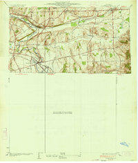 1934 Honeoye Falls1934 Print · USGSMonroe County and the surrounding valleys are shown here in the 1930s, centered on the village of Honeoye Falls. Local historians can trace early school districts and family plots at Quaker Cem, Graves Cem, and the old rail hub at Rochester Junction.
 - 1935 Map of Mendon Ponds
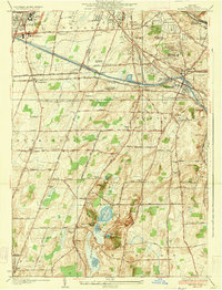 1935 Mendon Ponds1935 Print · USGSMonroe County south of Rochester is shown in the mid-1930s, featuring a landscape of glacial ponds and expanding rail infrastructure. Genealogists can locate numerous rural schoolhouses and historic landmarks like the Iola Sanitarium and East Ch.3 unique versions available
 - 1942 Map of Victor
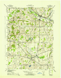 1942 Victor1942 Print · USGSOntario County during the early 1940s reveals a landscape defined by the convergence of the Lehigh Valley and New York Central railroads. You can trace early family settlements and rural centers like Ionia, East Bloomfield, and the historic burial grounds at French Cem or Dibble Cem.
 - 1942 Map of Honeoye Falls
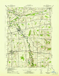 1942 Honeoye Falls1942 Print · USGSWestern New York at the onset of the 1940s reveals a landscape of thriving rail hubs and rural crossroads villages. Genealogists can trace family names through landmarks like Quaker Cem or Graves Cem and locate historic rural schools such as School No 10.
 - 1943 Map of Fairport
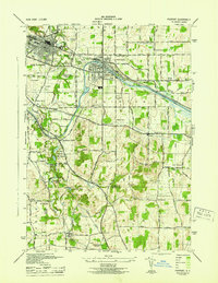 1943 Fairport1943 Print · USGSFairport and the surrounding Perinton countryside are captured here during the Second World War as the canal and rail networks remained vital. Genealogists can locate numerous numbered rural schools and historic burial grounds like Parks Cem and St Marys Cem.
 - 1950 Map of Elmira
 1950 Elmira1950 Print · USGSThe Finger Lakes region thrived in the late 1940s as a hub of industry and transport. Trace family roots and vanished landmarks near Seneca Lake or explore the rail lines of the Erie RR and the sprawling Seneca Ordnance Depot.2 unique versions available
 - 1951 Map of Honeoye Falls, 1952 Print
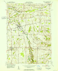 1951 Honeoye Falls1952 Print · USGSThe Genesee Valley region comes to life in the early 1950s, showing the intersection of the rail-and-river economy just south of Rochester. Genealogists can locate several historic burial grounds like Quaker Cem and St Pauls Cem or trace family roots through landmarks such as Tomlinson Corners.2 unique versions available
 - 1951 Map of Victor, 1952 Print
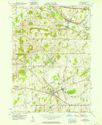 1951 Victor1952 Print · USGSOntario County is captured here in the early fifties as the postwar highway system begins to overlay its historic rail corridors. Genealogists can locate family burial sites like Gunn Cem and Parker Cem alongside established settlements like Ionia and Holcomb.3 unique versions available
 - 1951 Map of Rush, 1952 Print
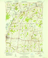 1951 Rush1952 Print · USGSThe Genesee Valley in the early fifties shows a landscape shaped by three major railroads and the winding paths of Honeoye Creek. Genealogists can trace family names through landmarks like East Avon Cemetery, Gannett, and the State Industrial School.2 unique versions available
 - 1952 Map of Fairport, 1954 Print
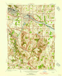 1952 Fairport1954 Print · USGSThe Erie Canal and major rail corridors define this Monroe County landscape in the early fifties, showing Fairport and East Rochester in a period of postwar growth. Genealogists and local historians can trace legacy sites from the South Perinton Ch to old crossroads like Egypt and Railroad Mills.4 unique versions available
 - 1952 Map of Mendon Ponds, 1954 Print
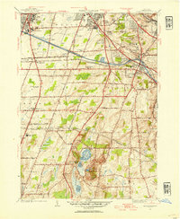 1952 Mendon Ponds1954 Print · USGSMonroe County south of Rochester is shown here during a period of massive infrastructure growth as the Thruway was being built. Researchers can trace the development of St John Fisher College and local landmarks like Devils Bathtub or the Barge Canal.3 unique versions available
 - 1958 Map of Elmira
 1958 Elmira1958 Print · USGSThe New York Finger Lakes during the late fifties reveal a complex landscape of glacial geology and industrial growth. Researchers can trace historic transport corridors like the Erie Canal and Erie RR, or locate institutional landmarks like Cornell University.2 unique versions available
Showing maps 1-25 of 63
Top cities near Mendon
- Rochester historical maps
- Greece historical maps
- Irondequoit historical maps
- Perinton historical maps
- Henrietta historical maps
- Webster historical maps
See more
Top neighborhoods of Mendon
- Ford Corner historical maps
- Mendon Center historical maps
- Moran Corner historical maps
- Rochester Junction historical maps
- Sibleyville historical maps
- Tomlinson Corners historical maps
See more
Frequently asked questions
- What are the different types of historical maps available for Mendon?
- What is the oldest map of Mendon?
- Where can I purchase historical maps of Mendon for my home or office?
- Where can I download high-res historical maps of Mendon?
- Are there historical topographic maps available for Mendon?
- Is there historical aerial imagery available for Mendon?
- Where are historical maps of Mendon sourced from?