Old Maps of Wheatland, New York for Academic Research
Study the evolution of Wheatland with 63 high-resolution historic maps. Whether you're teaching, researching, or modeling changes in land use, these maps provide essential visual documentation of urban, environmental, and geographic change.
- Analyze long-term change: Track patterns in development, transportation, and natural features.
- Ideal for environmental or urban studies: Support academic projects with primary historical map data.
- Use in the classroom or lab: Educators and researchers rely on these maps to bring historical context to life.
These maps are a powerful tool for teaching, research, and visualizing how Wheatland has changed over the decades.
Wheatland, NY maps
(63)- 1895 Map of Rochester
 1895 Rochester1895 Print · USGSRochester and its surrounding townships thrived at the end of the century as a hub of canal traffic and steam rail. Genealogists can trace family roots in early settlements like Barnard Crossing, South Greece Station, and the lakeside resort of Glen Haven.
 - 1898 Map of Rochester
 1898 Rochester1898 Print · USGSMonroe County was a burgeoning hub of rail and water commerce in the 1890s, anchored by a dense industrial core. Researchers can trace the original path of the Erie Canal and locate long-lost railway depots at South Greece Station and Henrietta Station.5 unique versions available
 - 1899 Map of Brockport
 1899 Brockport1899 Print · USGSMonroe and Genesee Counties are captured here at the close of the nineteenth century as the industrial power of the Erie Canal and five different railroads reshaped the landscape. Genealogists and local historians can trace family-named sites and vanished hamlets like Moreton Farm, Hinkleyville, and Stone Church.8 unique versions available
 - 1901 Map of Honeoye, 1954 Print
 1901 Honeoye1954 Print · USGSThe Finger Lakes region at the turn of the century was a bustling corridor of milling and rail transit. Genealogists and rail historians can trace the intricate routes of the Lehigh Valley and Erie RR between settlements like Honeoye Falls and Richmond Mills.
 - 1904 Map of Caledonia
 1904 Caledonia1904 Print · USGSLivingston County and its surrounding borders are shown here at the height of the early railroad era. Researchers can trace the complex rail junctions at Caledonia or locate vanished landmarks and post offices like Wadsworth P.O. S.Greigsville and Retsof.6 unique versions available
 - 1904 Map of Honeoye
 1904 Honeoye1904 Print · USGSThe Finger Lakes region thrived at the start of the century as a vital rail and milling corridor. Researchers can trace the path of the Electric R. R. and locate family landmarks like Jakman Hill or the old milling sites at Richmond Mills.6 unique versions available
 - 1912 Map of Rochester
 1912 Rochester1912 Print · USGSRochester and its surrounding Monroe County townships are shown here during a transformative era of canal and rail expansion. Genealogists can locate family-named stations and settlements like Maplewood Bealsburg PO, Mortimer, and Barnard along the busy tracks of the Lehigh Valley R. R.2 unique versions available
 - 1920 Map of Rochester
 1920 Rochester1920 Print · USGSRochester and its surrounding townships thrive at the height of the rail and canal era during the early 1920s. Researchers can trace the original routes of the Barge Canal and locate specific sites like the State Industrial School or South Greece Station.5 unique versions available
 - 1934 Map of Rush
 1934 Rush1934 Print · USGSThe Genesee River valley in the 1930s serves as a busy crossroads for major rail lines and rural hamlets. Researchers can trace family homesteads along Martin Road, locate the grounds of School No 6, or map the rail junctions at Golah and West Rush.2 unique versions available
 - 1934 Map of Clifton
 1934 Clifton1934 Print · USGSMonroe County in the mid-1930s shows a thriving network of rail lines and rural school districts centered around the Oatka Creek valley. Researchers can trace family roots through several local burial grounds like Clifton Cem and Oatka Cem or locate former landmarks like the Chedro Seminary.2 unique versions available
 - 1935 Map of Genesee Junction
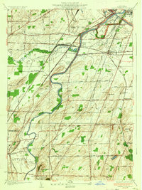 1935 Genesee Junction1935 Print · USGSMonroe County was a bustling intersection of rail and water transport during the mid-1930s. Genealogists and local historians can trace the foundations of West Henrietta and Scottsville or locate family plots at Riverview Cem and Maplewood Cem.2 unique versions available
 - 1935 Map of Churchville
 1935 Churchville1935 Print · USGSWestern Monroe County was a hub of rail travel and agriculture in the 1930s. Genealogists and historians can trace the foundations of local life through sites like Churchville Park, the rural settlement of Beulah, and old local schools like School No 9.
 - 1944 Map of Churchville
 1944 Churchville1944 Print · USGSMonroe and Genesee counties are captured here in the mid-1940s, showing a landscape defined by the New York Central System and Bergen Swamp Wild Life Sanctuary. Researchers can trace rural school districts like School No 9 and settlements at Stone Church or Beulah.
 - 1944 Map of Le Roy
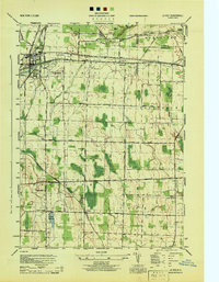 1944 Le Roy1944 Print · USGSLe Roy and its surrounding townships are shown at the height of the steam-to-diesel rail era, where three major lines intersect. Genealogists can locate family landmarks such as Machpelah Cemetery, Union Corners, and many rural schoolhouses like School No 7.
 - 1950 Map of Elmira
 1950 Elmira1950 Print · USGSThe Finger Lakes region thrived in the late 1940s as a hub of industry and transport. Trace family roots and vanished landmarks near Seneca Lake or explore the rail lines of the Erie RR and the sprawling Seneca Ordnance Depot.2 unique versions available
 - 1950 Map of Churchville, 1952 Print
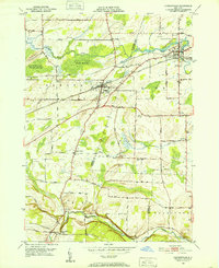 1950 Churchville1952 Print · USGSThe rural borderlands of Genesee and Monroe Counties come alive in this mid-century survey of the New York Central rail corridor. Researchers can trace historic farmstead locations and early settlements like Stone Church, Jericon Corners, and the scenic Buttermilk Falls.2 unique versions available
 - 1950 Map of Clifton, 1952 Print
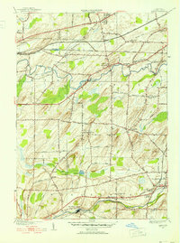 1950 Clifton1952 Print · USGSMonroe County was a network of rail-side hamlets and creekside settlements at mid-century. Researchers can trace the legacy of local families through landmarks like Clifton Cem and Oatka Cem or the grounds of Roberts Wesleyan College.3 unique versions available
 - 1950 Map of Caledonia, 1952 Print
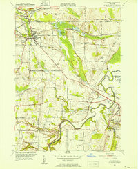 1950 Caledonia1952 Print · USGSMid-century Livingston County is captured here as a major railroad crossroads along the Genesee River. Genealogists and local historians can trace family plots at Scottish Cem or explore rail-side hamlets like Mumford, Canawaugus, and Ashantee.4 unique versions available
 - 1950 Map of Le Roy, 1952 Print
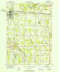 1950 Le Roy1952 Print · USGSWestern New York at mid-century reveals a landscape shaped by competing rail lines and rural settlements. You can trace the early industrial footprint of Le Roy and find family-named landmarks like Machpelah Cem, St Anthony Ch, and the GULF.4 unique versions available
 - 1951 Map of Rush, 1952 Print
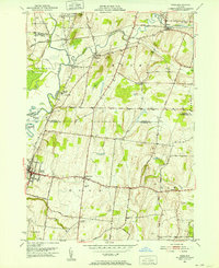 1951 Rush1952 Print · USGSThe Genesee Valley in the early fifties shows a landscape shaped by three major railroads and the winding paths of Honeoye Creek. Genealogists can trace family names through landmarks like East Avon Cemetery, Gannett, and the State Industrial School.2 unique versions available
 - 1951 Map of Caledonia, 1956 Print
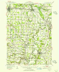 1951 Caledonia1956 Print · USGSThe Genesee Valley flourished as a rail crossroads in the early fifties, where five major lines converged near the river. Local historians can trace family-named corners and rural institutions like St Columbus Ch, Machpelah Cem, and Retsof Central Sch.2 unique versions available
 - 1952 Map of Genesee Junction, 1954 Print
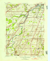 1952 Genesee Junction1954 Print · USGSMonroe County south of Rochester is shown here in the early fifties, where the Genesee River meets an intricate web of competing railroads. Researchers can trace the routes of the Lehigh Valley and Erie lines past West Henrietta or locate family sites like Grove Place Cem and Bushman Cem.3 unique versions available
 - 1958 Map of Elmira
 1958 Elmira1958 Print · USGSThe New York Finger Lakes during the late fifties reveal a complex landscape of glacial geology and industrial growth. Researchers can trace historic transport corridors like the Erie Canal and Erie RR, or locate institutional landmarks like Cornell University.2 unique versions available
 - 1960 Map of Rochester
 1960 Rochester1960 Print · USGSThe Lake Ontario shoreline in the late fifties was a bustling corridor of rail and water commerce. Genealogists and historians can trace the path of the New York Central through canal towns like Newark or explore the coastal landmarks around Sackets Harbor.2 unique versions available
 - 1961 Map of Rochester, 1973 Print
 1961 Rochester1973 Print · USGSThe Lake Ontario shoreline and Finger Lakes frontier are shown here at the height of the mid-century infrastructure boom. Genealogists and historians can trace the rail-and-road evolution from Sackets Harbor down to the New York State Thruway, passing through centers like Pulaski and Adams Center.3 unique versions available
Showing maps 1-25 of 63
Top cities near Wheatland
- Rochester historical maps
- Greece historical maps
- Irondequoit historical maps
- Henrietta historical maps
- Brighton historical maps
- Gates historical maps
See more
Top neighborhoods of Wheatland
- Garbutt historical maps
- Mumford historical maps
- Wheatland Center historical maps
- Belcoda historical maps
- Beulah historical maps
- Scottsville historical maps
Frequently asked questions
- What are the different types of historical maps available for Wheatland?
- What is the oldest map of Wheatland?
- Where can I purchase historical maps of Wheatland for my home or office?
- Where can I download high-res historical maps of Wheatland?
- Are there historical topographic maps available for Wheatland?
- Is there historical aerial imagery available for Wheatland?
- Where are historical maps of Wheatland sourced from?