Old Maps of Amsterdam, New York for Academic Research
Study the evolution of Amsterdam with 31 high-resolution historic maps. Whether you're teaching, researching, or modeling changes in land use, these maps provide essential visual documentation of urban, environmental, and geographic change.
- Analyze long-term change: Track patterns in development, transportation, and natural features.
- Ideal for environmental or urban studies: Support academic projects with primary historical map data.
- Use in the classroom or lab: Educators and researchers rely on these maps to bring historical context to life.
These maps are a powerful tool for teaching, research, and visualizing how Amsterdam has changed over the decades.
Amsterdam, NY maps
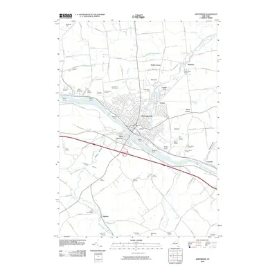
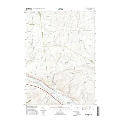
(31)- 1895 Map of Amsterdam
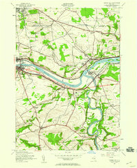
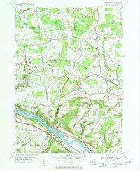
 1895 Amsterdam1895 Print · USGSThe Mohawk River valley thrives in the late nineteenth century as a corridor of heavy rail and canal traffic. Trace the historic paths of the Erie Canal and West Shore R.R. past Amsterdam and the old Hoffman Ferry crossing.7 unique versions available
 - 1896 Map of Fonda
 1896 Fonda1896 Print · USGSThe Mohawk Valley was a technological corridor in the 1890s, defined by the convergence of major rail lines and the Erie Canal. Genealogists and historians can trace the old post offices and hamlet life at Yatesville Randall P.O., Auriesville, and Rural Grove.
 - 1898 Map of Fonda
 1898 Fonda1898 Print · USGSThe Mohawk Valley at the close of the 19th century was a powerhouse of transit and industry. Genealogists and historians can trace the bustling Erie Canal corridor through Fonda, the upland reaches of Charleston, and the path of the West Shore R. R.
 - 1902 Map of Fonda
 1902 Fonda1902 Print · USGSThe Mohawk Valley at the close of the nineteenth century reveals a critical junction of the Erie Canal and major railroads. Genealogists and historians can trace old homesteads and local centers like Auriesville, Sammonsville, and the remote Charleston Four Corners.8 unique versions available
 - 1931 Map of Amsterdam
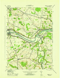
 1931 Amsterdam1931 Print · USGSThe Mohawk Valley thrives at the height of its rail and canal era in the late twenties and early thirties. Genealogists can trace family names through dozens of rural schools and churches, from St Marys Ch to the quiet hamlets of Mariaville and Scotch Bush.3 unique versions available
 - 1944 Map of Tribes Hill, 1959 Print
 1944 Tribes Hill1959 Print · USGSThe Mohawk Valley's transition into the interstate era is documented here as the new thruway cuts across traditional canal and rail corridors. Genealogists and local historians can trace family-named sites like Wycoff Cem, Switzer Hill, and the Cadaughrity Sch.2 unique versions available
 - 1946 Map of Tribes Hill
 1946 Tribes Hill1946 Print · USGSThe Mohawk Valley in the mid-1940s reveals a landscape shaped by centuries of transit and settlement along the water. Researchers can trace the path of the Abandoned Erie Canal or find family landmarks like the Wycoff Cem and Cadaughrity Sch.
 - 1947 Map of Amsterdam, 1963 Print
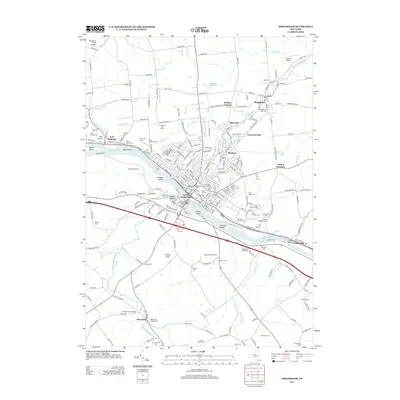
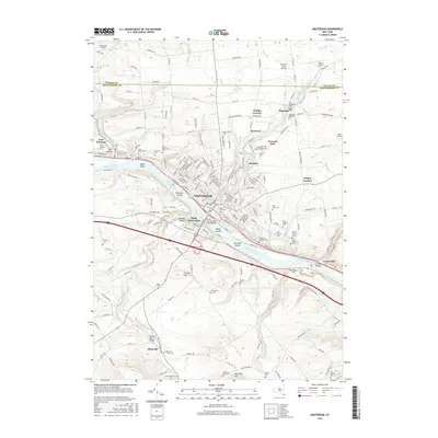
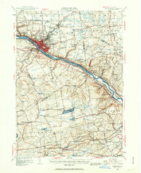 1947 Amsterdam1963 Print · USGSThe Mohawk Valley and its surrounding uplands are captured here in the late 1940s, highlighting the heavy industrial and transit hubs of the day. Researchers can trace the legacy of the Erie Canal, find numerous rural schoolhouses like Log City Sch, and locate the Duanesburg Churches.3 unique versions available
 - 1948 Map of Binghamton, 1980 Print
 1948 Binghamton1980 Print · USGSCentral New York and the Southern Tier thrive in the late 1940s as a hub of rail traffic and mountain industry. Researchers can trace historic transit lines like the Erie Railroad through Binghamton or find old valley settlements near Oneonta and Delhi.
 - 1949 Map of Amsterdam
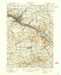 1949 Amsterdam1949 Print · USGSThe Mohawk Valley corridor thrives in the late 1940s as a vital artery for rail, canal, and industry. Researchers can trace the legacy of local education and faith at Duanesburg Churches, School No 7, and the Montgomery County Sanatorium.2 unique versions available
 - 1950 Map of Binghamton
 1950 Binghamton1950 Print · USGSBinghamton and the surrounding Southern Tier are shown in the mid-century era, highlighting the intricate rail and river networks that drove local industry. Researchers can trace the path of the Erie Railroad and locate landmarks from Otsego Lake to Sidney Mountain.2 unique versions available
 - 1954 Map of Pattersonville, 1956 Print
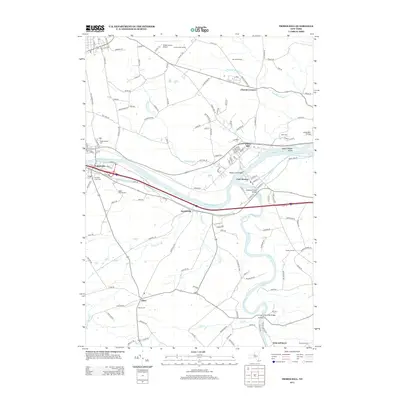
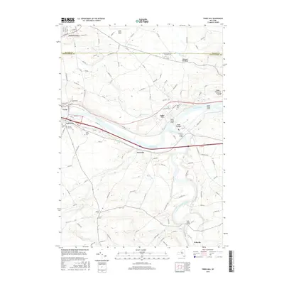
 1954 Pattersonville1956 Print · USGSThe Mohawk River valley near Pattersonville was a bustling corridor of rail and water transit in the mid-1950s. Researchers can trace family history through sites like Woestina Cem and early landmarks like the abandoned Erie Canal and Hoffmans.2 unique versions available
 - 1954 Map of Amsterdam, 1956 Print
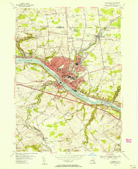 1954 Amsterdam1956 Print · USGSMid-century Amsterdam and the Mohawk Valley are shown here in their industrial prime, centered on a busy river-and-rail corridor. Researchers can trace the layout of vanished neighborhood schools like Milton Avenue Sch or locate ancestors at Green Hill Cemetery and St Marys Cem.4 unique versions available
 - 1958 Map of Binghamton
 1958 Binghamton1958 Print · USGSCentral New York in the late fifties was a network of manufacturing cities and river valleys connected by vital rail lines. Genealogists and historians can trace family roots in Oneonta, Norwich, and Cooperstown or locate long-standing farms along Schoharie Creek.
 - 1963 Map of Binghamton
 1963 Binghamton1963 Print · USGSThe Southern Tier and Catskill peaks are shown in the early sixties as new reservoirs reshaped the valleys. Trace historic rail corridors like the Erie Lackawanna RR and explore lakeside settlements such as Cooperstown and Oneonta.
 - 1985 Map of Amsterdam, 1986 Print
 1985 Amsterdam1986 Print · USGSUpstate New York in the mid-1980s reveals a landscape defined by historic river valleys and expanding interstate corridors. Researchers can trace family sites near Stone Arabia Cemetery or explore the civic centers of Amsterdam and Cooperstown near Otsego Lake.2 unique versions available
 - 2010 Map of Pattersonville, 2010 Print
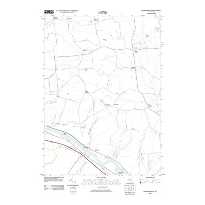 2010 Pattersonville2010 Print · USGSCovers Amsterdam, including Rotterdam, Glenville, and other nearby areas
 - 2010 Map of Tribes Hill, 2010 Print
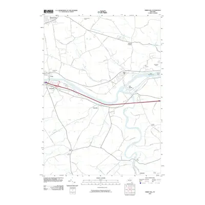 2010 Tribes Hill2010 Print · USGSCovers Amsterdam, including Johnstown, Johnstown, and other nearby areas
 - 2010 Map of Amsterdam, 2010 Print
 2010 Amsterdam2010 Print · USGSCovers Amsterdam, including Duanesburg, Perth, and other nearby areas
 - 2013 Map of Tribes Hill, 2013 Print
 2013 Tribes Hill2013 Print · USGSCovers Amsterdam, including Johnstown, Johnstown, and other nearby areas
 - 2013 Map of Pattersonville, 2013 Print
 2013 Pattersonville2013 Print · USGSCovers Amsterdam, including Rotterdam, Glenville, and other nearby areas
 - 2013 Map of Amsterdam, 2013 Print
 2013 Amsterdam2013 Print · USGSCovers Amsterdam, including Duanesburg, Perth, and other nearby areas
 - 2016 Map of Pattersonville, 2016 Print
 2016 Pattersonville2016 Print · USGSCovers Amsterdam, including Rotterdam, Glenville, and other nearby areas
 - 2016 Map of Amsterdam, 2016 Print
 2016 Amsterdam2016 Print · USGSCovers Amsterdam, including Duanesburg, Perth, and other nearby areas
 - 2016 Map of Tribes Hill, 2016 Print
 2016 Tribes Hill2016 Print · USGSCovers Amsterdam, including Johnstown, Johnstown, and other nearby areas
Showing maps 1-25 of 31
Top cities near Amsterdam
- Schenectady historical maps
- Guilderland historical maps
- Rotterdam historical maps
- Glenville historical maps
- West Glenville historical maps
- Milton historical maps
See more
Top neighborhoods of Amsterdam
- Cranesville historical maps
- Crescent Park historical maps
- Manny Corners historical maps
- Church Corners historical maps
- Harrower historical maps
- Hagaman historical maps
See more
Frequently asked questions
- What are the different types of historical maps available for Amsterdam?
- What is the oldest map of Amsterdam?
- Where can I purchase historical maps of Amsterdam for my home or office?
- Where can I download high-res historical maps of Amsterdam?
- Are there historical topographic maps available for Amsterdam?
- Is there historical aerial imagery available for Amsterdam?
- Where are historical maps of Amsterdam sourced from?