Old Maps of Fort Plain, Minden for Genealogy
Trace your family roots with 22 historic maps of Fort Plain. These high-res maps reveal old neighborhoods, homesites, landmarks, and streets — helping you uncover where your ancestors lived and how the area evolved over time.
- Explore historic neighborhoods: Identify where your relatives may have lived in the 1800s or 1900s.
- Compare maps over time: Trace the changes in streets, buildings, and landmarks for multi-generational research.
- Perfect for genealogy & ancestry research: Used by family historians and researchers to map out lineage and migration.
These maps are an incredible resource for exploring your personal connection to Fort Plain's past.
Fort Plain, Minden maps
(22)- 1898 Map of Canajoharie, 1954 Print
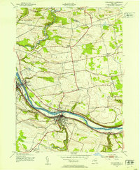
 1898 Canajoharie1954 Print · USGSThe Mohawk Valley was at its industrial peak in the late 1890s, when the river, canal, and railroads all shared the same narrow corridor. Genealogists and historians can trace old homesteads and local landmarks in Stone Arabia, Ft. Plain, and the historic resort at Sharon Springs.
 - 1900 Map of Canajoharie
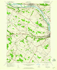
 1900 Canajoharie1900 Print · USGSThe Mohawk Valley at the turn of the century shows a dense network of canal, rail, and river transportation. Genealogists can trace family footprints in historic Canajoharie, the upland farms near Stone Arabia, and the resort area of Sharon Springs.
 - 1902 Map of Canajoharie
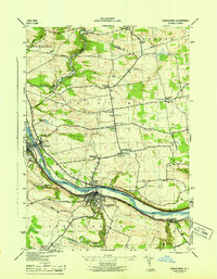
 1902 Canajoharie1902 Print · USGSThe Mohawk Valley was a bustling corridor of canal traffic and steam power just after the turn of the century. Genealogists can trace family names and farmsteads near Stone Arabia or explore the resort layout of Sharon Springs and the industrial hubs of Ft. Plain and Canajoharie.6 unique versions available
 - 1944 Map of Canajoharie, 1953 Print
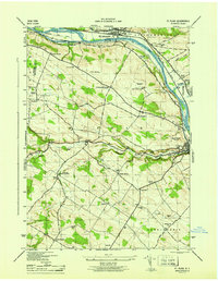
 1944 Canajoharie1953 Print · USGSThe Mohawk Valley corridor thrives during the mid-forties as a vital transport artery for the New York Central railroad and the Barge Canal. Genealogists can locate family plots like Dillenback Cem and rural centers such as Stone Arabia and Nelliston.2 unique versions available
 - 1944 Map of Fort Plain, 1960 Print
 1944 Fort Plain1960 Print · USGSThe Mohawk Valley during the war years shows a landscape defined by the New York State Barge Canal and the New York Central Railroad. Genealogists can locate family landmarks like the Nellis Cem, Klock Sch, and the riverside settlement of Mindenville.2 unique versions available
 - 1946 Map of Canajoharie
 1946 Canajoharie1946 Print · USGSThe Mohawk Valley corridor is captured here just after the war, showing the industrial and transit hubs of Canajoharie and Fort Plain. Genealogists can trace family locations near Dillenback Cem or rural landmarks like Stone Arabia and School No 6.
 - 1946 Map of Fort Plain
 1946 Fort Plain1946 Print · USGSThe Mohawk Valley in the mid-1940s shows a landscape of busy river commerce and quiet upland farming. Researchers can trace family sites at Mount Hope Cem or follow the early 20th-century progress of the Erie Barge Canal and Fort Plain Airport.
 - 1948 Map of Binghamton, 1980 Print
 1948 Binghamton1980 Print · USGSCentral New York and the Southern Tier thrive in the late 1940s as a hub of rail traffic and mountain industry. Researchers can trace historic transit lines like the Erie Railroad through Binghamton or find old valley settlements near Oneonta and Delhi.
 - 1950 Map of Binghamton
 1950 Binghamton1950 Print · USGSBinghamton and the surrounding Southern Tier are shown in the mid-century era, highlighting the intricate rail and river networks that drove local industry. Researchers can trace the path of the Erie Railroad and locate landmarks from Otsego Lake to Sidney Mountain.2 unique versions available
 - 1958 Map of Binghamton
 1958 Binghamton1958 Print · USGSCentral New York in the late fifties was a network of manufacturing cities and river valleys connected by vital rail lines. Genealogists and historians can trace family roots in Oneonta, Norwich, and Cooperstown or locate long-standing farms along Schoharie Creek.
 - 1963 Map of Binghamton
 1963 Binghamton1963 Print · USGSThe Southern Tier and Catskill peaks are shown in the early sixties as new reservoirs reshaped the valleys. Trace historic rail corridors like the Erie Lackawanna RR and explore lakeside settlements such as Cooperstown and Oneonta.
 - 1985 Map of Amsterdam, 1986 Print
 1985 Amsterdam1986 Print · USGSUpstate New York in the mid-1980s reveals a landscape defined by historic river valleys and expanding interstate corridors. Researchers can trace family sites near Stone Arabia Cemetery or explore the civic centers of Amsterdam and Cooperstown near Otsego Lake.2 unique versions available
 - 2010 Map of Canajoharie, 2010 Print
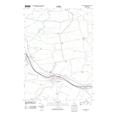 2010 Canajoharie2010 Print · USGSCovers Fort Plain, including Minden, Canajoharie, and other nearby areas
 - 2010 Map of Fort Plain, 2010 Print
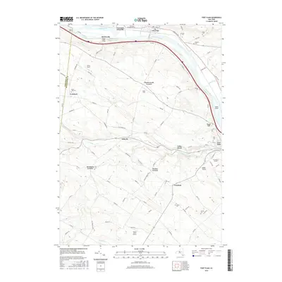
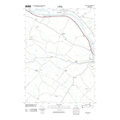 2010 Fort Plain2010 Print · USGSCovers Fort Plain, including Minden, Canajoharie, and other nearby areas
 - 2013 Map of Canajoharie, 2013 Print
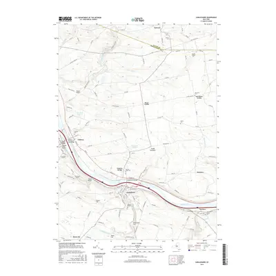
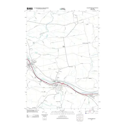 2013 Canajoharie2013 Print · USGSCovers Fort Plain, including Minden, Canajoharie, and other nearby areas
 - 2013 Map of Fort Plain, 2013 Print
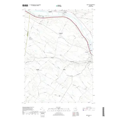
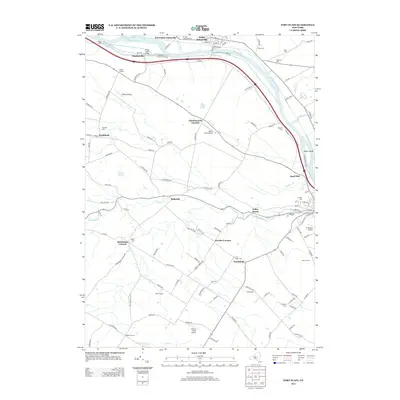 2013 Fort Plain2013 Print · USGSCovers Fort Plain, including Minden, Canajoharie, and other nearby areas
 - 2016 Map of Fort Plain, 2016 Print
 2016 Fort Plain2016 Print · USGSCovers Fort Plain, including Minden, Canajoharie, and other nearby areas
 - 2016 Map of Canajoharie, 2016 Print
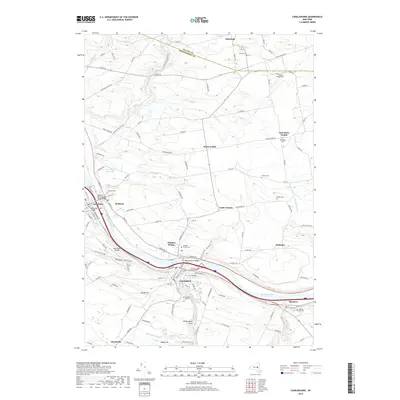
 2016 Canajoharie2016 Print · USGSCovers Fort Plain, including Minden, Canajoharie, and other nearby areas
 - 2019 Map of Fort Plain, 2019 Print
 2019 Fort Plain2019 Print · USGSCovers Fort Plain, including Minden, Canajoharie, and other nearby areas
 - 2019 Map of Canajoharie, 2019 Print
 2019 Canajoharie2019 Print · USGSCovers Fort Plain, including Minden, Canajoharie, and other nearby areas
 - 2023 Map of Fort Plain, 2023 Print
 2023 Fort Plain2023 Print · USGSThe Mohawk Valley corridor in the early 21st century remains defined by its historic water routes and compact riverside settlements. Genealogists and historians can trace family ties through several rural burial grounds such as Mount Hope Cem and Yerding Cem, or explore the transit heritage of the Erie Canal and Nelliston.
 - 2023 Map of Canajoharie, 2023 Print
 2023 Canajoharie2023 Print · USGSThe Mohawk River corridor thrives in this modern survey of central New York, where industrial river towns meet traditional upland farming hamlets. Researchers can trace family history through numerous burial grounds like Prospect Hill Cem or locate landmarks like Canajoharie Falls and Wintergreen Flats.
End of results
Showing maps 1-22 of 22
Top cities near Fort Plain
- Johnstown historical maps
- Johnstown historical maps
- Cobleskill historical maps
- Little Falls historical maps
- Minden historical maps
- Canajoharie historical maps
See more
Frequently asked questions
- What are the different types of historical maps available for Fort Plain?
- What is the oldest map of Fort Plain?
- Where can I purchase historical maps of Fort Plain for my home or office?
- Where can I download high-res historical maps of Fort Plain?
- Are there historical topographic maps available for Fort Plain?
- Is there historical aerial imagery available for Fort Plain?
- Where are historical maps of Fort Plain sourced from?